high water in the harbour

Even without looking out of the window, living on Nyhavn, I know when the level of the water in the harbour is high because I can hear the engines of the tourists boats turning over as they stop at a small landing stage at Nyhavnsbroen, for people to get on and off, rather than going on under the bridge to their main landing stage at the inner end of Nyhavn at Kongens Nytorv.

Most of the boats have windscreens to shield the skipper but these are hinged to drop down to gain a few inches to get under the bridge and, through the summer, my days are punctuated by tannoy announcements from the guides trying to make passengers sit down as the boat goes under Nyhavnsbroen. I’ve never seen a tourist’s head floating in the harbour but it would give them a great if final selfie.

On Sunday the water in Nyhavn was at the highest level I have seen since I moved here …. about 1.5 metres above its normal level and just 60cm below the level of the quay.

Such a high water level was caused by storms over Denmark on Saturday. Named Storm Malik by Danmarks Meteorolgiske Institut, it forced water from the North Sea against the west coast and caused water to rise between the islands so effecting Limfjorden, Roskilde Fjord, and, to a lesser extent, Copenhagen.

It sounds dramatic but there had been good, early and accurate warnings so vulnerable areas prepared with sand bags and booms and here boat owners adjusted moorings and checked service pipes to and from their boats.

Of course, people were out on Sunday morning because they were curious but Copenhageners, like city people the World over, are pretty nonchalant about these things …. or, at least, can feign nonchalance. When I told a neighbour that this was the highest I have seen water in the harbour, he sniffed and said in his 55 years of working and living around Nyhavn, he had seen the water much, much, much higher.

Danmarks Meteorologiske Institut - Storm Malik

water lapping over the lower level of the quay at Gammel Strand

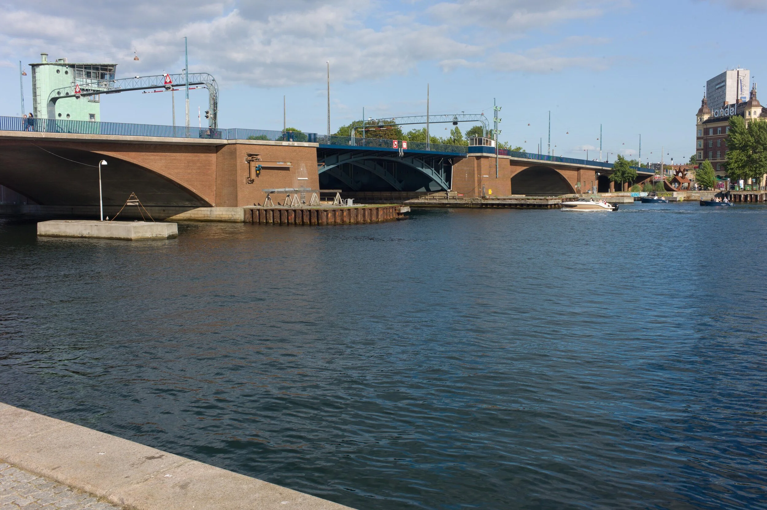
looking down at Nyhavnsbroen - the bridge across Nyhavn - at about 10am on Sunday. With the water this high, it would be difficult to get a raft let alone a tourist boat under the bridge to get to the inner end of Nyhavn at Kongens Nytorv

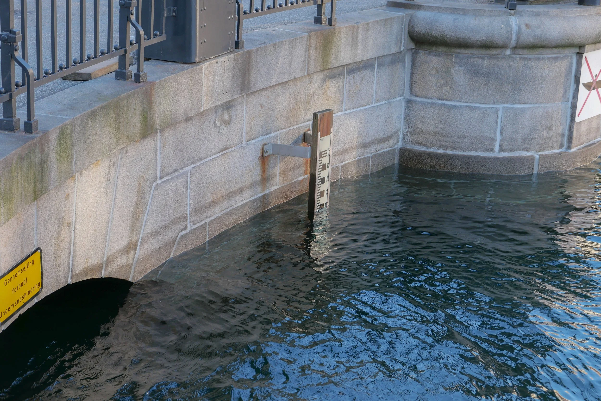
the water level at Nyhavnsbroen on Sunday at about 10am …. the water level had already dropped by about 20 cm - as shown by the tide mark - because when the water was at it’s highest point, the arched opening was completely submerged

update:
24 hours later - at about 10am on Monday - the water level had dropped by 1.6 metres and, if anything, is lower than normal

the warehouses at the end of Nyhavn and Skuespilhuset / The National Theatre from the inner harbour bridge around lunchtime on Sunday when the level of water in the inner harbour had already dropped

the main canal through Christianshavn where the quay is not at a constant level and, at one of the lowest points, the road was just 20 cm above the water
this sounds dramatic but, of course, if the water had risen above the edge of the quay then, as the area of flooding increases, then increasingly large amounts of water would be needed to raise the level

of course, that does happen but, more often, the problem is that, as the level of water in the harbour rises, storm drains that clear water from the street, fail and drains and sewers back up


why the city has to prepare for rising sea levels

This weekend, Danmarks Meteorologiske Institut classed Storm Malik as level two on their scale with the highest storm level being four.

The storm drove water from the Sound into the harbour and when you look at the area of the inner harbour then the amount of water here was certainly impressive - amazing even - but not dramatic for there was little flooding.

But storm surges will become more of a problem as sea levels rise because of climate change and could become a dangerous and expensive catastrophe if storm surges or high levels of water in the Sound and in the harbour coincide with heavy rain over the city. To put it simply, that is when water running of the land meets water flooding in.

Cloud bursts here are dramatic with a cloud burst defined as 15cm or more of rain falling within 30 minutes so the policy now is to control and contain surface water so that it can be released into the harbour once water levels drop. There are now also plans for raising sea defences including the construction of a tidal barrier that could be raised to block the entrance to the harbour in the event of a storm like Malik.

also see:
Sankt Kjelds Plads - climate change landscape
climate change and sustainability in Denmark?
Enghave Parken - restoration and climate change mitigation
climate change - Scandiagade

This is Christians Brygge where it goes under Knippelsbro - the bridge at the centre of the inner harbour that links the historic centre to Christianshavn and Amager. This road along the quay is a main route into the city from the south. The water was just shallow enough to drive through although unfortunate for cyclists caught by the spray and the wake from cars.

It was difficult to judge (I did not have a tape measure with me) but this flooding appears to be above the level of the water in the harbour so may well have been caused by the water in the harbour rising and blocking drains- The level of the road surface cannot be raised because the construction of the historic bridge has a shallow arch which is an integral part of the construction and already limits the height of traffic …. hence the warning lights and red and white striped warning sign.

The prediction is that, by 2070, sea levels could rise by 50cm and this map, from Danmarks Meteorologiske Institut, shows the parts of the city that would be flooded should there be a storm surge of 1.9 metres on top of that …. the rise in level this weekend was about 1.6 metres in the harbour and was, I think, rated as a once in 20 year event

The map shows the roads under the harbour bridges flooded; water over the quay in Nyhavn; Ofelia Plads and the harbour end of Sankt Annæ Plads flooded. More important, extensive areas of Christianshavn and the whole of Christiania would be under water. The outer defences of Christianshavn would overflow, including possibly covering the road between Christianshavn and Amager.

Kløvermarken - the large area of park south of the old defence and here shaped rather like a grand piano - would be under water. This is significant because plans to build housing across Kløvermarken are back on the planners’ agenda. Maybe a fact-finding trip to Chiloe in Chile might be useful to look at ways of building houses on stilts! Or maybe, just maybe, leaving Kløvermarken as an open green space for sports might be an easier if less profitable option.

Langebro in new colours

Langebro - the main road bridge from the city centre to Amager - is hung with scaffolding as the ironwork is repainted.

Langebro was designed by Kaj Gottlob (1887-1976) and was opened in 1954. There are three wide arches with the outer in brick and the central opening arch in iron to cross the harbour - here well over 100 metres across. It carries a wide deck - about 33 metres wide - with three lanes of fast-moving traffic in each direction and bike lanes and footpaths on both sides.

With the construction of the BLOX building, the elegant silhouette of the bridge and the copper-clad bridge tower has been lost when seen from the south. The iron railings and the gantry towers were white or grey white but were recently basically dirt and rust …. hence the need to repaint.

The new colour scheme has pale grey-blue paint for the gantries; very dark blue for the railings, and a deep steel grey for the ironwork of the central arch below the bridge deck. This goes some way to restore a stronger upper edge to the bridge when seen from the quay and is a phenomenal improvement.

Are there drawings or records that show the original colours? - Gottlob certainly used strong colours in many of his buildings and for his furniture and interior designs- or was this an inspired choice by the city engineers?

To give greater strength to the railings, without using heavier ironwork, there are, inner and outer lines of rails that are staggered.

note:
the scaffolding that, in effect, hooked over the top of the railings with heavy concrete blocks on the pavement to counterbalance platforms hanging out over the water.

the old ….

and the new


can Lynetteholm be car free?

A recent article in the newspaper Politiken has suggested that the proposed development of Lynetteholm, on a new island to be constructed across the entrance to the harbour, will not be designed to be car free even though the initial plans included good links by public transport.

A new report has concluded that by making the residential areas completely car free, property and land values would be reduced so the sums do not stack up for the returns required to make the project viable.

The report by the consulting engineers Rambøll and MOE Tetraplan looked at three scenarios for the new island from almost completely car-free (10 to 15 cars per 1,000 inhabitants) through partially car-free (120 to 130 cars) and also without restrictions imposed so with average car ownership of 250 cars per 1,000 residents.

If the development goes ahead, there would be homes on Lynetteholm for around 35,000 people and jobs for 35,000.

However, this new island is not simply a development for homes and jobs but also has a complicated part in the construction a barrier that is necessary to protect the harbour from storm surges and there should also be recreational areas along the new shoreline that will attract people from all over the city.

Initial plans for the island included a link to the metro that would be a 'relatively' straightforward extension of the recently-opened line to Nordhavn but the new report has concluded that a metro line would only generate the level of service required, if there were no cars on the island and if the line was built to complete an arc across Amager so to continue round to the metro station at Christianshavn and then on under the harbour in a new tunnel to the central railway station and that, of course, that would add very considerably to the cost.

The report also suggests that the harbour ferry service, that now terminates at Refshaleøen, should not just be extended to Lynetteholm but, if the area is to be completely free of cars, would have to run every ten minutes rather than every 30 minutes with the present service.

Lynette after.jpeg

update - Hilton Hotel on the harbour

Work is moving forward to convert the old Nordea Bank offices for a new Hilton Hotel on this prominent harbour site by Knippelsbro. Now you can see just how high the extra story will be and you can see just how the hotel will break through to the quay - to colonise it as an attractive new feature - a valuable commercial asset - for the new hotel.

And in return ……… the city gets some new steps down to the quay from the bridge.

The old office building was much too big and, with hefty concrete cladding, brutal and ugly but in part it was those things for clear reasons. When it was constructed in the 1950s, the harbour was a working port and not a tourist destination and this was the offices of the Burmeister & Wain ship yard that was crucial for providing jobs for the city and was a major player in the post-war effort by the country to restore the economy. Looking pretty was not on the design brief.

But right here, right now, if the Hilton Group had cleared the site and started again, a scheme for a building of that size and in that position would not be given planning permission.

And then they pushed the boundaries by asking for and getting permission to add an extra floor on a building that was already too big.

Until last year I lived in an apartment buildings to the south, behind the church, and looked out across the top of the trees in the churchyard with a clear sky line broken only by the church tower and with no one looking in. Then work started and the Nordea building took a deep breath and puffed out and began to loom over the trees.

Those apartment buildings are not the most stunning design but they are well designed and carefully designed to create pleasant living space and good streetscapes on land where there had been dry docks and sheds that no one could see a way of preserving after the yards closed. More to the point, planning controls kept the apartment buildings to the same overall height as the gutter or eaves of the church …. so not to the overall height of the church roof and not to the overall height of the spire but to the height of the body of the church. That development showed at least some respect for the historic buildings that still do and still should dominate the area.

In the general sweep of things I'm only a visitor to the city so it is not my place to be offended on behalf of københavnerne - who are certainly more than capable of defending their own values - but there seems to be something basically undemocratic about these huge international hotels that break the spirit if not the letter of Janteloven. The Hilton will make use of the nearby metro - though I guess most guests will arrive by taxi - and the ferry is at the back door to serve hotel guests and the quay will make a ‘picturesque’ backdrop from their harbour-side café or bar but I'm not exactly sure what citizens get back in return. Presumably, that huge glazed new top floor will be expensive restaurants and spaces for events but how many people in the city will ever use that unless they go just once to see what is up there. They don't need another ‘new perspective’ to see over their own city or a viewing platform to look down on their fellow citizens.


Waterfront Design Catalogue


More and more articles in newspapers and planning reports in Copenhagen are talking about green and blue planning policies …. so policies that look in a coherent way at green nature in the city but alongside policies for water quality and for making the harbour and lakes a more crucial part of life in Copenhagen.

Recently, I came across this publication from the Technical Department of the city council that was published in 2013. Drawn up by, among others, the architectural studio of COBE, the illustrations are good at showing just how many different ways there are to deal with the hard edge of the quay around the harbour that forms the link between the land and the water and there are many ideas about how to encourage more access to the water and more activities.

The cycle route around the harbour is now complete and at over 13 kilometres it draws in a large area of water of the inner harbour and, as work on the new district of Nordhavn moves forward, more and more facilities on the water have been provided. The new swimming area in Nordhavn opened last year.

City planners are now considering the possibility of designating the wooden decking and the inner part of the dock at Ofelia Plads, north of the National Theatre, as a new official swimming area.

download PDF

update - Lille Langebro

Lille Langebro is almost complete with final work on the hard landscaping on the quay at at each side almost finished.

This is the new bridge for cyclists and pedestrians that will cross the harbour from Christians Brygge, from the quayside opposite the end of Vester Voldgade, to the Christianshavn side and lining up with Langebrogade.

Current traffic surveys suggest that there are around 40,000 cycle journeys a day across the main road bridge - an astounding number - and planners hope that at least 16,000 cyclists a day will change there route to the new bridge and also avoid the heavy and relatively fast road traffic along Hans Christian Andersens Boulevard.

The official opening is set for the Autumn but opening and closing of the new bridge is already controlled from the tower of the main bridge so presumably the wait is for safety tests.

There was a post on this site when the sections of the new bridge were lifted into place but Realdania have since posted a time lapse record of that work over two days when the four sections were delivered by barge from where they were manufactured in the Netherlands and were lifted into place by a giant crane.

post on Lille Langebro in September 2017

lifting the sections of the bridge into place April 2019

the harbour and the future of Nyholm

The Danish Navy maintain an important though reduced presence in Copenhagen - with the main naval bases for the country now in Frederikshaven and Korsør - but there are plans for much that is still here to be moved away from the city and recently there have been discussions to decide on the most appropriate use for the historic naval buildings on Nyholm.

This is an important part of the harbour and not just because Nyholm is prominent on the east side of the entrance to the historic inner harbour but also because the island has an important and symbolic place in the history of the city … on the emplacement at the north end of the islands are guns for official salutes to mark royal and national occasions; the flag flown here has huge significance and when the royal yacht returns to Copenhagen, it is moored immediately north of Nyholm.

There are important historic buildings here including two of the most extraordinary buildings in the city … the Mast Crane that is an amazing example of maritime engineering and the Hovedvagt, or Main Guard House, with a feature on the roof that looks like a giant chess piece. Both date from the middle of the 18th century and both are by the important architect Philip de Lange.

read more

photograph taken from the harbour ferry as it pulled in at the landing stage just below Skuespilhuset - the National Theatre.

Nyholm is the island between the Opera House and Refshaleøen and at the centre of this view is the distinct silhouette of the 17th-century Mast Crane

note:
the cormorants are on an artificial reef that was created in 2017 to encourage biodiversity in the harbour. The University of Aarhus has produced a report …

Restoration of Stone Reefs in Denmark


view across to Nyholm from the south - from the canal to the east of the opera house

Spanteloftsbygningen looking across the canal from the south east

above, the Mast Crane from the south with the low but wide Drawing Building to its east

Søminegraven - the canal along the east side of Nyholm from the south

Hovedvagt - Main Guard House or ‘Under the Crown’ from the east designed by Philip de Lange

Workshops at the south-east corner of Nyholm built in the late 19th-century


Lynetteholmen - a new island across the harbour

Included by ministers in the launch in January of their 52 point Capital Initiative was a major project for a large, new island to be constructed across the entrance to the harbour. Work could start in 2035.

Under a heading Room for Everyone it was, in fact, the first point of the 52 - but already the proposal seems to have generated a fair amount of criticism.

The island, to be called Lynetteholmen, could have housing for at least 35,000 people and eventually work for as many and would include coastal protection measures to stop surges of storm water entering the inner harbour but it would have a fundamental impact on the character of the inner harbour by closing off views out to the sound and would restrict the routes of access into the harbour for large and small vessels.

Although the new cruise ship terminal at Nordhavn is outside the proposed island, the drawing shows further quays for large ships on the seaward side of the new island so it is not clear if these would replace the present berths for cruise ships along Langelinie Kaj.

note:

Politiken published an article on the 3 March with comments from a workshops with architects and engineers and planners where it was suggested that the island, as shown in the drawing first presented by the Prime Minister in October, is too close to the Trekroner fortress and is too large with several critics suggesting that it should be broken down into a series of smaller islands. No further decisions can be made until tests of the sea bed are completed and until related projects are confirmed including the plan for a major road link across the east side of the city that would have to cross the harbour and the proposal for an extension of the metro through a tunnel between Refshaleøen and Nordhavn.

looking down the harbour


Walking over the new bridge from the Christianshavn or Opera House side of the harbour to Nyhavn, on Sunday afternoon, this was the view down the harbour looking towards Knippelsbro.

It was mid afternoon so the light was dropping and the buildings were reduced to silhouettes - almost to a series of planes - as if they were the scenery flats of a giant theatre. 

It is curious to see which buildings are obvious and which are not. On the left is the warehouse that for now is the home of the Danish Architecture Centre. The outline of the towers of the bridge - of Knippelsbro itself - has been lost against the scale of the more recent buildings that are set on either side beyond but the beautiful curve of the bridge arch stands out. The distinct mass of the Black Diamond - the national library just beyond the bridge on the right  - has been lost in the gloom but the bright fractured cubes of the new BLOX building beyond, almost in the centre of the view, is caught in the sun reflected up off the water. This will be the new home of DAC from next Spring. The red-brick apartment building in front of the bridge - between the harbour and the 17th-century Bourse - is oddly a distraction and even from this distance the superstructure on top of the hotel tower looks a mess.

Perhaps most people crossing over the harbour do little more than glance at the view but that does not make it any less important to make sure that new buildings do not intrude or distract … new developments should not be dramatic or iconic or challenging or brave … just simply a good neighbour that slots into the view down the harbour rather than dominating it. 

Autumn at Islands Brygge


Autumn seems to have come early to Copenhagen this year. Nobody was swimming in the harbour baths at Islands Brygge today although I have seen some - the hardy or the foolhardy - swimming there on much much colder days than this.

But the park was still being used … by a group being put through an exercise regime and by a group huddled under umbrellas having a picnic and there was a group on bikes being given a lecture … my guess … this was one of the events for the 850th anniversary of the city being celebrated this week and next.

The quay here was a bustling part of the port through into the 1950s and 1960s with cranes and gantries and railway lines for loading and unloading the ships. Some of the evidence from that working port survives but not much. 

The park is crowded in the summer with people laid out in the sun … and watching people laid out in the sun ... and being seen ... a really good example of the way the city has been very careful about providing good space for people to colonise and use.

Even if it was a bit cold and wet today, this really is Our Urban Living Room ...... the subject of a major exhibition at the Danish Architecture Centre back in January.

The quay of Islands Brygge in the early 20th century - before the construction of Langebro.

The apartment buildings on the right and the buildings of the sugar factory - the ornate gable in the distance - and some sections of the gantries and parts of the railway track survive

a new bridge over the harbour

Work has just started on a new bridge over the harbour for cyclists and pedestrians that will curve across the water parallel to and north of Langebro to provide a new route from Christianshavn or Islands Brygge to the city centre so that cyclists can avoid the heavy road traffic of H C Andersens Boulevard by encouraging people to use the quieter road - Vester Voldgade - that runs parallel up to the city hall.

unnamed.jpg