Bispeengbuen - a new plan

Yesterday, an article in the Danish newspaper Politken reported that planners and politicians in Copenhagen might have come to a decision on the fate of Bispeengbuen - the section of elevated motorway that runs down the border between Frederiksberg and the Nørrebro district of Copenhagen.

One of several major schemes to improve the road system in the city in the late 1960s and 1970s, Bispeengbuen was planned to reduce delays for traffic coming into the city from suburbs to the north west.

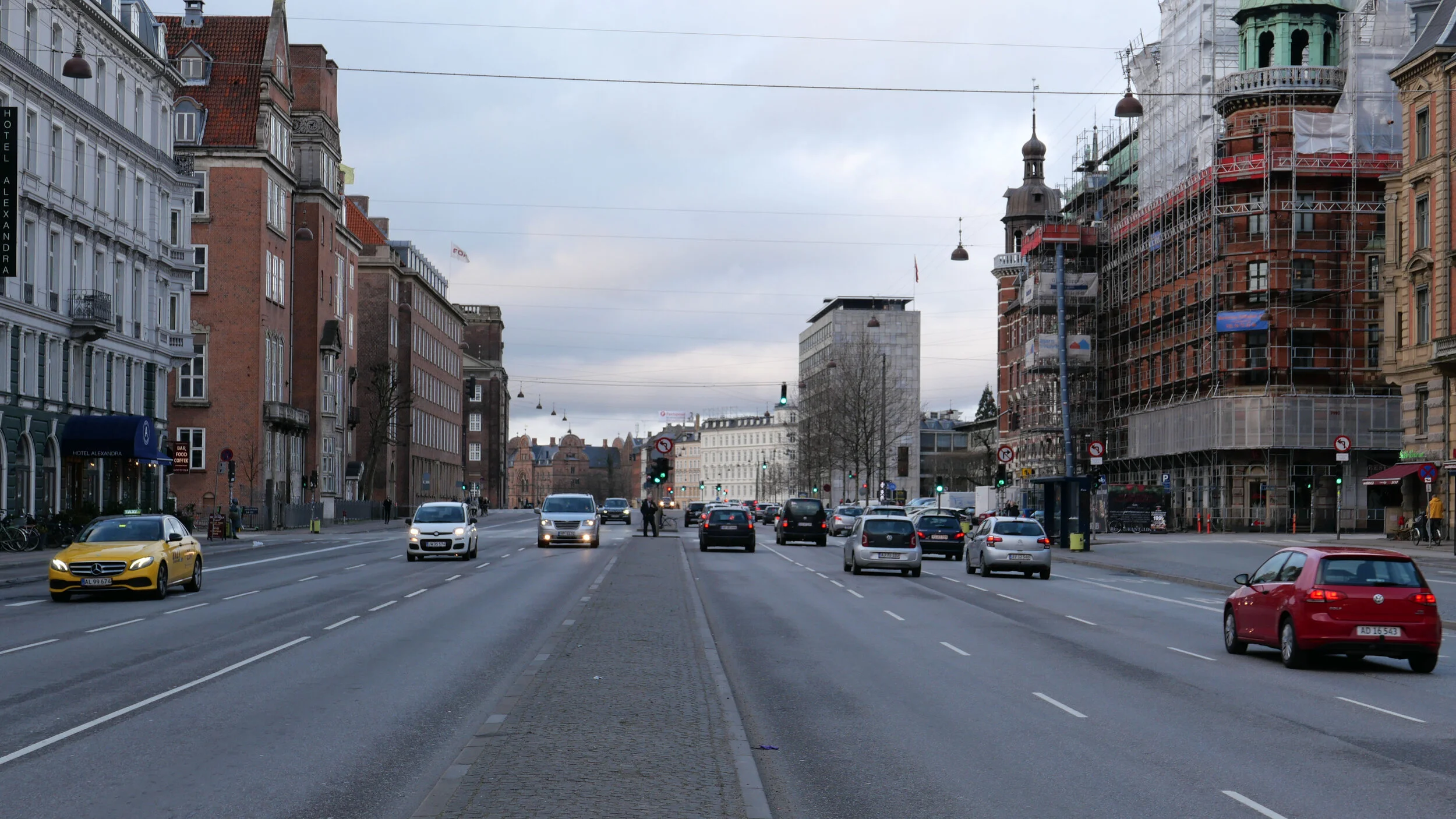
At the south end of the elevated section, at Borups Plads, traffic, heading into the city, drops back down to street level and continues first down Ågade and then on down Åboulevard to the lakes and, if it is through traffic, then on, past the city hall, and down HC Andersens Boulevard to Langebro and across the harbour to Amager.

Between the elevated section and the lakes, the road follows the line of a river that, from the late 16th century, had flowed through low-lying meadows - the Bispeeng or Bishop's Meadow - and brought fresh water in to the lakes. In 1897, the river was dropped down into a covered culvert and it still flows underground below the present traffic.

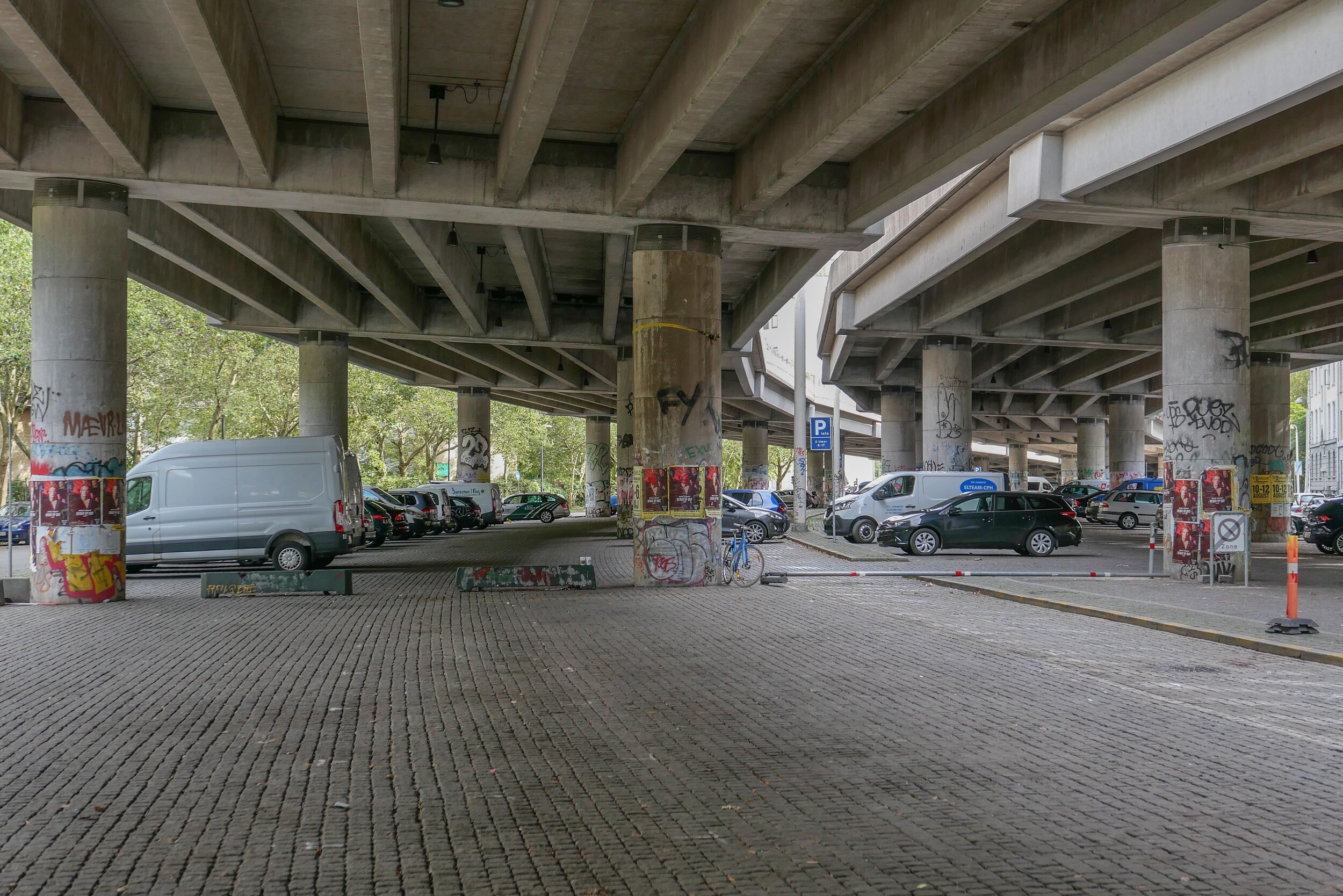
From the start, the elevated section was controversial as it cuts past and close to apartment buildings on either side - close to windows at second-floor level - and the area underneath is gloomy and generally oppressive. Traffic is fast moving and generates a fair bit of noise and it forms a distinct barrier between the districts on either side.

There has been an ambitious plan to drop the road and its traffic down into a tunnel with the river brought back up to the surface as the main feature of a new linear park. The full and very ambitious plan - for ambitious read expensive - was to extend the tunnel on to take all through traffic underground, to Amager on the south side of the harbour.

There has been talk of a less expensive plan to demolish the elevated section, to bring all traffic back down to street level, which would be cheaper but would not reduce the traffic and would leave the heavy traffic on HC Andersens Boulevard as a barrier between the city centre and the densely-populated inner suburb of Vesterbro.

This latest scheme, a slightly curious compromise, is to demolish half the elevated section. That's not half the length but one side of the elevated section. There are three lanes and a hard shoulder in each direction and the north-bound and city bound sides are on independent structures. With one side removed, traffic in both directions would be on the remaining side but presumably speed limits would be reduced - so, possibly, reducing traffic noise - and the demolished side would be replaced by green areas although it would still be under the shadow of the surviving lanes.

It was suggested in the article that this is considered to have the least impact on the environment for the greatest gain ... the impact of both demolition and new construction are now assessed for any construction project.

There is already a relatively short and narrow section of park on the west side of the highway, just south of Borups Plads, and that is surprisingly quiet - despite alongside the road.

On both sides of the road, housing is densely laid out with very little public green space so it would seem that both the city of Copenhagen and the city of Frederiksberg are keen to proceed. Presumably they feel half the park is better than none although I'm not sure you could argue that half an elevated highway is anywhere near as good as no elevated motorway.

The situation is further complicated because the highway is owned and controlled by the state - as it is part of the national road system - so they would have to approve any work and police in the city may also be in a position to veto plans if they feel that it will have too much of an impact on the movement of traffic through the area.

update - Bispeengbuen - 14 January 2020
update - a road tunnel below Åboulevard - 15 January 2020

note:
Given the brouhaha over each new proposal to demolish the elevated section of the motorway, it is only 700 metres overall from the railway bridge to Borups Plads and it takes the traffic over just two major intersections - at Nordre Fasanvej and Borups Allé -  where otherwise there would be cross roads with traffic lights. I'm not implying that the impact of the road is negligible - it has a huge impact on the area - but, back in the 1960s, planners clearly had no idea how many problems and how much expense they were pushing forward half a century with a scheme that, to them, must have seemed rational.

My assumption has been that the motorway was constructed, under pressure from the car and road lobby, as part of a tarmac version of the Finger Plan of the 1940s.

The famous Finger Plan was an attempt to provide control over the expansion of the city, and was based on what were then the relatively-new suburban railway lines that run out from the centre. New housing was to be built close to railway stations and with areas of green between the developments along each railway line .... hence the resemblance to a hand with the city centre as the palm and the railway lines as outstretched fingers.

Then, through the 1950s and 1960s, the number of private cars in Copenhagen increased dramatically and deliveries of goods by road also increased as commercial traffic by rail declined.

I don't know who the traffic planners were in Copenhagen in the 1950s and 1960s but, looking back, they barely appreciated old building or existing communities, and, presumably, looked to LA and, possibly, to the Romania of Nicolae Ceaușescu for inspiration. Their ultimate aim, in their professional lives, seems have been to design a perfect motorway intersection where traffic flowed without any delays.

They wanted to build a motorway down the lakes and when that was thwarted they proposed a massive motorway system that was to be one block back from the outer shore of the lakes - sweeping away the inner districts of Østerbro and Nørrebro - and with new apartment buildings along the edge of the lake - between their new motorway and the lake - that would have formed a series of semi-circular amphitheatres looking across the lakes to the old city. The whole of the inner half of Vesterbro, including the meat market area, and the area of the railway station would have become an enormous interchange of motorways where the only purpose was to keep traffic moving.

We have to be grateful that few of those road schemes were realised but there is also a clear lesson that, however amazing and visionary a major plan for new infrastructure may appear, it can, in solving an immediate problem, create huge problems for future generations to sort out.

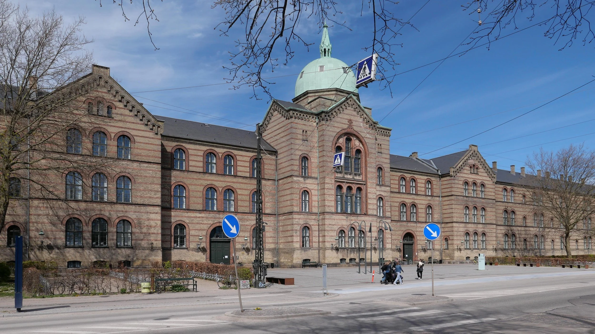
approaching the elevated motorway from the south
the motorway from Ågade on the east side
the motorway crossing Borups Allé

the river close to the lakes at Åboulevard but now in a culvert below the road

Bispeengbuen under construction showing how it cut a swathe through the existing neighbourhood - city archive 50675

the earlier proposal to bury the road in a tunnel and bring the river back up to the surface as the main feature of a new linear park

small area of park on the west side of the road

will the pandemic have a long-term impact on planning and architecture in Denmark?

Some disasters, by their nature, end with extensive new building works so, for example, the earthquakes in Lisbon, in Portugal, in 1755 and the earthquake and subsequent fires in San Francisco in 1906 caused so much damage that it meant that both cities were extensively rebuilt.
In Copenhagen, a devastating fire in 1728, that spread across much of the city, and then another major fire in 1795 and the firebombing of the city by the British navy in 1807 explain why there are so few medieval buildings in the city.
The cholera epidemic of 1853 in Copenhagen, when around 5,000 people in the city died through that summer, had a less-obvious impact on individual buildings but had a crucial role in changing planning in the city and began the process of creating the modern city we know.

a testing centres for Covid-19 in a temporary tent on Ofelia Plads in Copenhagen … there were similar centres in huge tents on Frue Plads and on Fælledparken


Through the early years of the 19th century, the population of Copenhagen had grown rapidly but that expansion was constrained and contained within defensive walls and the city was closed every night with locked gates .... a very real and complete lockdown. Many leading figures in the city had become concerned about both the overcrowding and the poor quality of the water supply and there was no system for dealing with human waste.

But it was the cholera epidemic that was the trigger that changed everything because within a couple of years of those catastrophic deaths, the walls and gates had been demolished; there was a new water works; a large new hospital had been completed on land outside the old walls and, for the first time, housing was allowed outside the city gates and that formed the first movements for building decent housing for ordinary people.

Then came rapid developments in technology and with the arrival of town gas for lighting and electricity and with new trams for transport and finally, by the end of the century, telephones and large new suburbs, Copenhagen became what we would now recognise as a modern city.

built immediately after the outbreak of cholera in Copenhagen in 1853 …..

a new water works opened in 1857

a large new hospital in the 1860s

the first phase of building the Brumleby housing, designed by Michael Gottlieb Bindesbøll for working families, was finished by 1857
the houses were outside the old city defences, so that densely-packed and poorly-built housing in the centre of the city could be cleared.


Now, although we have been caught up with a pandemic for nearly two years, and that has had a dramatic impact on our lives, there is little sign so far that it will have any long-term impact on architecture or design.

Centres for mass inoculation have been in existing buildings that have been adapted temporarily to these new uses - I had my first two jabs at the Bella Center in what is normally an area for conferences and exhibitions - and recently centres for jabs and for tests have been set up in huge tents that were set up on public spaces and in the main park.

On, down the line, we may see some more but subtle changes.

Perspex screens on cash desks in shops were quickly put in place but then were replaced with stronger and better screens and these have not been removed yet and the design of entrance doorways from the street and lobbies and circulation areas in public spaces may well be enlarged permanently if people now feel that really they never actually enjoyed being crammed into tightly restricted spaces just to get into and out of a building.

Will more doors open automatically if we continue to feel slightly uneasy about using handles?

We are yet to see how many people continue to work from home, at least for part of the time, so office buildings and huge headquarter offices may change.

There has been a distinct trend recently for new apartments in the city to be smaller - much smaller - with rumours that official building standards might be changed - but surely that now has to be reconsidered. For the first time, in maybe twenty years, more people have left the city than have moved here as they have realised that they could not function well if they were trapped in a small apartment with partners or small children so have reassessed their opinions on living in the suburbs and have moved out, if they could, to houses with gardens.

Maybe the incentive for developers to cram in more and more housing units to maximise profit may now seem misplaced ... at least in terms of people feeling healthy and happy in their homes rather than feeling hemmed in with a small and crowded living space.

My own feeling is that traditional, relatively-large, Copenhagen apartments with dual aspects - so with good cross circulation of air - and with courtyards where people could at least get some fresh air have come into their own during the pandemic. I would like to see a study completed on rates of infection with coronavirus in tower blocks .... buildings with a single entry lobby and one or two lifts used by everyone over twelve or more floors and have that compared with rates of infection in a standard Copenhagen arrangement with apartments on just four or five floors and an entry and a back staircase with apartments on either side so with only eight or ten households sharing public space.

Tuberculosis was not as widespread as Coronavirus through the current pandemic but was a serious and debilitating disease that struck down many families. Friluftsskolen, on the east side of Amager, was designed by Kaj Gottlob and completed in 1938.
It had wards and classrooms with windows that faced south and that could be opened back to circulate the maximum amount of fresh air


In 1952 there was a major outbreak of polio in the city when, between July and September, 2,700 patients were treated at the Blegdamshospitalet where other patients had to be moved to other hospitals.
Nearly 900 patients were paralysed and as many as 70 patients at a time required artificial respiration. Following the outbreak, a new hospital - the Polioinstitutet - was built in Hellerup at Tuborgvej 5 and opened in 1955

update - Bispeengbuen

Bispeengbuen is a raised section of motorway in the north part of the city that opened in August 1972.

It has three lanes of traffic in each direction but with slip roads and with high sound baffles, added in the 1990s, it is intrusive as it cuts through and divides a densely-built residential neighbourhood. The heavy traffic using the road as a fast route into or out of the city is close to apartment buildings at the level of second-floor windows and, from the start, there were strong local protests with the opening marked by demonstrations and even a bomb threat.

The road is owned by the state but one suggestion now is that it should be transferred to the city and to the municipality of Frederiksberg - the road runs between the two - and, in 2017, politicians from both Copenhagen and Frederiksberg suggested that the road and its traffic could be taken down into a tunnel and the elevated section demolished.

This would provide an opportunity to reinstate a river that had flowed through a meadow here since the late 16th century although the river itself did not run along a natural course. In the 1580s, it was diverted to bring water to low marshy ground around the west side of the city, outside and below the defensive embankments, to form a stronger outer defence and to provide a supply of fresh water for the city.

Around 1900, at the city, end the river, Ladegårdsåen, was taken down into a covered culvert and the road to the lakes became a major route into the city from the north.

From the north end, from Borups Allé, traffic coming into the city goes under the suburban railway line - just to the east of the station at Fuglebakken - and then, immediately south of the railway line, the traffic is taken up onto the raised section that continues on for about 700 metres to Borups Plads where the road returns to ground level but the tunnel would continue on further, closer to the intersection with Jagtvej to make this north part of the proposed tunnel about a kilometre in length.

If the river is reinstated with extensive planting to create a park here, the work could be part of major climate-change mitigation on this side of the city and would create a significant amenity for this residential area.

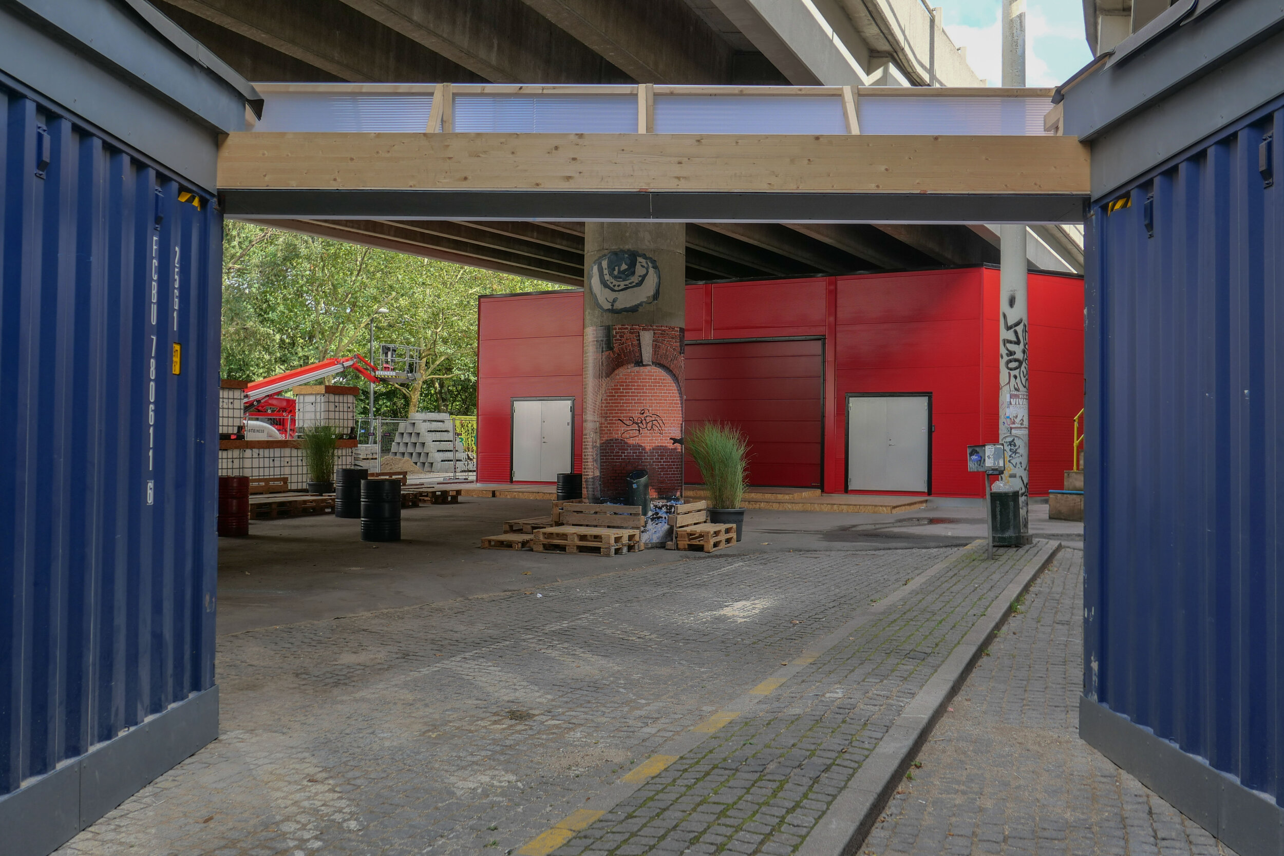
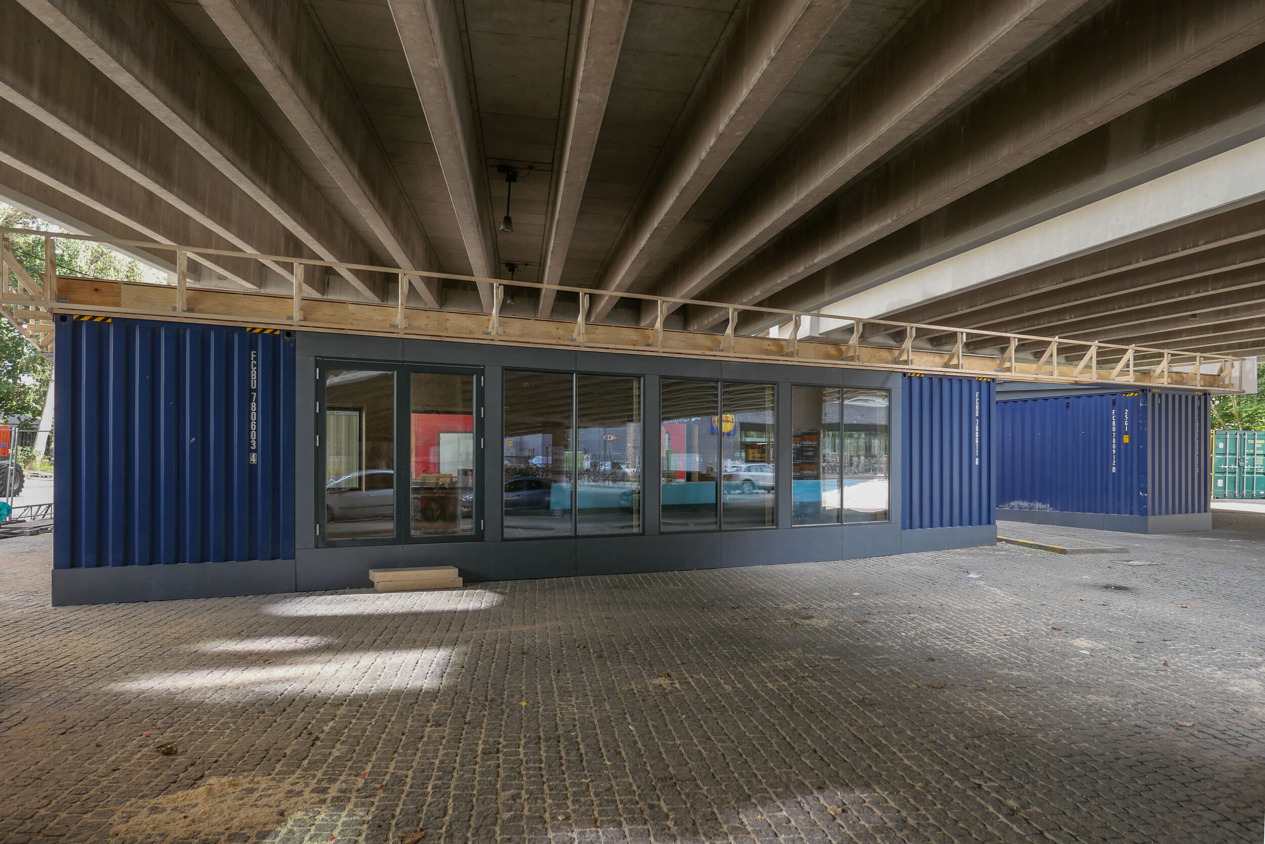
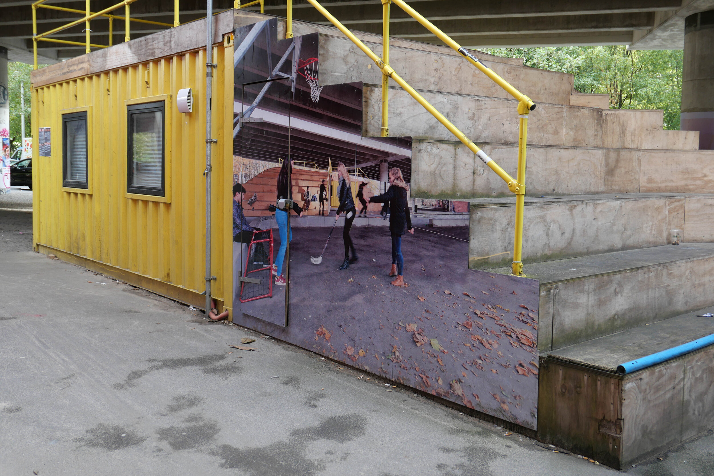
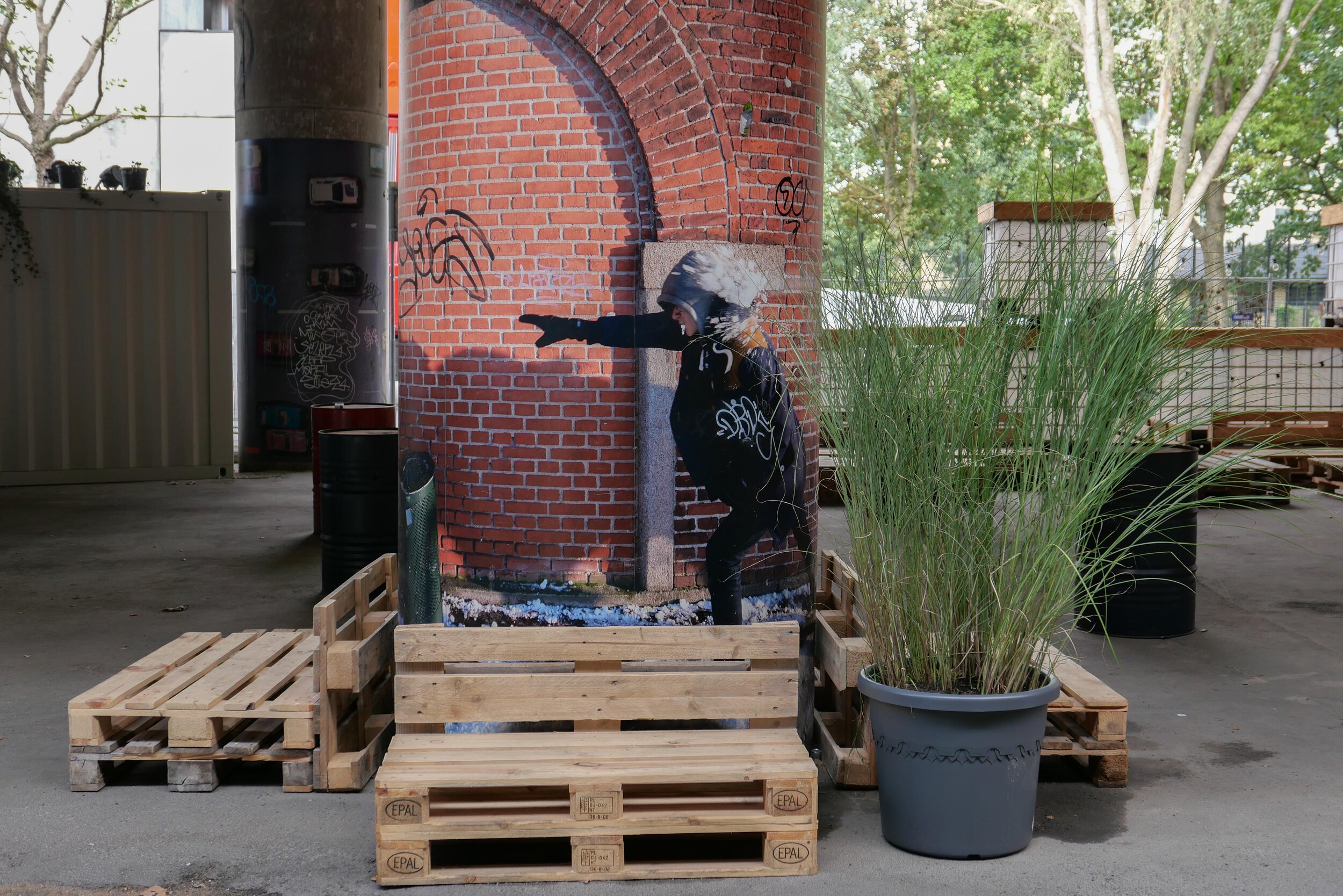
With a decision on the tunnel delayed, the area under the raised section of the road has been improved with the opening in April 2019 of Urban 13 - “a creative urban space.”

Designed by Platant, shipping containers have been adapted to create a cafe and a function room for local events and an area with steep blocks or steps for seating forms an outdoor concert venue and there is new planting in containers.

proposal from PLATANT to build a deck over the elevated motorway for housing and gardens with access by new towers against the edge of the road

Container City will be here for five years and, even then, work on the elevated roadway may be delayed so Platant have put forward an imaginative and ambitious scheme to adapt the motorway itself with an upper deck that could be constructed above the road deck to support new housing and gardens and with access by way of a number of new towers built along the road edge. It would be designed so that this could be dismantled and the materials reused if work on demolishing the road and building the tunnel does go ahead.

URBAN 13
PLATANT
Cloudburst Masterplan by Rambøll


view from Google Earth with the curve of the elevated section of motorway top left

a tunnel, to take the main through traffic underground, could replace the motorway and it could be continued down Åboulevard, following the line of an old river to the lakes, and the river, now in a covered culvert below the road, would then be returned to the surface


the line of the proposed tunnel from the suburban railway line at Fuglebakken to the lakes and from there along the line of HC Andersens Boulevard and on under the harbour to Islands Brygge to connect with a north harbour tunnel that is also being considered.

there would be a limited number of entry and exit points from the tunnel because it is not for local journeys but for through traffic

the tunnel from Fugglebakken to Islands Brygge is just over 4.5 kilometres


proposal for the park and the reinstated river if Bispeengbuen - the elevated motorway - is demolished and the traffic taken down into a new tunnel


update - a road tunnel below Åboulevard and then on below HC Andersens Boulevard

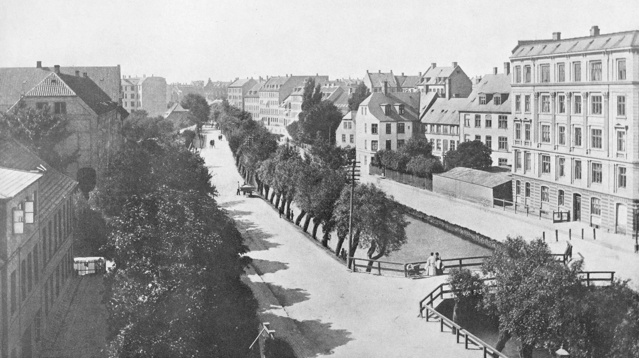
Åboulevard in the late 19th century looking north with the river still at the centre

Bethlehem church designed by Kaare Klint was completed in 1938 but the apartment building dating from around 1900 is on the right on both the historic view and the photograph of Åboulevard now


A proposal for a major engineering project, to construct a traffic tunnel down the west side of the historic city centre, is now in doubt.

It would take underground much of the traffic that now drives along HC Andersens Boulevard, on the west side of the city hall, and is part of a plan to remove the elevated motorway at Bispeengbuen - bringing traffic into the city from the north - and this would make it possible to reinstate a river that flowed into the lakes that now flows through a covered culvert below Åboulevard.

From Jagtvej, at the south end of the elevated highway at Bispeengbuen, and following the line of Åboulevard to the outer side of the lake, is about 1.6 kilometres and, from the lakes, a tunnel running between Jørgens Sø and Peblinge Sø and on along the line of Gyldenløvesgade to Jarmers Plads and then down the full length of HC Andersens Boulevard and then under the harbour to Islands Brygge is another 2 kilometres so, including the proposed tunnel at Bispeengbuen, that would be between 4.5 and 5 kilometres of tunnel in total.

For comparison, in Oslo, the Festning tunnel - opened in 1990 to take traffic away from the square in front of Oslo city hall - and then an extension to the east - the Operatunnelen completed in 2010 - form, together, about 5.7 kilometres of underground motorway.

The landscape and architecture studio Tredje Natur and the engineering specialists COWI have drawn up a feasibility study for the proposed scheme for the finance directors of the city and of the municipality of Frederiksberg - the road runs between the two areas.

Reinstating the river and extensive landscaping would be an important part of storm water protection for the low-lying areas of Frederiksberg with planting, surface drains, and culverts controlling storm floods before taking it away from the area in substantial storm drains in the bottom half of the tunnels below the road decks in the upper half of the tunnel.

Tredje Natur have produced drawings for the planting that would be possible along HC Andersens Boulevard if the heavy traffic that uses the road is taken down into a new tunnel. There could be a narrow road for local traffic, an open water course and extensive planting.

Tredje Natur


a suggestion for new landscaping along HC Andersens Boulevard proposed by Tredje Natur

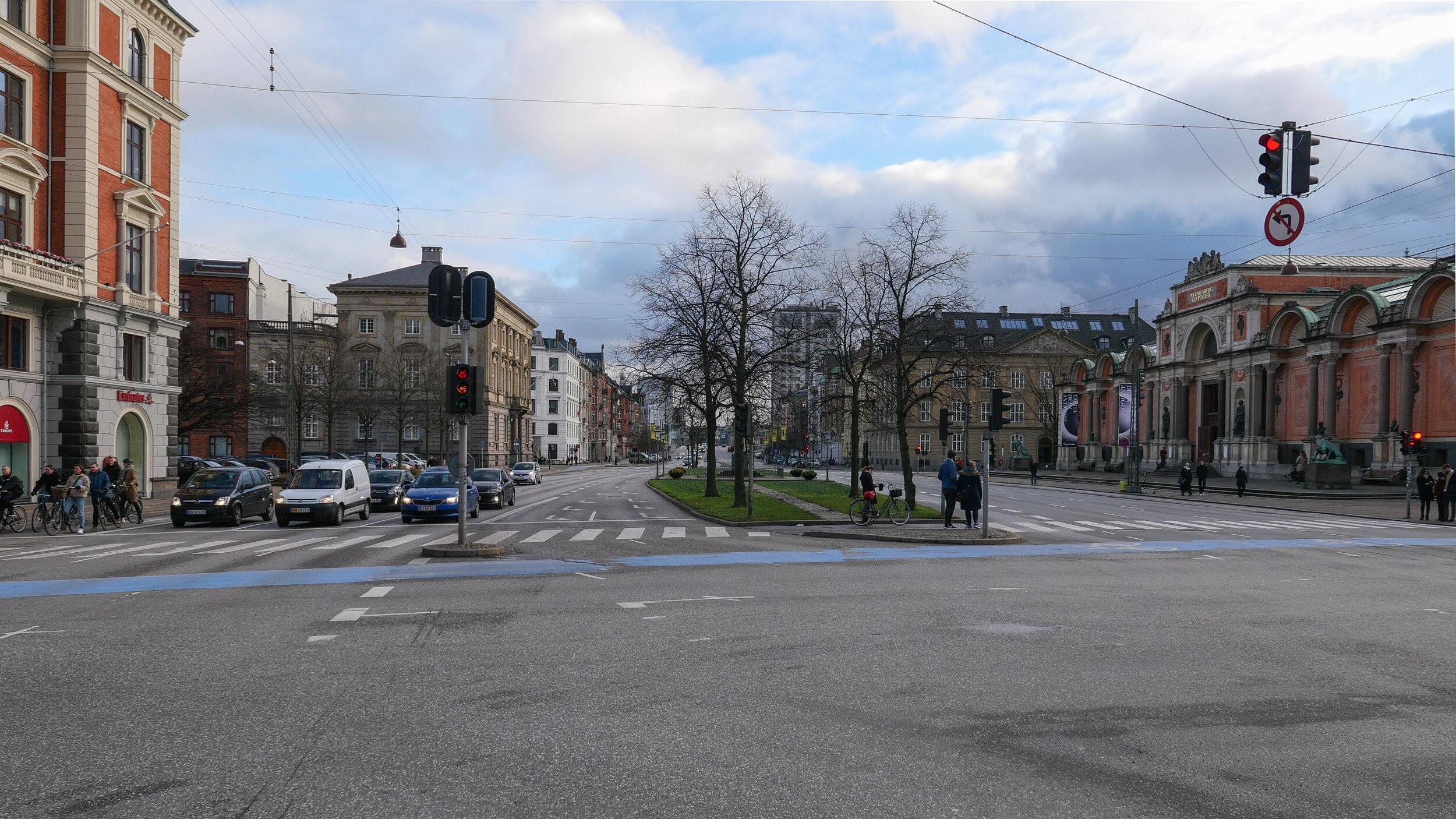
1 south end of the boulevard looking south towards Langebro with the Glyptotek to the right
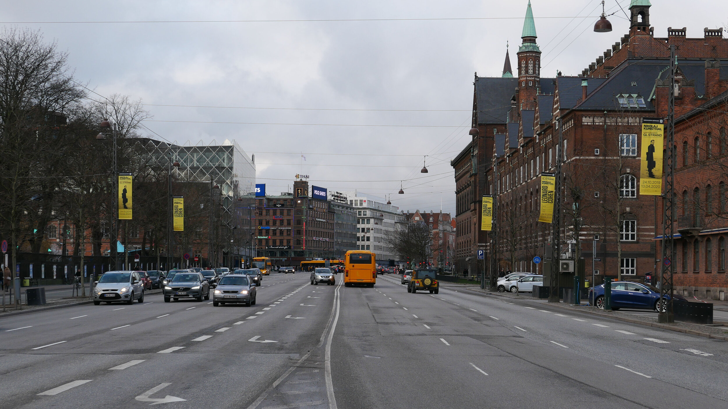
2 looking north from the Glyptotek with Tivoli to the left and the city hall to the right
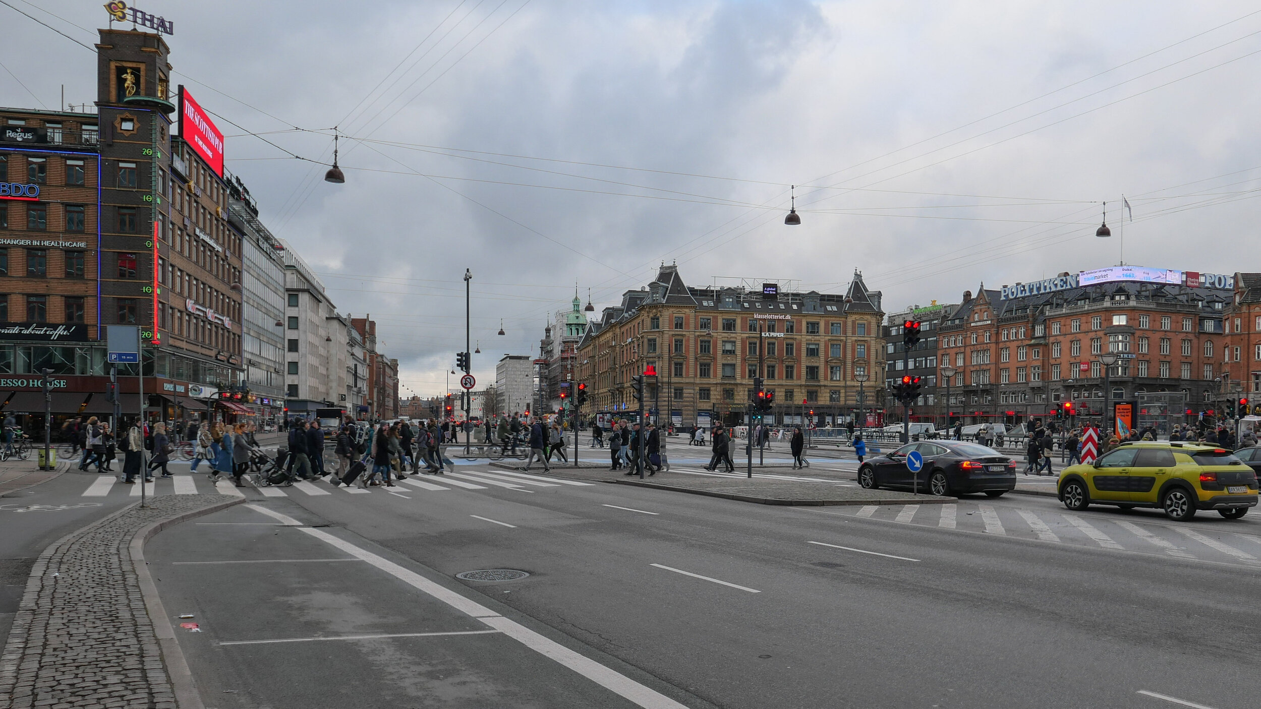
3 from the south-west corner of the city hall square
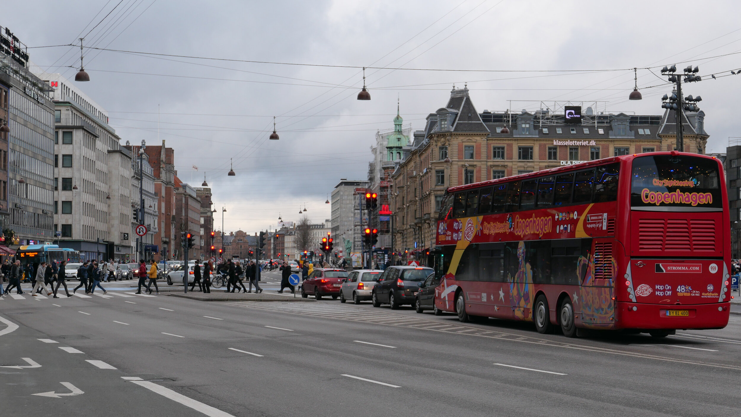
4 crossing the city hall square heading north
5 the north end of HC Andersens Boulevard looking to to the tower of Realdania on Jarmers Plads

the map was published in 1860 and shows the river flowing into the lakes at the south end of Peblinge Sø with the road on the south bank and just a narrow lane, Aagade, at the back of gardens on the north bank

the river was moved down into a culvert and Åboulevard - the road above the culvert - is now wide and busy with traffic to and from the centre of the city

the lakes to the top with Sankt Jørgens Sø to the left and the end of Peblinge Sø to the right

the road over the causeway comes down to Jarmers Plads and then past the west side of the city hall at about the centre of the photograph with Tivoli to the left and then HC Andersens Boulevard continues on down to Langebro as a main route to cross from the city to Amager

historic aerial view showing the bridge over the harbour at Langebro that was built in 1903 and the first part of HC Andersens Boulevard with densely-planted trees down the centre rather than bumper to bumper cars now


retrofitting balconies is a problem

If you live in an apartment in Copenhagen, a balcony can be a real asset.

If the balcony is small but faces in the right direction then it’s a place to grow a few flowers or herbs or if it’s large enough for a chair or two and a table, it can even be a useful extra room - at least on sunny days.

Through the 18th and 19th centuries in Copenhagen, a balcony was usually a grand architectural statement … a feature of bigger and better houses and these balconies were usually on the street frontage and on the most important floor level, so, more often than not, on the first floor and, more often than not, the balcony was defined or marked by a display of impressive or pretentious architectural details … so under a pediment or flanked by columns and with an elaborate iron railing or a stone balustrade and was there to impress … more a place from which to make a speech to the crowd than a place to lounge in the sun.

But by the 1920s, people living in the city had discovered sun and fresh air and, generally, as apartments became smaller and as purpose-built apartment buildings tended to get larger, balconies became more common.

They meant the apartment had a private outdoor space, so people did not have to go down to the courtyard to be outside, and, if the balcony was on the front of a building, then there could be a view out over the street or, in well-located apartment buildings, the view could be over a square or over the lakes or even over the sound. 

With the use of concrete and steel in the construction of more and more new buildings, it became possible to cantilever out ever larger balconies and by the 1930s apartment buildings became common where every apartment had a balcony and with those balconies often forming the dominant feature across the facade. In some buildings, it was almost as if the balconies had been designed first and everything else made to fit behind.

Glazed doors to get out on to the balcony bring more light into the room and on, hot days, the doors can be left open to improve the circulation of air …. so what’s not to like.

But there is a growing problem with retrofitting balconies on buildings that did not have them originally.

Not too much of a problem, in terms of the look of a building, if they are on the courtyard side and even acceptable on the street frontage if secondary balconies are placed carefully and try to show at least some respect for the style and architectural articulation of the building. 

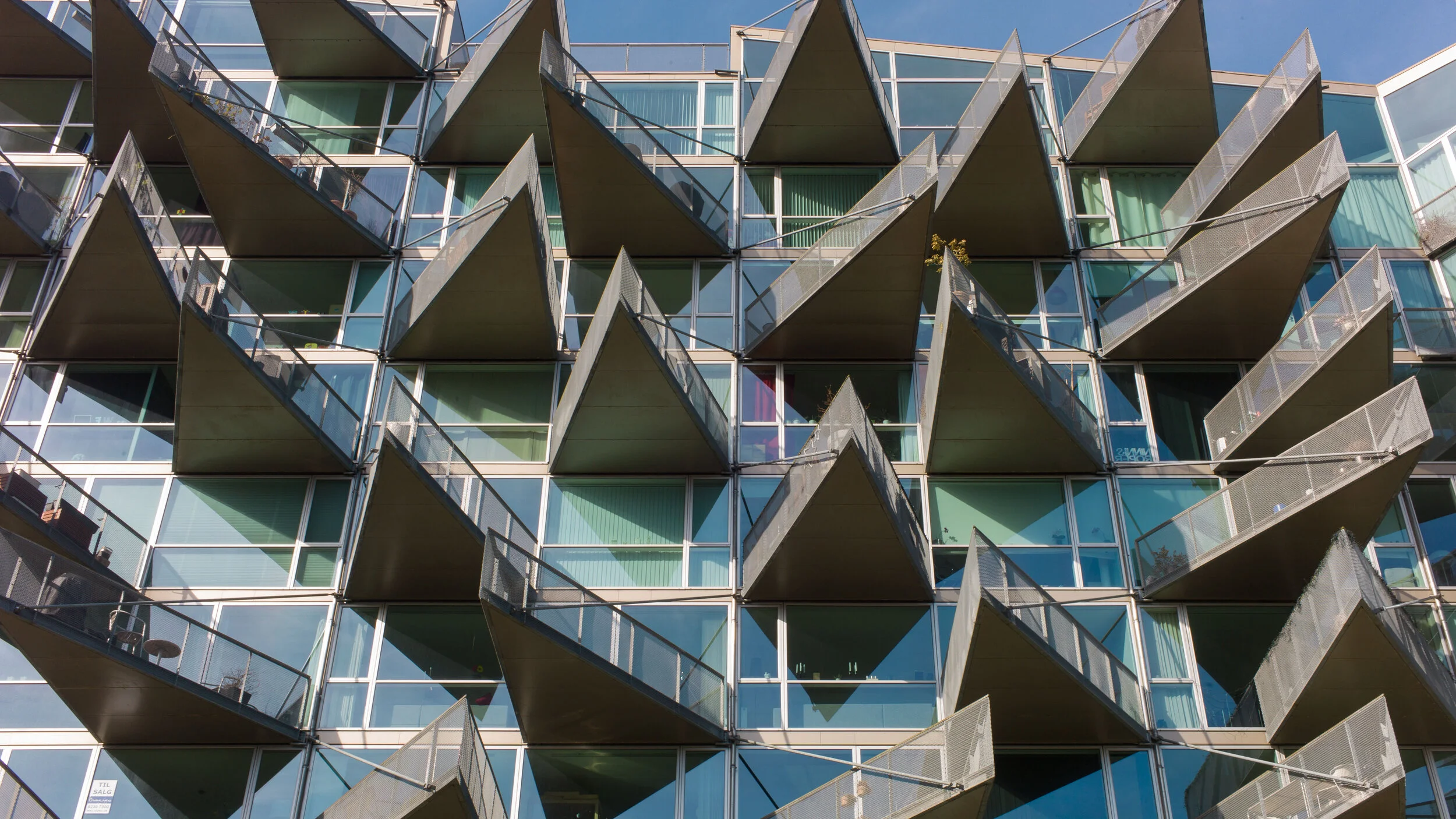
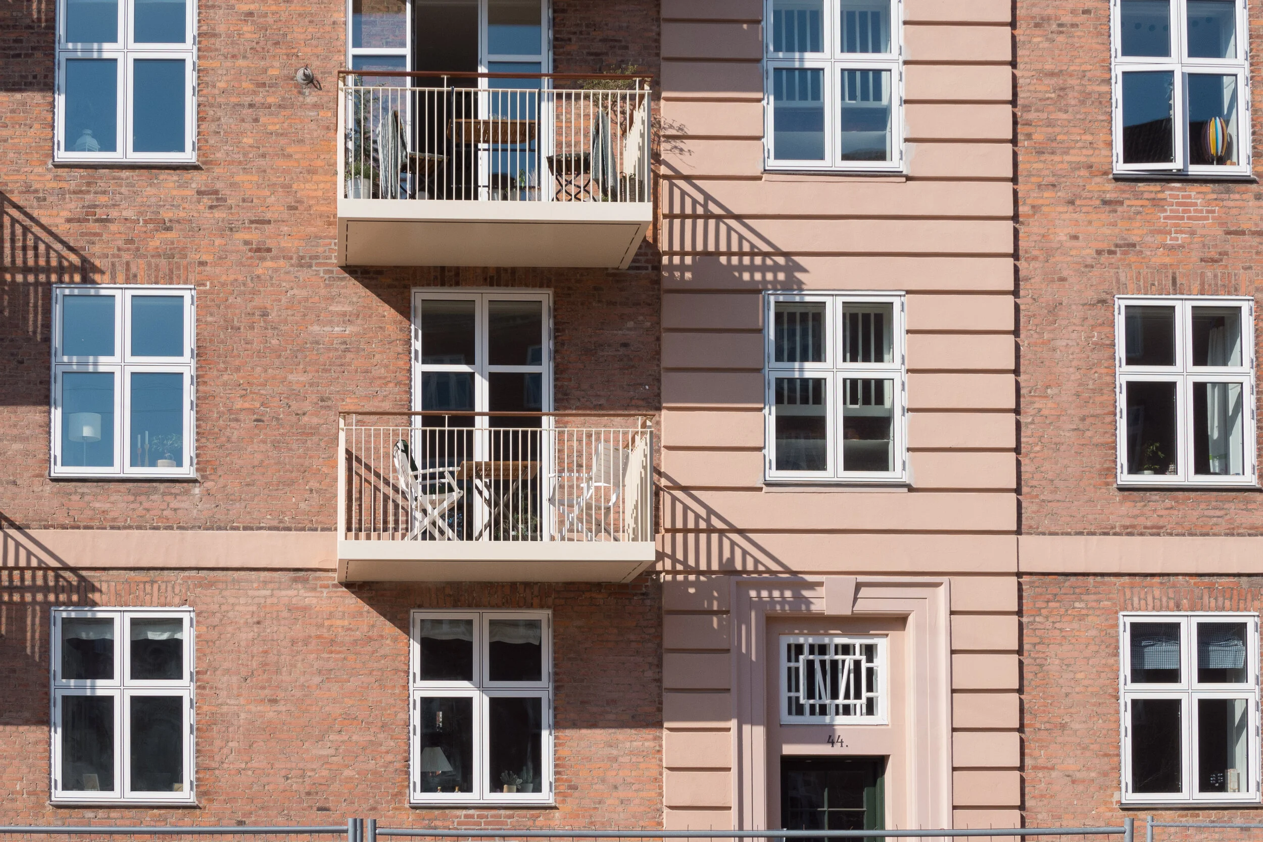
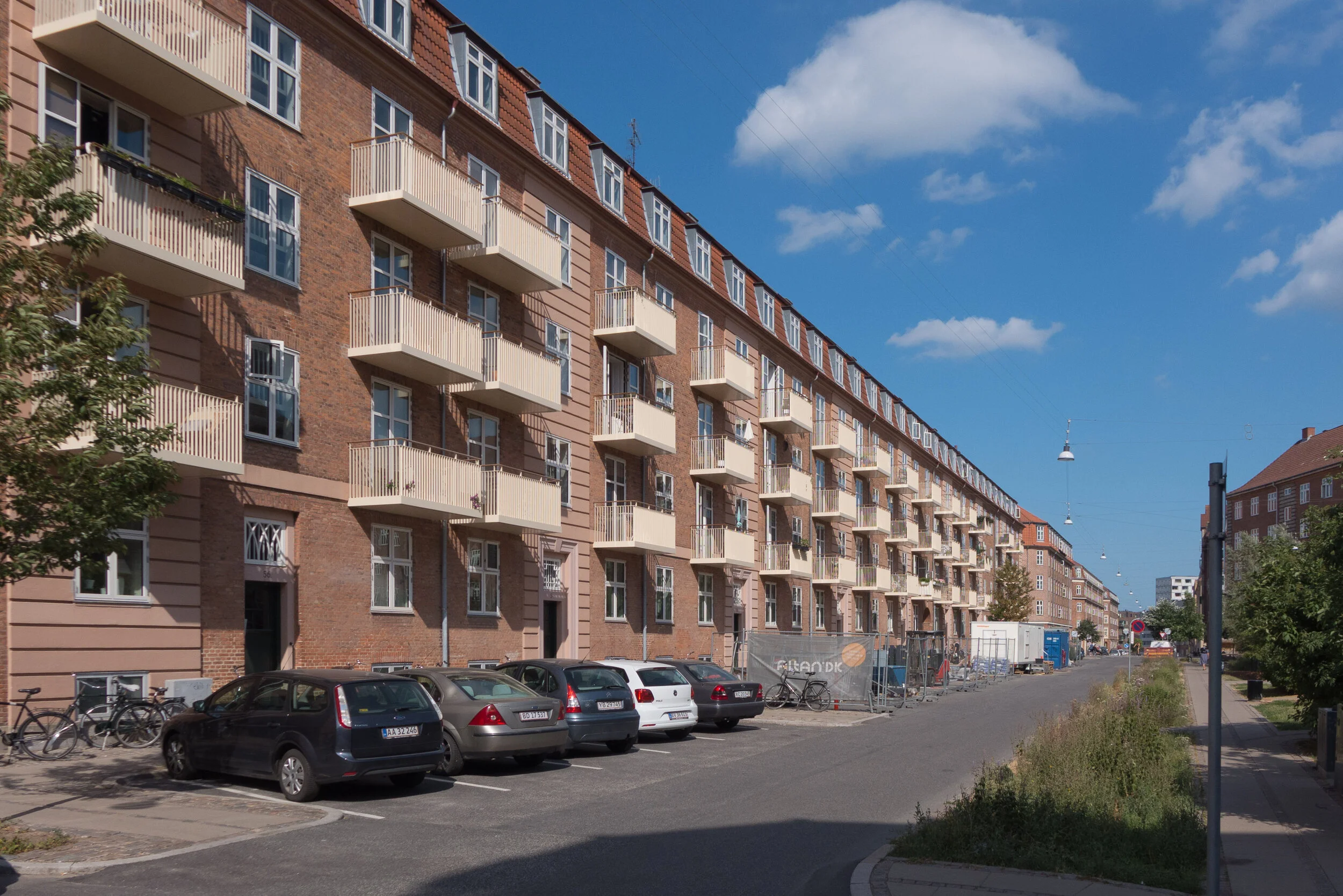
But, too often, these secondary balconies are simply metal boxes clamped across the front and, if nothing else, they increase the visual clutter of the street - diminish the streetscape - and, if not all the owners or tenants want the disruption or the expense of knocking out walls below windows for doorways and for constructing the required supports for the balconies - they can be spread randomly across an otherwise regular frontage.

Worse, when placed across the sunny side of the building, new balconies can throw deep shadows across windows below so actually they mean less light for those lower rooms and, in some cases, balconies above will take away an unimpeded view of the sky when someone is in the room below.

It’s difficult. Obviously people like and want a balcony and who is a mere planner to say they can’t have one?

But now they really do have to be reigned back and controlled.

Copenhagen has a phenomenal stock of well-built apartments that date from across the last three centuries and with modern materials for glazing and with modern and efficient heating systems and insulation we can give these older buildings an important extended life and, without doubt, buildings only survive if they can be adapted for changes in the way we want to live. But too many good buildings are being devalued by poorly thought out balconies and too often these end up simply as extra space to store kids toys or the best bike that cannot be left in the courtyard or a barbecue that once seemed like a nice idea but somehow now is rarely used.


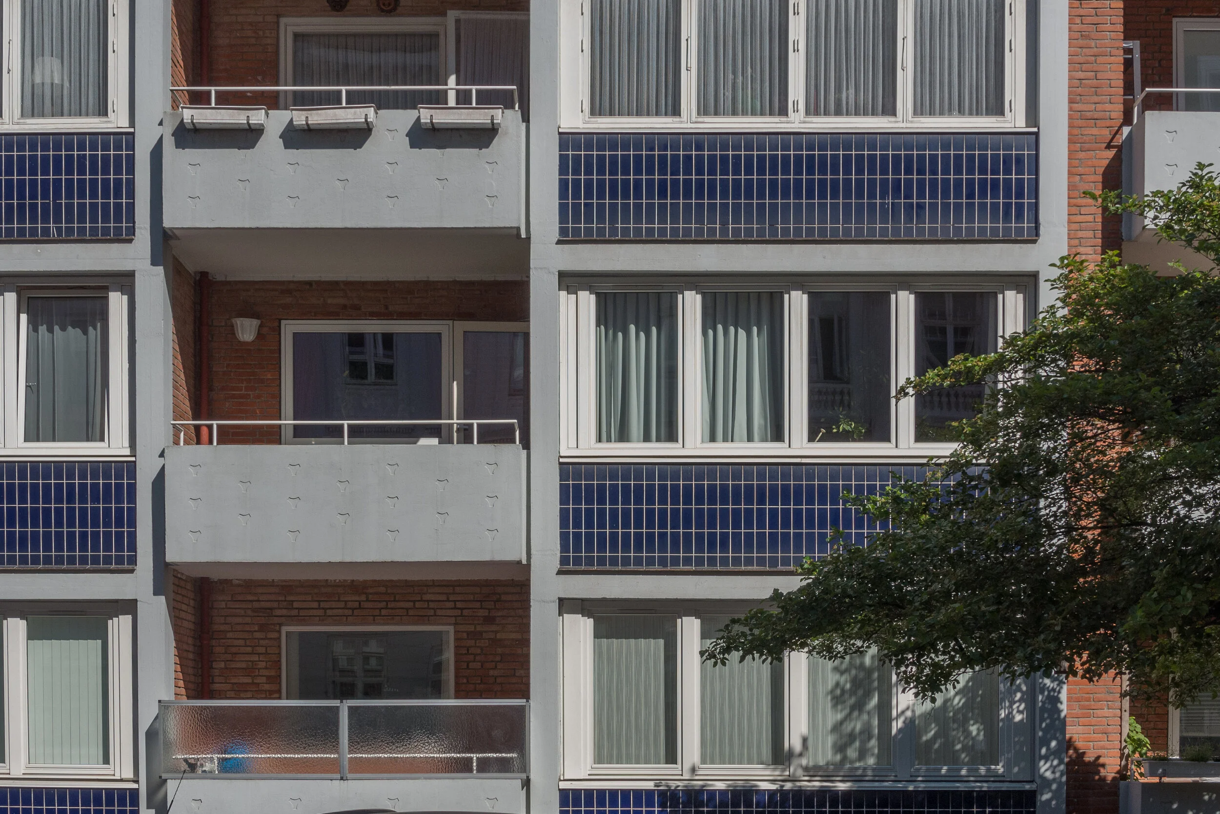
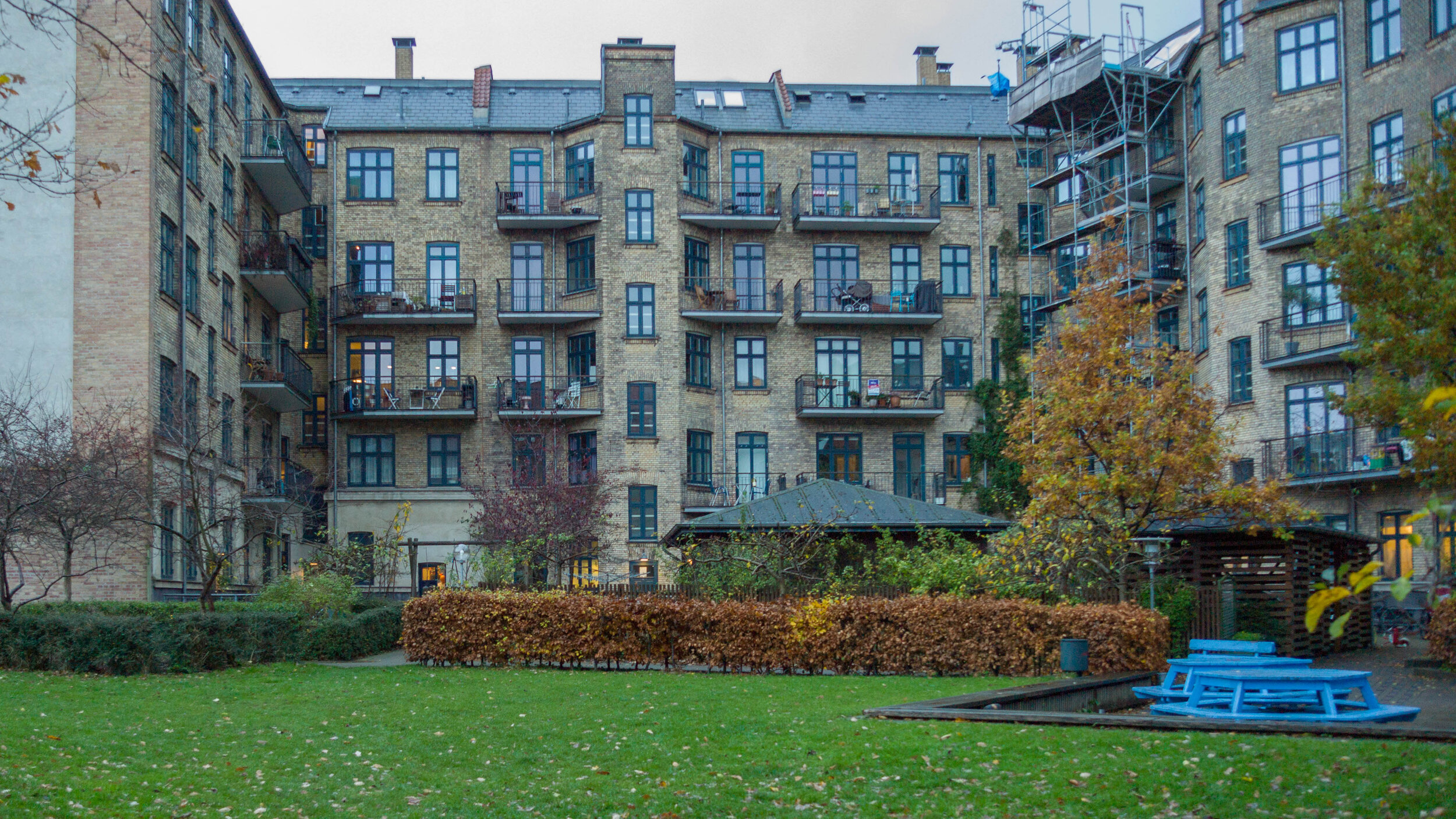
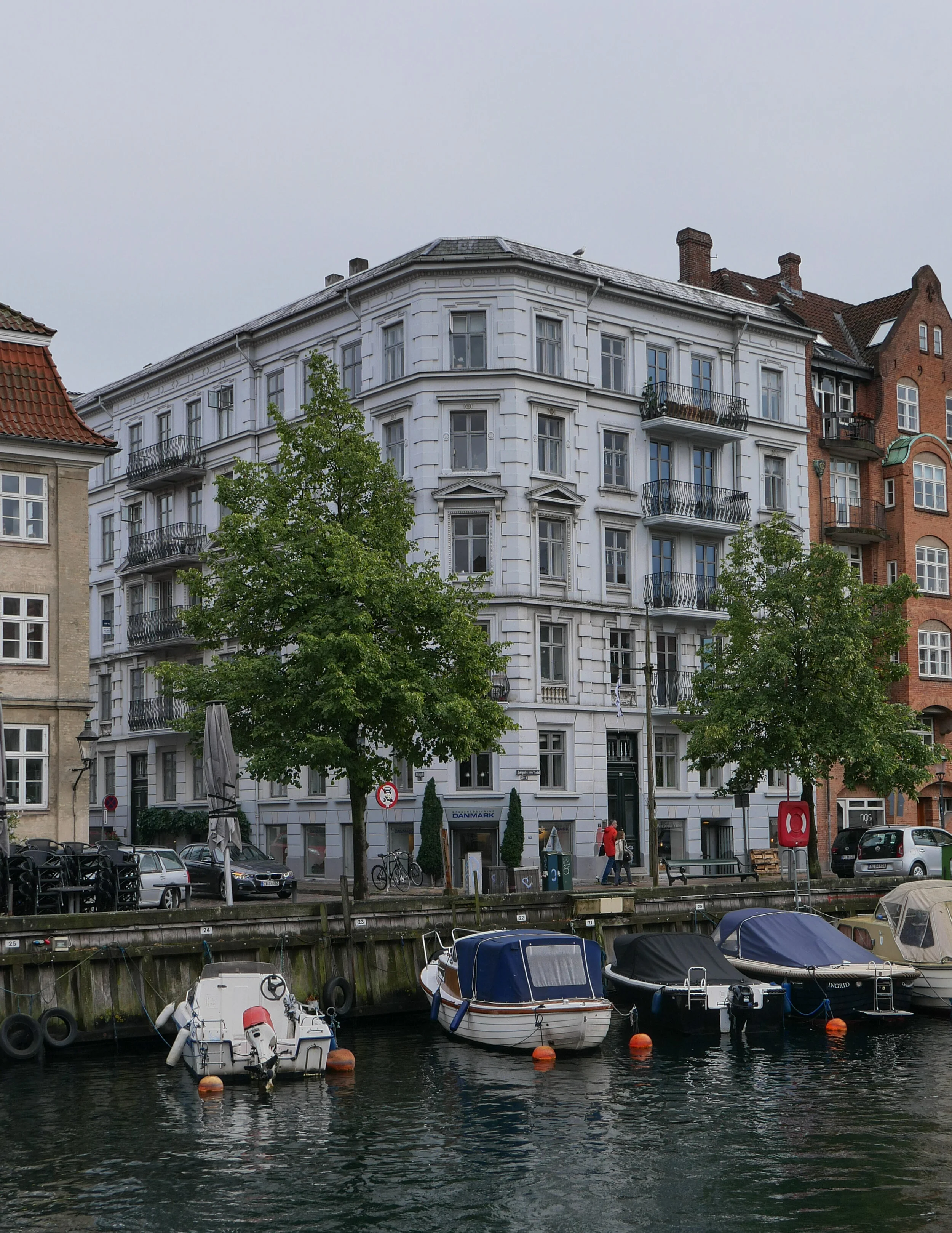
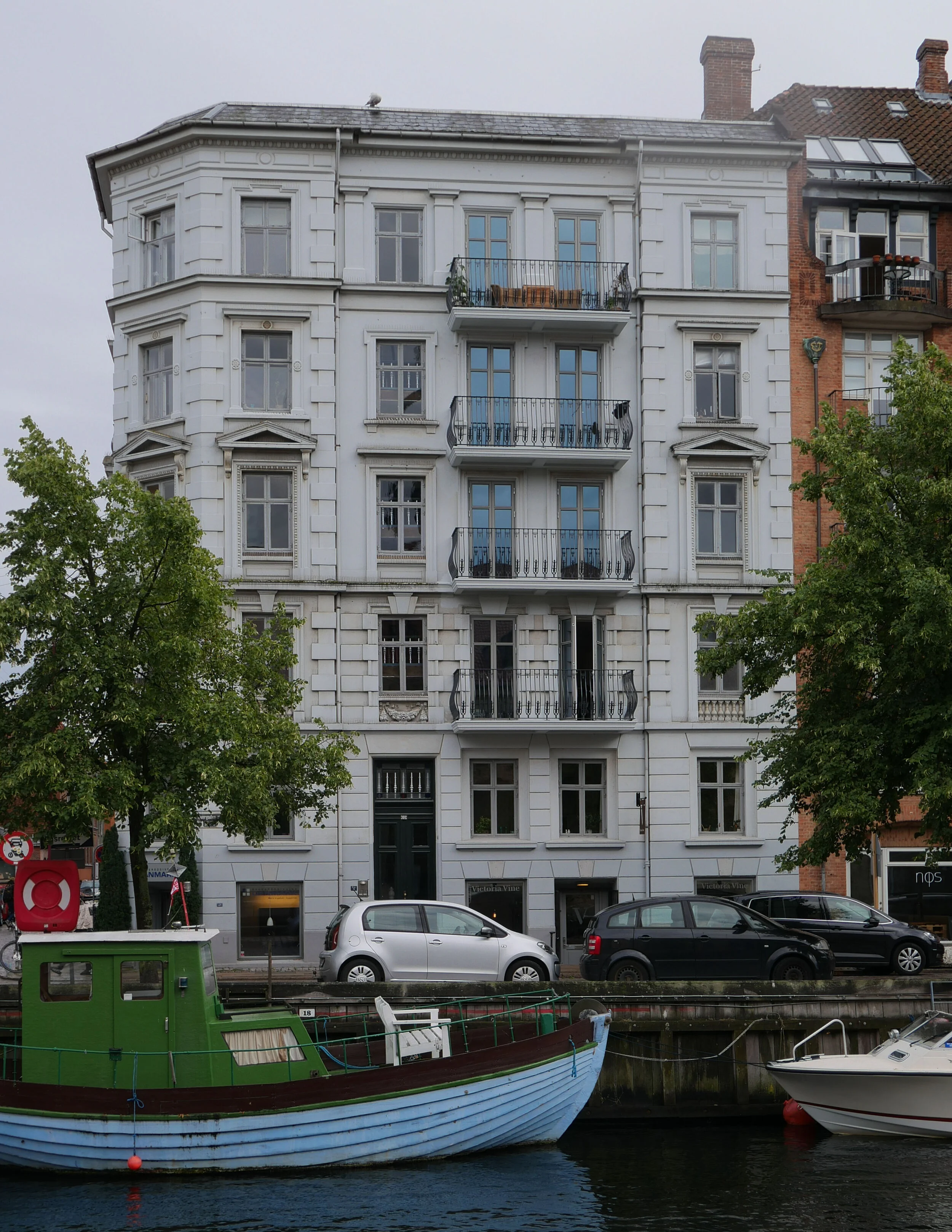
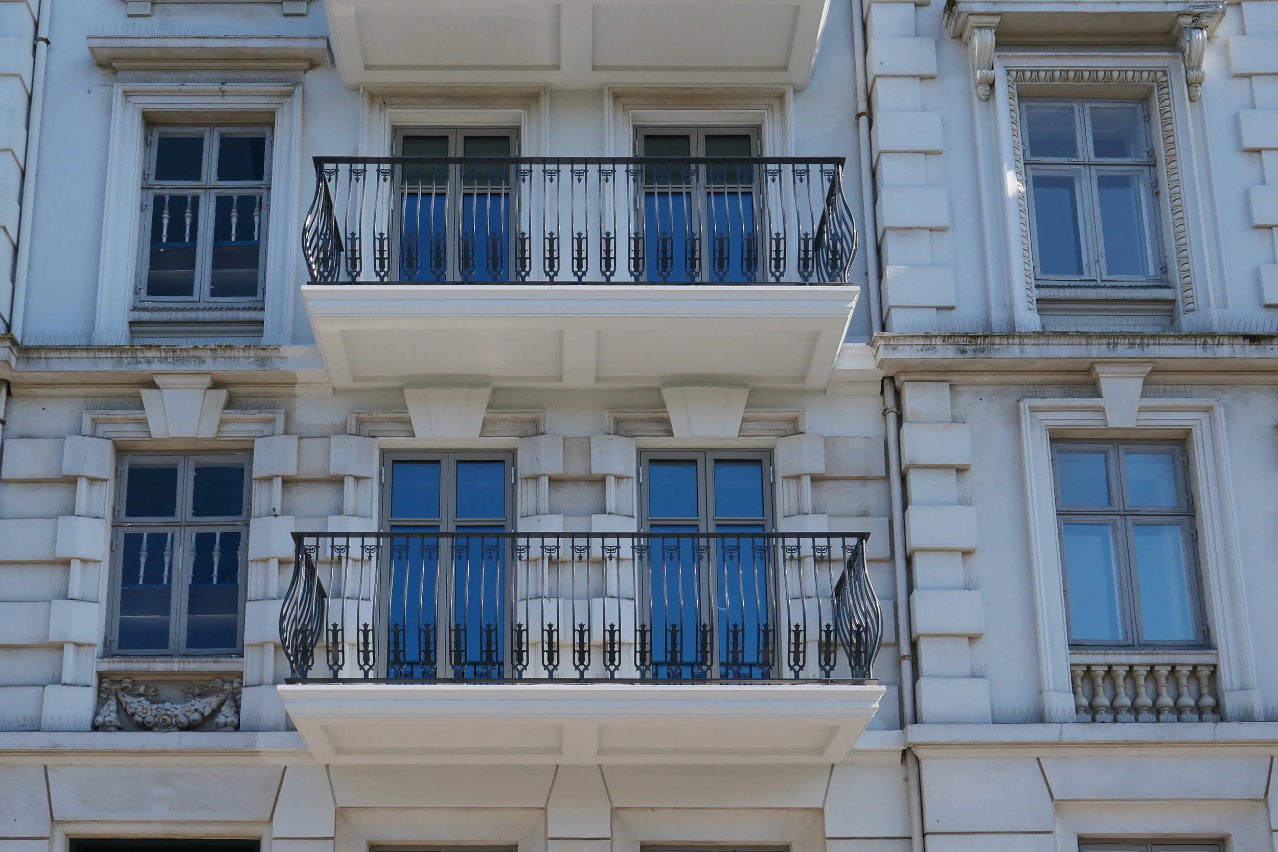
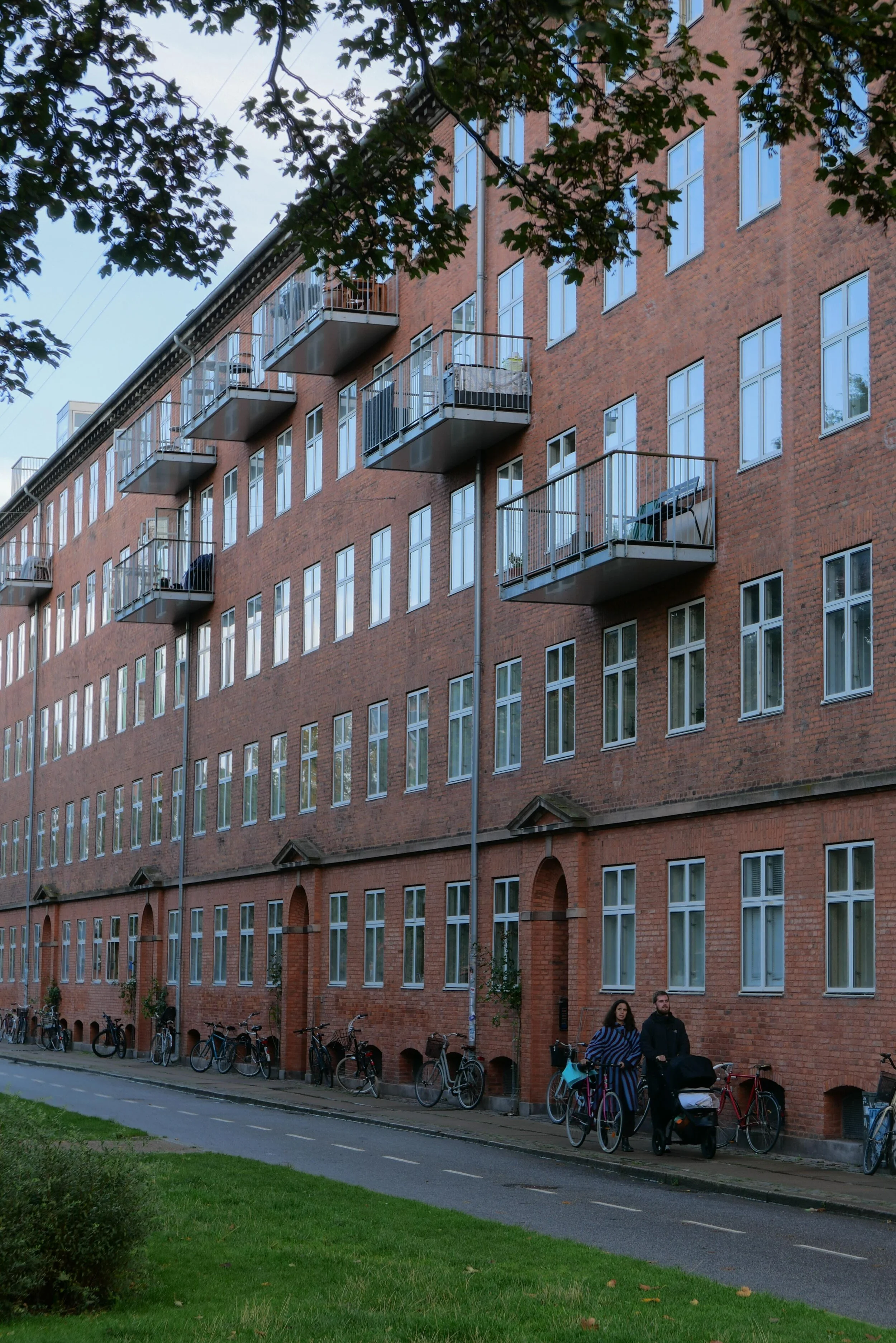
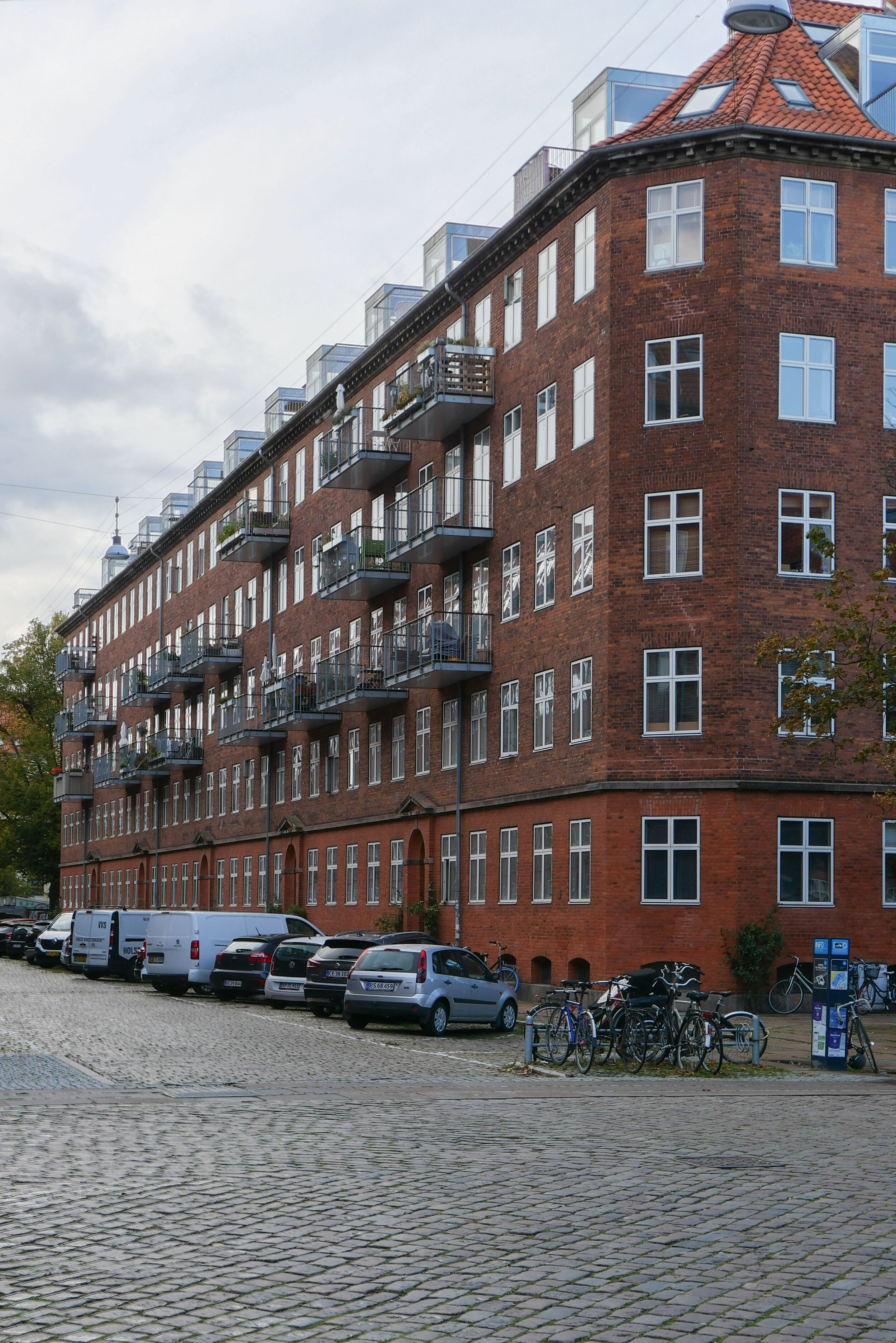
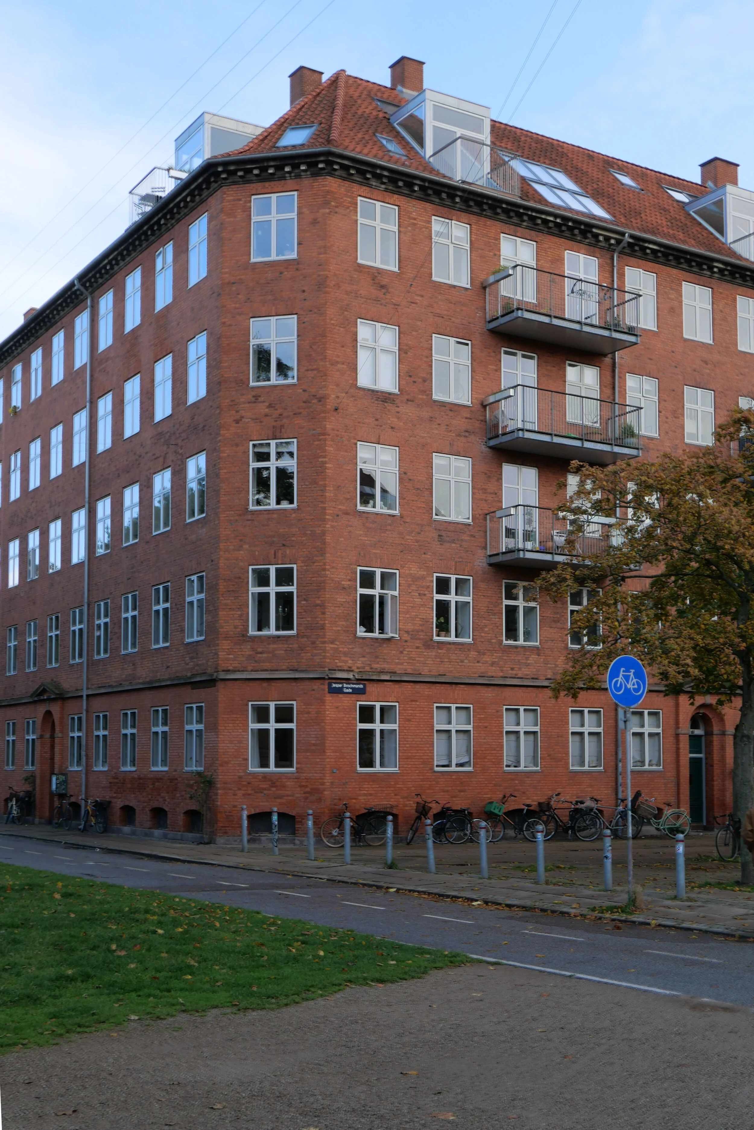
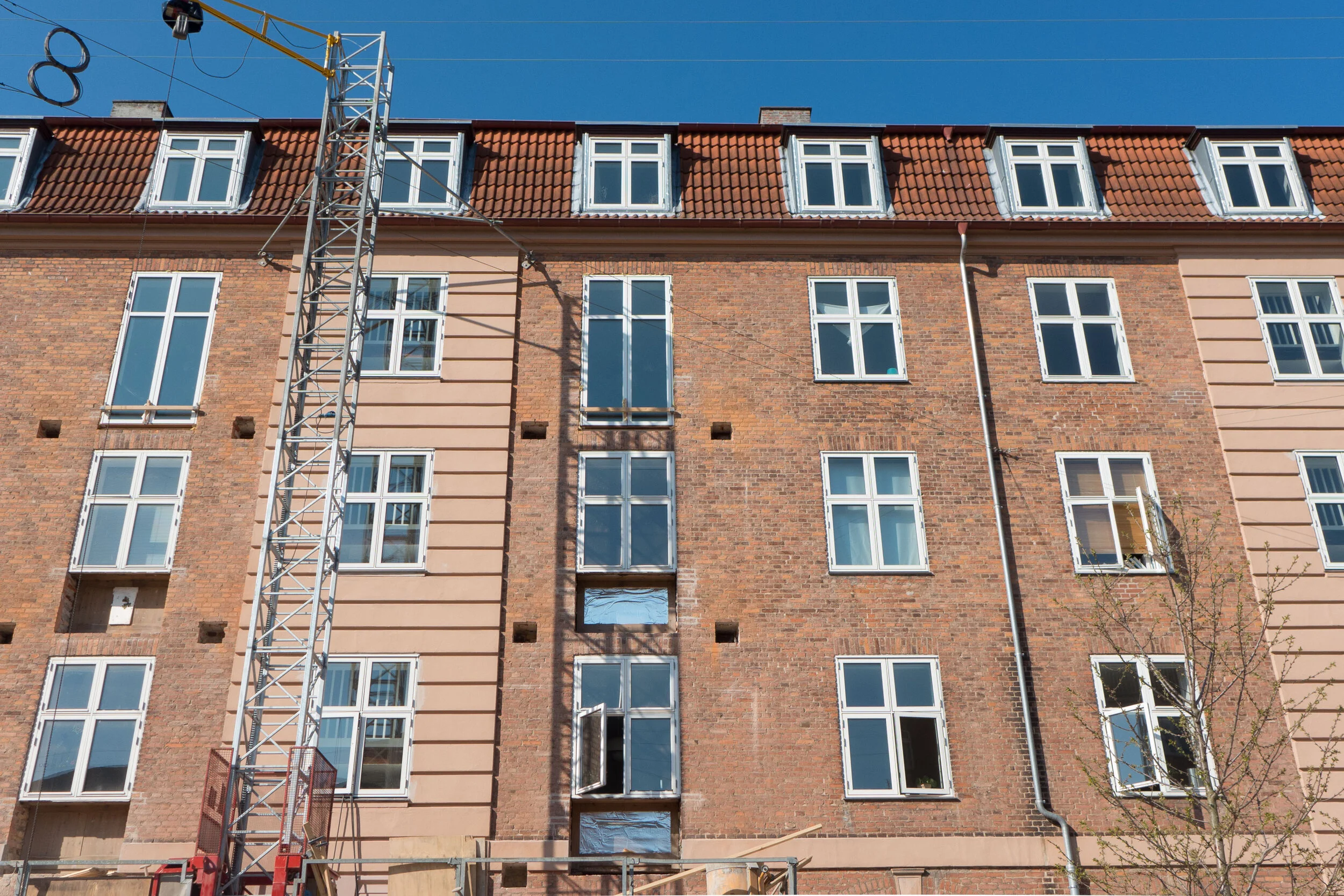
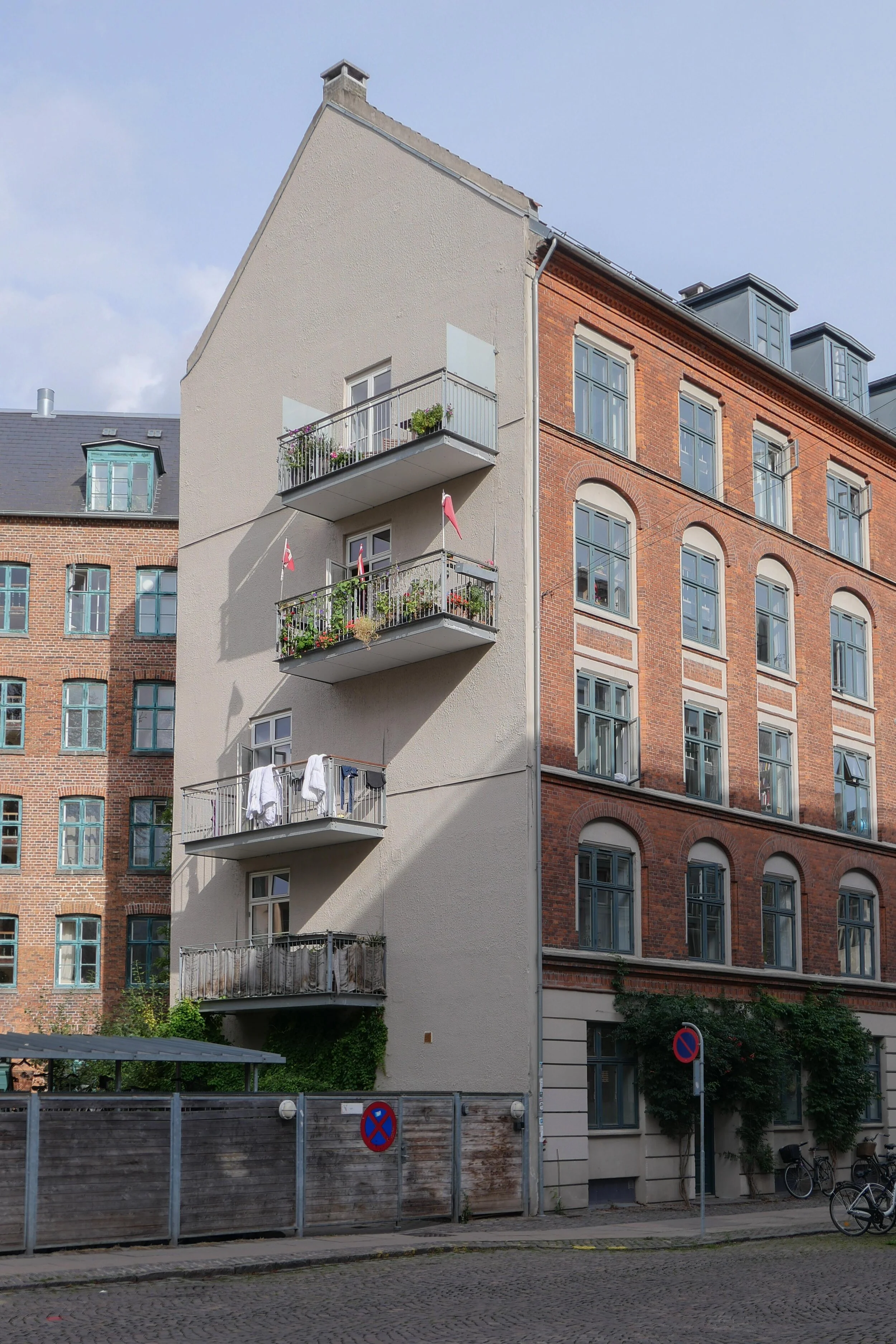
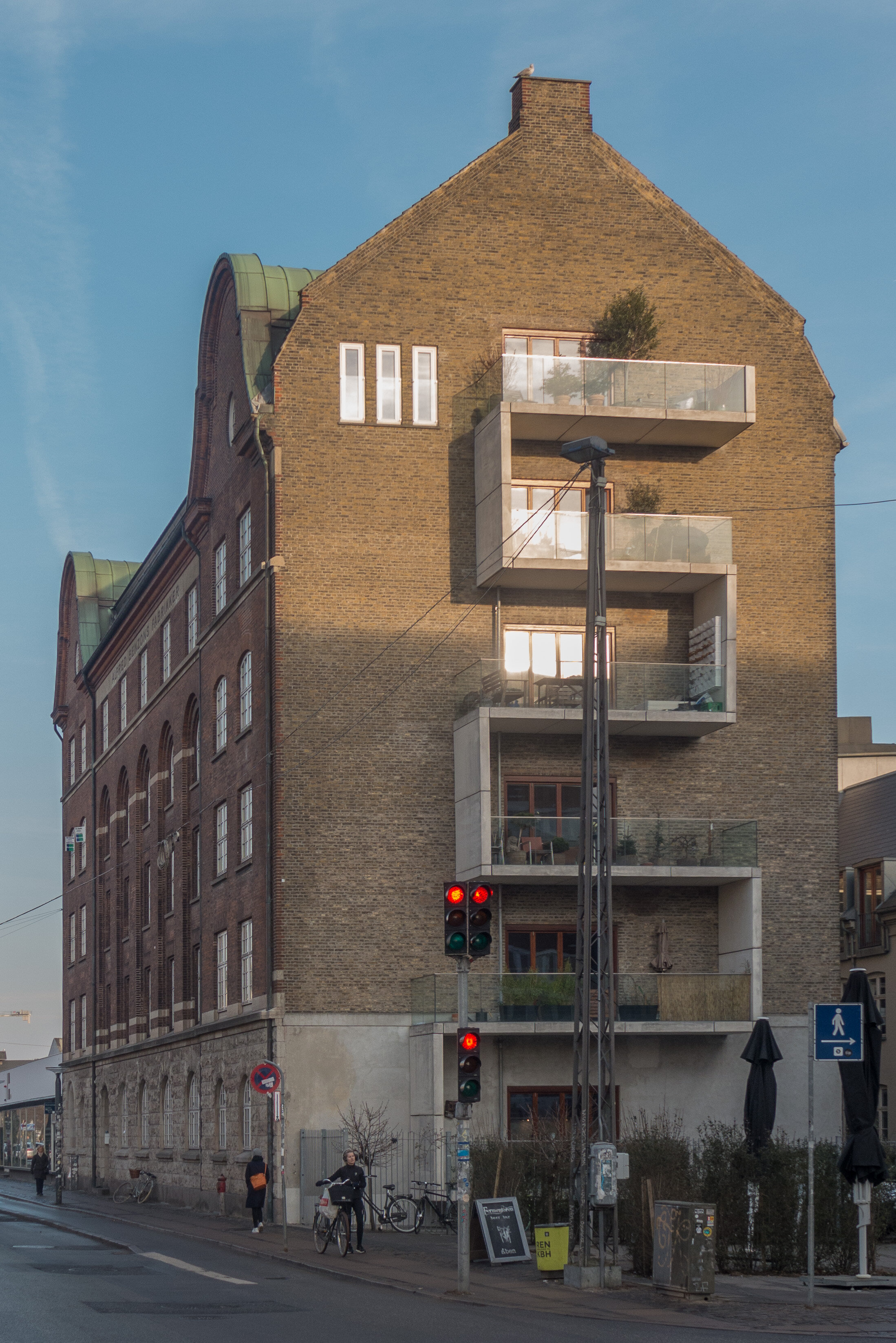
An apartment building on the corner of Sønder Boulevard and Sommerstedgade (left) and an apartment building on Broagergade are two examples where it could be argued that balconies add interest to otherwise stark or plain facades but both show clearly the problem with balconies throwing deep shadows across windows below

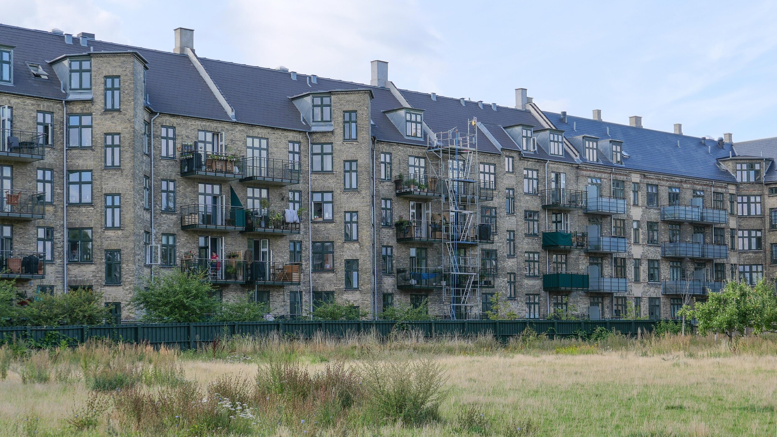
Skydebanegade (below left) and Nordre Fasanvej in Frederiksberg are examples where courtyards have been cleared of buildings and new balconies added to rooms at the back of the apartments that look down to the courtyard.


Overgaden Oven Vandet - expensive balconies added to an apartment building from the late 19th century
pairs of window were lowered for access to a long balcony but this meant the removal of aprons or panels below the windows and distinct features like key stones above windows were partly covered so changing the careful articulation of the original design


Tavsensgade housing scheme on the west side of Assistens Kirkegaard was designed by Povl Baumann and completed in 1920

the architecture of the brick blocks is severe but this is a major and influential group of buildings of considerable historic importance.

balconies have been added in a random pattern across the street frontages


Tåsingegade … a scheme to upgrade these apartments in Nørrebro has more justification …
balconies were added across the front of all the apartments to look down on new climate-change improvements on the square and this gives people a stronger sense of community and a stronger sense of ownership and participation in the improvements to their street


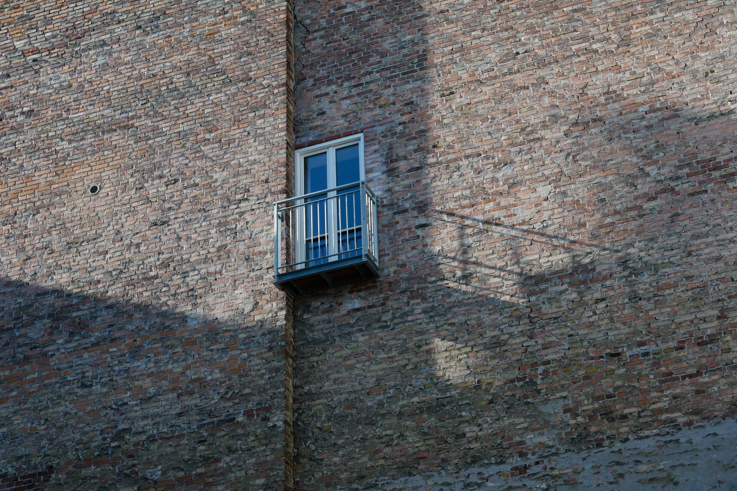
Rejsbygade - an apartment close to Enghave Parken - and a building on Sønder Boulevard have new balconies on what were blank gable walls … both seem to be associated with small areas of garden where adjoining buildings have been demolished

L1066646.JPG
 

Ørkenfortet / Desert Fort, Christianshavn

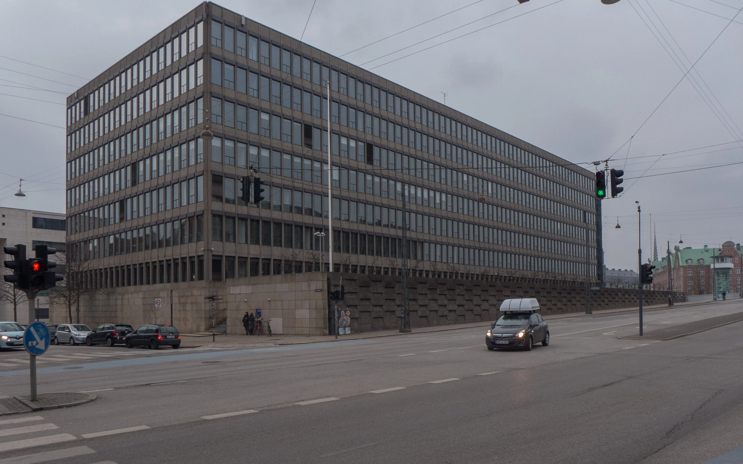
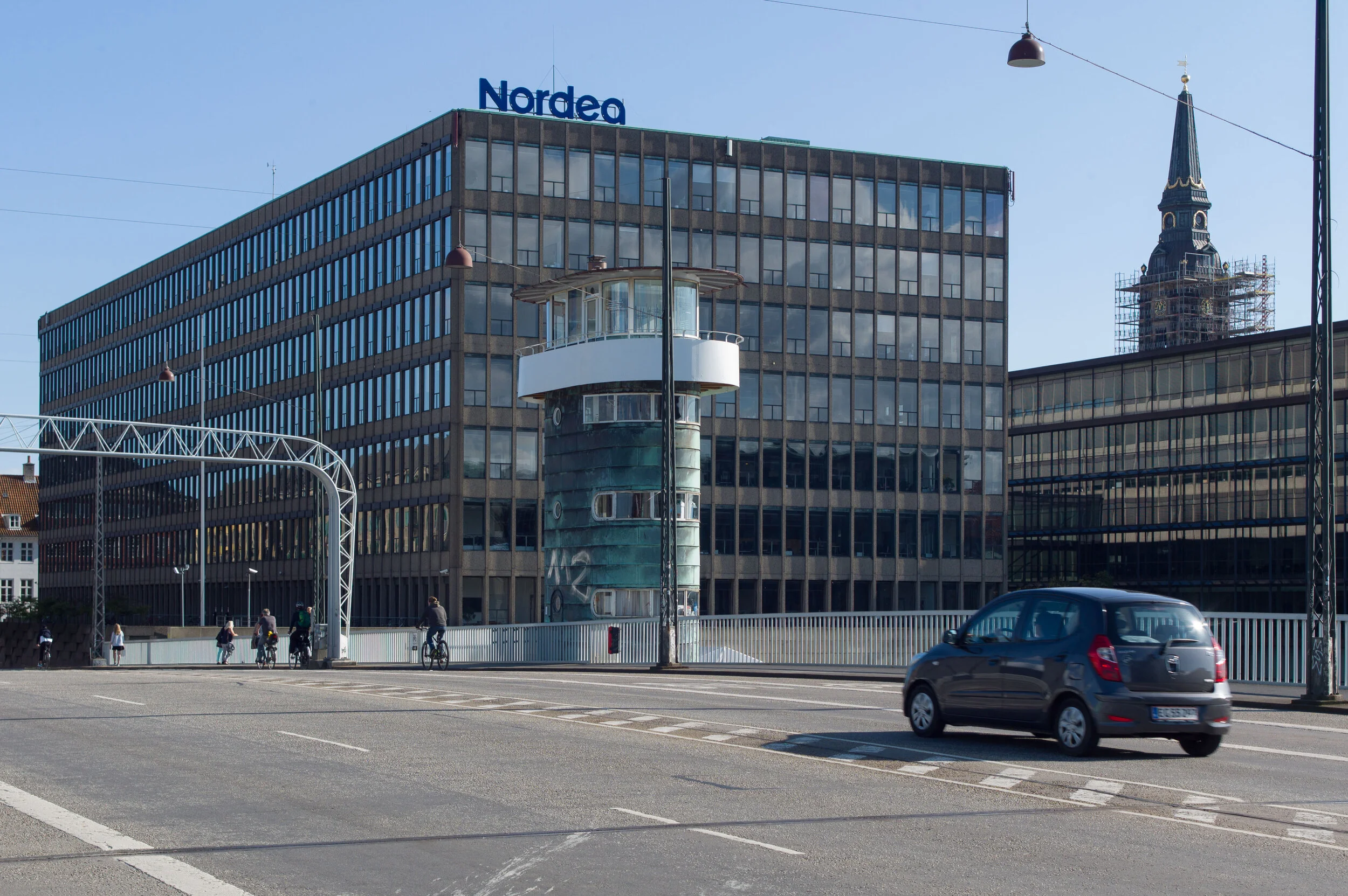
Work is moving forward fast on Ørkenfortet, the Desert Fort - the large office building that is at the centre of the harbour at the Christianshavn end of Knipplesbro - the central bridge that crosses the harbour between the centre of the city and Christianshavn.

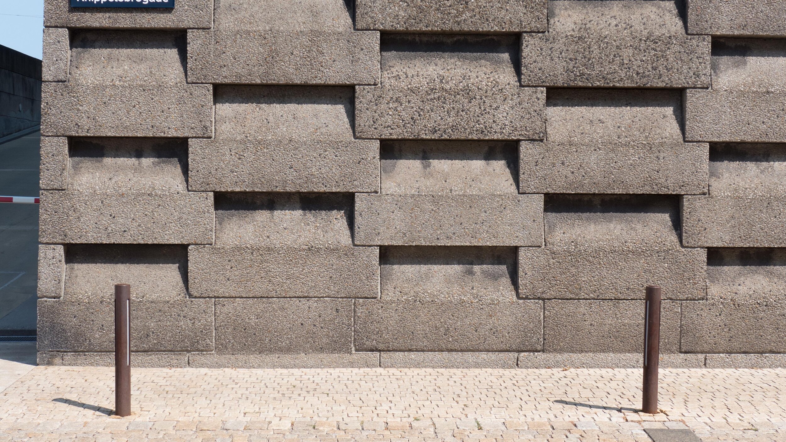
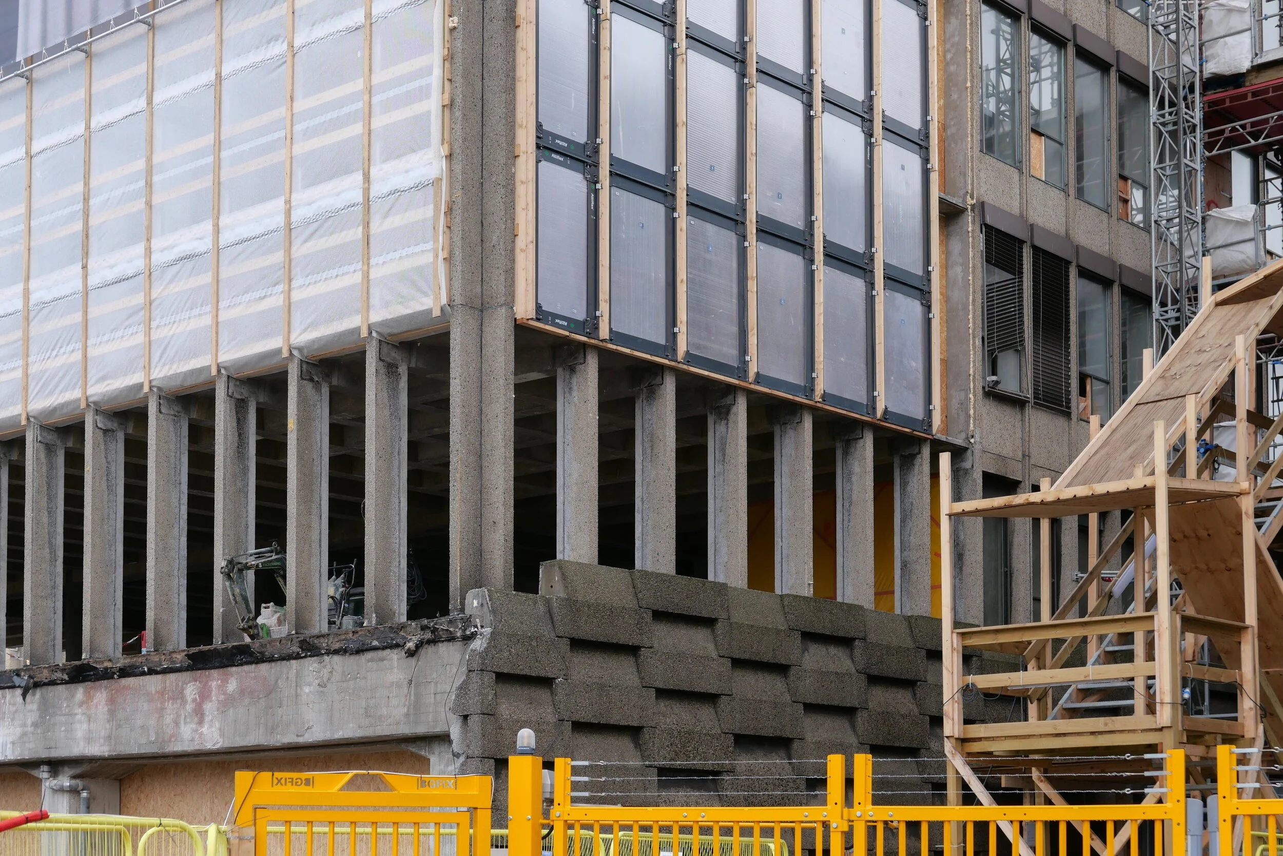
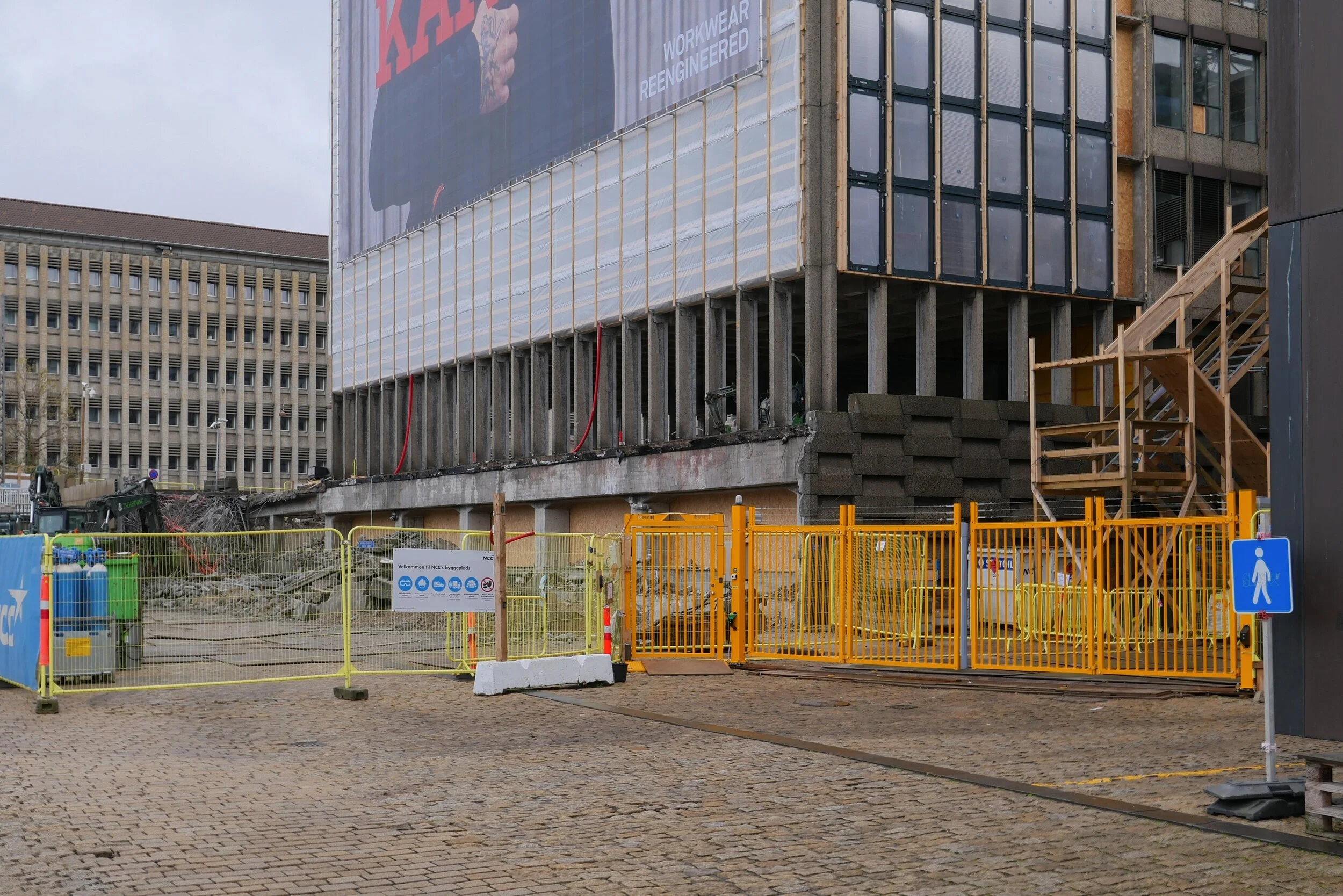
The interior at all levels has been gutted and all original windows and all external cladding have been removed. Work has started on cutting down new internal courtyards or light wells within the concrete structure of the block and on removing hefty concrete retaining walls along both the street frontage towards Torvegade and at the level of the quay on the end of the building towards the harbour that formed a base for the building.

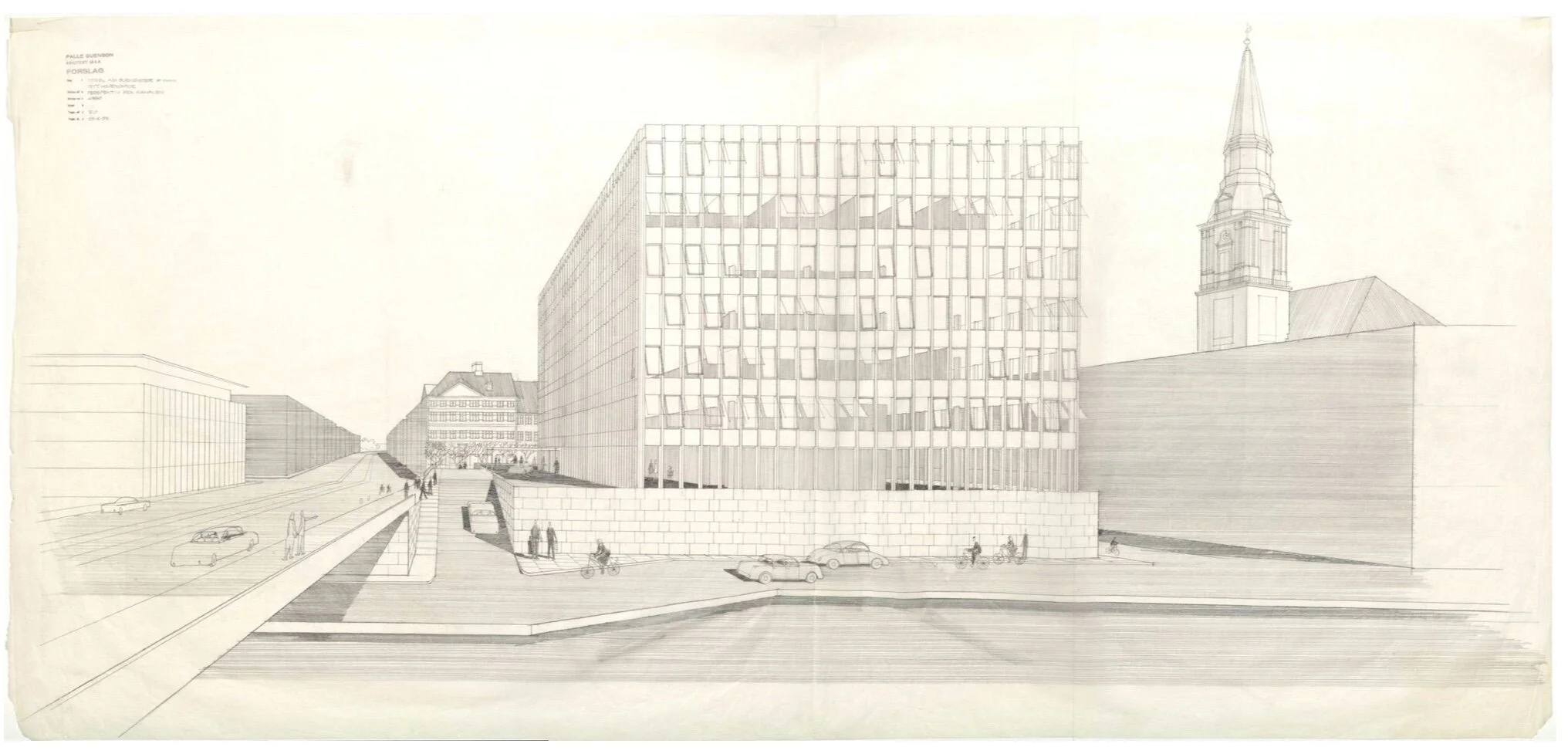
Ørkenfortet was designed by Palle Suenson (1904-1987) and was completed in 1962 as offices for Burmeister & Wain who were a well-established and major engineering and ship-building company in the city.

They had been established under that name in 1865 and, by the middle of the last century, their main ship yards were at Reshaleøen - at the north end of the harbour - where the main dry dock survives along with the some of the huge sheds and buildings of the yards but the engine works were here at the south end of Christianshavn, immediately south of this office building.

These extensive engineering yards on Christianshavn shut in 1993. Although some of the earlier buildings - including former drawing offices and the works' gates - survive, most of the buildings along the quay towards the harbour were demolished and wharves and docks were filled in for the site to be redeveloped with large new apartment buildings and extensive office buildings that were designed by the architects Henning Larsen.

Several of these office buildings along the harbour were occupied by the Danish headquarters of Nordea Bank including the office building by Suenson but in 2017, the bank moved their offices to a new site, close to the metro station at DR Byen, and the main office building from the 1960s became available for redevelopment.

This is all fairly straightforward history - the recent history of the site and of the building - but what I don't understand is the planning decisions then made for this key site at the very centre of the harbour.

Of course, I can see the logic and the reasons for planning decisions made in the 1950s. As Denmark emerged from the war, the priorities were for economic recovery. These ship-building and engineering works were not only a major employer in the city but these were highly skilled and, presumably, relatively well-paid jobs. The company was well established and, if nothing else, emerging from the widespread destruction of the war, there was an obvious market for new engines and new ships to replace what had been lost. Perhaps, and even more significant at that stage, although the harbour was, in terms of topography, at the heart of the historic city, attitudes to the harbour then were very different.

Then , north of Knippelsbro, were the working naval docks, with all that meant, and with the only road access through Christianshavn. Through the centre of the harbour and below or south of Knippelsbro was a working port with all that meant. Polite, middle-class society in the city would have seen the harbour as a major resource but that was as a major financial resource, so a massive new office building for Burmeister & Wain would not have been seen as an eye sore … even though its within sight of the 17th-century buildings of the exchange, on the other side of the harbour, and close to the magnificent warehouses from the 18th century, of the Asiatic Quay and Gammel Dok, on the other side of the road … but it would have been seen as an astute and positive show of confidence in the industries of the city and in their future.

It has only been with the decline of the dockyard and the working port and those industries that the harbour had to look for and has certainly found a new purpose at the heart of the city but I'm not sure how this massive hotel development actually makes a positive contribution.

On the side away from the harbour, the existing building looms over Strandgade - an exceptionally important street of historic buildings with many that date back to the early 17th century - and it overshadows the stunning Christians Church by Nicolai Eigtved that was built in the 1750s.

The block of the existing building is massive - one of the largest and certainly one of the most prominent at the centre of the harbour. It's 90 metres long by 31 metres deep and about 30 metres high. It's not a bad building as such but simply a product of its period and certainly not the best building for this location.

In terms of planning, the retention of the building and its conversion to a hotel by the Hilton Group, raises lots of issues.

It will have about 400 rooms so how will Christianshavn cope with the amount of traffic a hotel of this size generates with visitors coming and going, staff arriving and leaving and delivery lorries coming and going?

And why, when it is such a large building anyway, has permission been given to add a whole extra floor on the top that will increase the visual impact of the building and ensure that it overlooks even more properties. I can see that a roof-top dining room and roof terraces are a huge bonus for the hotel but I cannot see what they contribute to the harbour or to the neighbourhood.

Consent has been given to remove the hefty concrete retaining wall along the lowest level towards the quay but this means that the hotel can colonise and make use of the quayside as an asset for the hotel although citizens gain little from this apart from some new steps up from the quay to the bridge on this side. Note there are already steps up to the bridge on the other side of Torvegade and steps on both sides of the bridge on the city side so access from the bridge to the quay is actually adequate.

Almost-certainly, the city would not have given permission for a building of this size and prominence if the site had been empty land or there had been much lower buildings here.

Surely, it would have been better for the city and for the harbour if the building from the 1960s had been demolished and replaced with buildings that were lower and more compact, and with new buildings that reinstated or created a reasonable street frontage to the road up to the bridge and a more appropriate and more respectful frontage towards Strandgade.

Planning Statement - appendix to the Local Plan

notes:

In Danmarks Kunstbilbliotek / the Danish Art Library in Copenhagen there is a drawing of the building by Palle Suenson Inv. nr. 53296 - a perspective from Knippelsbro

While tracking down information on the building I came across a web site that revealed that the building was given a nickname by locals who called it Røven or The Arse. Initially, I assumed that was because the building was thought to be butt ugly but actually it was because at lunchtime workers in the office came out onto the forecourt and sat along the parapet of the wall along Torvegade and, for people walking along the pavement below, the only thing that could be seen from the street was a line of backsides.


photograph from 1965 showing Knippelsbro and Torvegade with the office building designed by Palle Suenson in the foreground and the engineering works of Burmeister & Wain beyond - along the harbour as far as the canal and around the south and east side of Christians Church


waste collection on Nyhavn

The photograph of rubbish piled around a street bin - posted with a quotation from Paul Mazur on Black Friday - was actually taken on the morning of Black Friday.

I had planned to post the quote because it seemed appropriate for this odd day that was contrived by marketing men in the States to make people spend. It’s the day after Thanksgiving - that public holiday when you spend time with families rather than spend money shopping - so presumably Black Friday is the bargain sale to hook you back into spending, just in case you forgot how spend having just had a day off. Is the message here that if you buy something you don't need then at least buy it at a knock-down price? Or maybe if you don't actually need it then by offering it at a sale price you might be persuaded to change your mind.

Anyway, I was heading out to take a photograph at the recycle centre on Amager - to go with the quote - but then there was this on the quay right outside my front door.

Everything had been abandoned - including a large and fairly new suitcase along with a good small metal case and various pictures in frames - so it looked as if someone is moving on from one of the apartments around here and what they were not taking with them had been dumped on the pavement sometime during the night. At least it gave me as good an image as any to represent our throw-away society.

Nyhavn, or New Harbour, was constructed in the 1670s for ships to load and unload goods. Over 400 metres long and 28 metres wide - it runs back from the main open harbour to the large public square of Kongens Nytorv

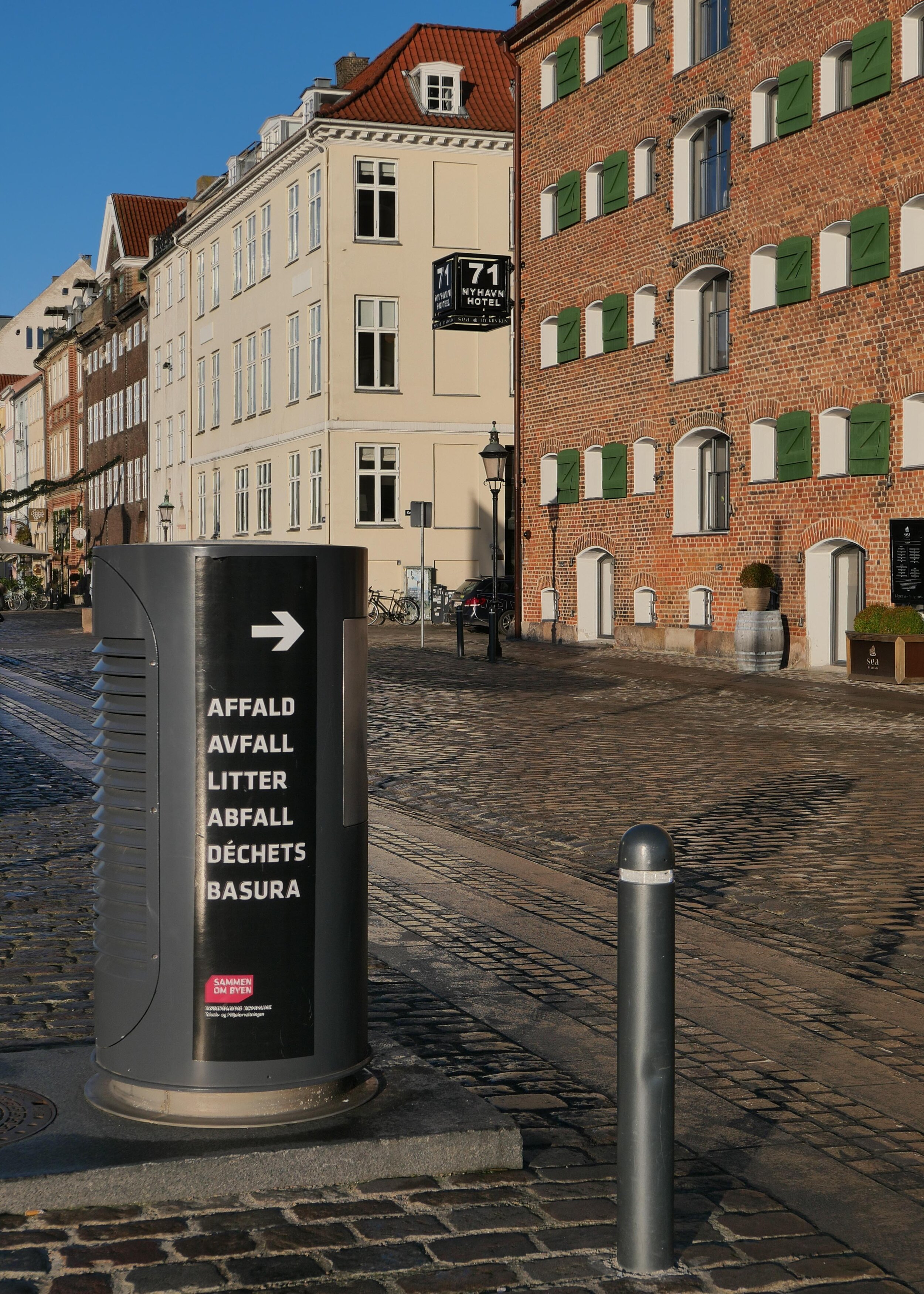
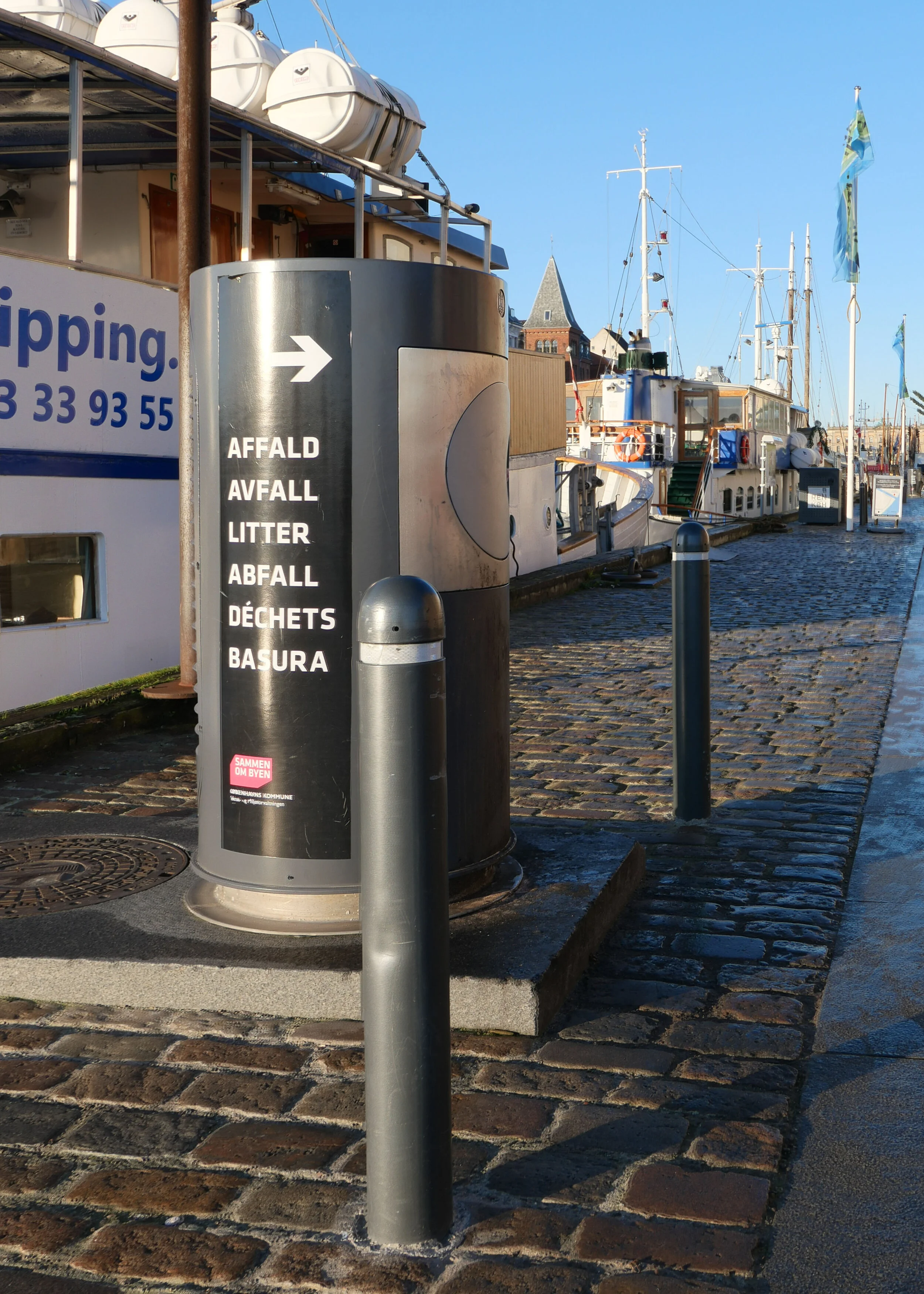
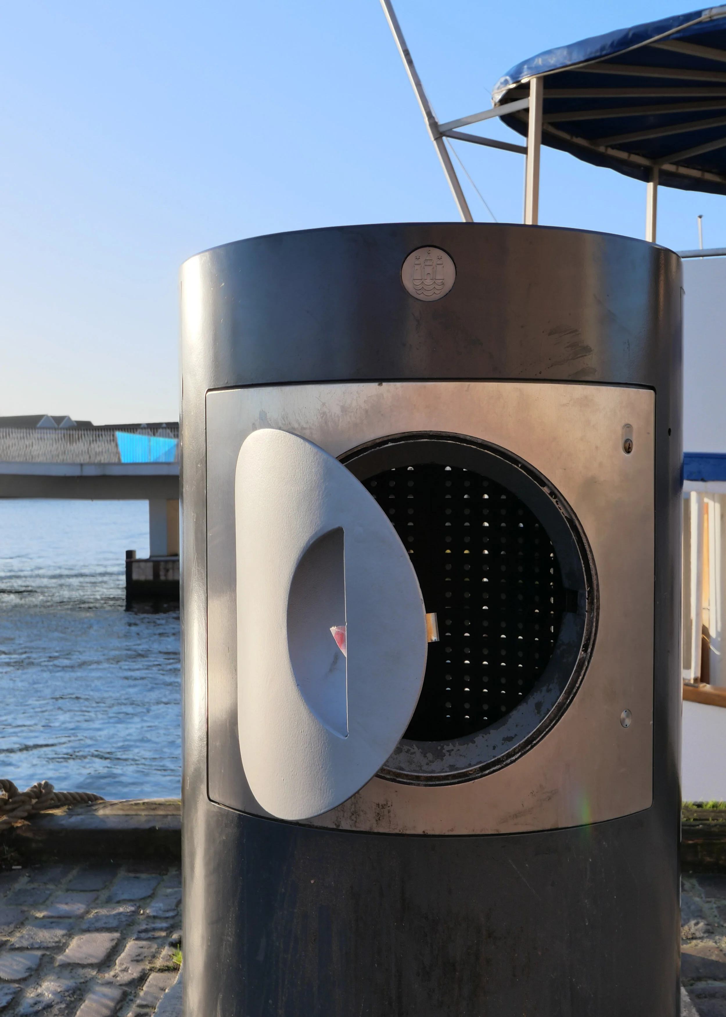
In any case, the bin system here is of interest and I had been thinking about a post for some time. It might look like an ordinary street bin but it's one of a line of bins along the quay that are the above-ground part of a sophisticated waste system from ENVAC.

When rubbish is dropped in, it doesn't go into a basket or inner bin that has to be emptied but it drops down into a buried pipe that is 500 mm in diameter and when the bin is full, triggered bt a level sensor, the waste is drawn through by vacuum to a service access point set down into the road at the end of the quay.

Nyhavn has large city blocks running back from the harbour on either side and is one of the most densely built up parts of the city with tightly-packed back buildings and small courtyards with homes and offices behind the street frontages. Not only is there little space for large modern waste bins in these yards but there is also a problem getting to the courtyards to empty any bins to take away waste. The quay, on this the north side of Nyhavn, was pedestrianised in the 1980s and although there is access for deliveries, the quay is normally thronged with tourists and there are around thirty restaurants just along this side and most of them have umbrellas and chairs and tables outside that are tightly packed together and most are there year round, so getting through to the archways, to get into and out of the courtyards, is difficult.

The only clue that the bins might not be ordinary street bins is the size - large for a street bin - and the slightly unusual port-hole style door but, presumably, very few tourists stop to wonder why.

They are 1.36 metres high and just over 70cm in diameter and are designed to take all the household waste from the apartments above the restaurants and from the apartments in the inner courtyard buildings - so some 150 apartments in total. That waste is dropped in through the small round hatch. For commercial waste - from the restaurants and bars - they have keys to open the full square opening to put in larger bags of rubbish and packaging.

Designed by Erik Brandt Dam and installed in May 2012 - when the system was upgraded - there are eight large waste bins along the quay - along the 760 metres from Kongens Nytorv to the harbour - with eight smaller bins at intermediate intervals for street litter. These smaller bins look more like traditional street bins, with narrow slots for rubbish on each side, but they also drop their contents down into the system.

The Nyhavn waste system, with sixteen bins and the service point down at the theatre end of the quay, deals with 60 tonnes of waste a week.

bins for the new ENVAC waste system in the Bella Quarter in Copenhagen

The advantage is that the waste is dealt with quickly and cleanly and few people are disturbed when the system is emptied but one drawback is that there is less incentive, with this Nyhavn set up, for people to sort their rubbish for recycling. On the quay, there is now one large standard recycle bin for glass, tucked away round a corner, close to the Theatre, down near the main harbour, but otherwise plastic, paper and cardboard, metal and batteries have to be taken to recycle points several blocks away - the nearest are on the other side of the harbour - or people will put everything through the ENVAC system to end at the incinerator.

A decade ago this system was seen as cutting-edge for waste disposal - good because waste was not going to landfill but to a district incinerator as fuel for the generation of hot water for the district heating system - but for new residential areas in Copenhagen there is now an opportunity to build in more ambitious waste collection systems.

In a new development in Ørestad - for the courtyards and pedestrian streets in the Bella Quarter - ENVAC are installing a waste system where there are not single bins but five separate bins at each waste collection point and each marked for separate and different waste to be recycled so residents can sort out waste quickly and easily - just outside their apartment. Then, as with the Nyhavn set up, it is drawn by vacuum to a service point where it is collected for processing.

This keeps the area close to homes free of smells and free of the lorries that take away the waste. According to the company web site, the system can daw rubbish through a distance up to 2 kilometres.

Another problem in Nyhavn is that restaurant staff, for understandable reasons, tired and at the end of a long work shift, drag out rubbish and force it down through the hatch so the bins do get blocked. It triggers a sort of waste indigestion with lots of weird noises coming up from underground.

Restaurants should use smaller rubbish bags but that would mean more trips between the kitchen and the bin.

Some people fail to realise that underground, just below the bin, the vertical drop has to take the waste through a right angle to go into the horizontal pipe that runs along to the service point so I have seen some ridiculously long and inflexible things being forced through the hatch and then the service team have to come out and sort out the blockage. It was only recently that I realised that they can control the pumps for the pneumatics remotely from the van … so clear a bit … suck a bit … repack a bit …. suck a bit until the blockage is cleared. In Danish the vacuum system is called affaldssug and Google translates this rather literally as ‘waste sucks’ ….. a good motto for any movement lobbying against conspicuous consumption.

ENVAC


Den Hvide Kødby Lokalplan nr. 562 / The White Meat City - Local Plan - report 562

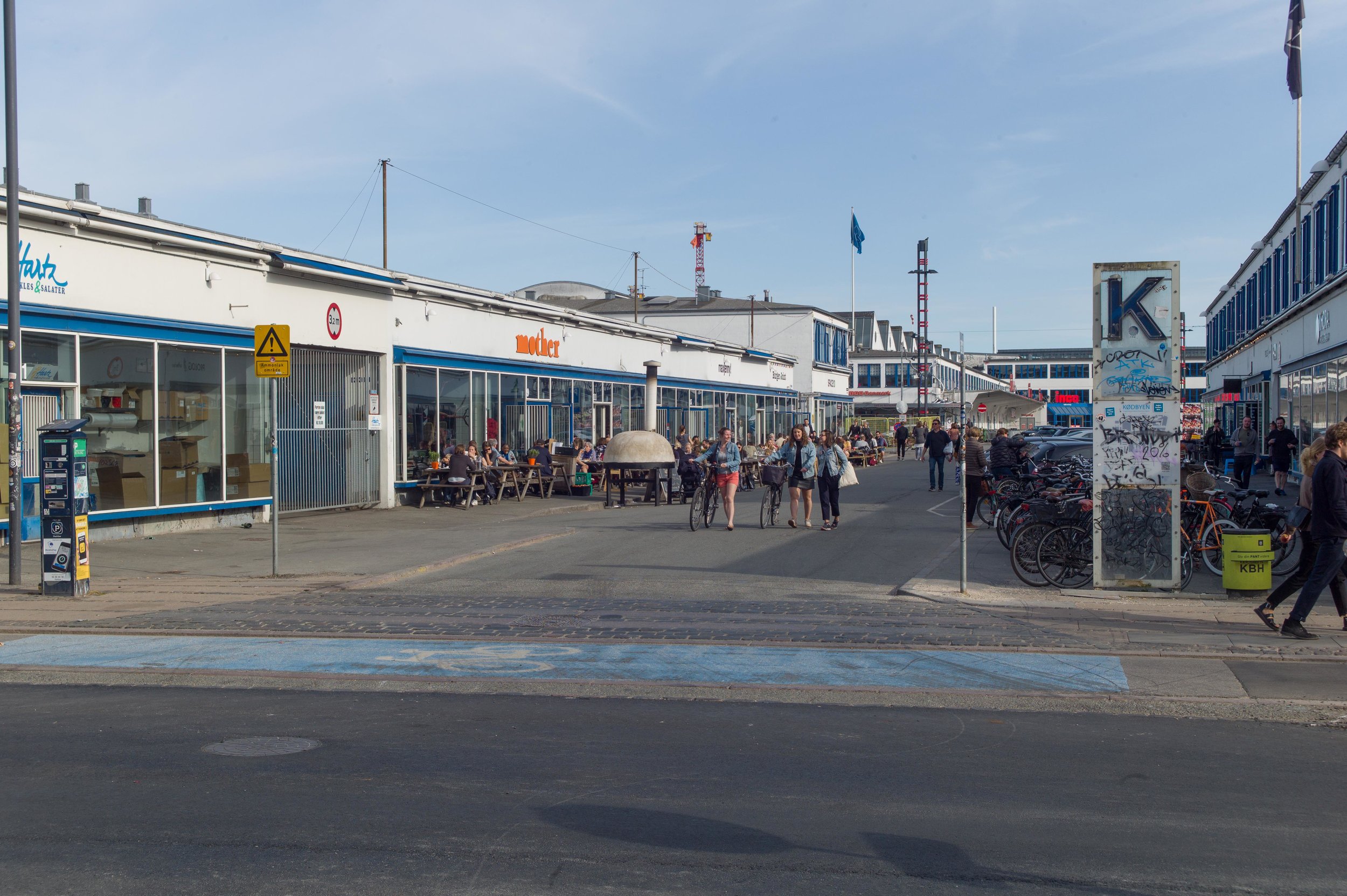
the Local Plan covers both the White and the Grey markets ... this is the boundary between the Brown Market to the left and the Grey Market to the right


select the image of the cover above and this is a link to a pdf file of the report published on line by the city

the oldest part of the meat market is Denbrone Kødby that was built out over what had been the foreshore with a new quay for ships beyond that marks approximately the line of the present railway as it approaches the main station from Roskilde


At the end of June a local plan - number 562 - was published by the city for Den Hvide Kødby /  the White Meat City district of Copenhagen. 

This is the west part of a large area of market buildings and slaughter houses that developed here from 1879 onwards when the meat market was moved from a site further north, closer to the lakes.

The market, sometimes referred to now as the Meat District, is west of the present central railway station and immediately south of a long open public space called Halmtorvet that continues on west into Sønder Boulevard and forms the north boundary of the site. 

Den Brune Kødby, the Brown Meat market, was the first part of the market to be built and is in brick. The buildings to its west - sometimes referred to as Den Grå Kødby or the Grey Market and included in this plan - were extensive additions to the market from around 1900 in grey or white brick and Den Hvide Kødby or White Meat City - primarily low and mainly flat-roofed buildings in concrete with white facades was a large addition to the meat market dating from the 1930s. 

In part because these are essentially industrial buildings but also because of the clean simple outlines with no decoration, then, in terms of style, this part of the market built in the 1930s is generally described as an important example of Functionalist architecture.

Note that the popular reference to the east part as the Brown Meat market only emerged after the construction of the additions of the 1930s - to distinguish the different parts the names refer to the colour of the buildings and not to the colour of the meat.

The area is owned by the city and this is certainly important for the long-term conservation of this area and for appropriate controls on detrimental development .

Changes to the market began around 2005 as meat processing here - from the sale of animals and their slaughter and on to finished meat preparation before selling on to shops and commercial buyers - declined. It is still an important part of the day-to-day life of the area but creative industries and restaurants and cafes began to move in alongside the whole-sale food markets and as new neighbours for the meat traders.

The plan acknowledges this:

"The local plan area together with Den Brune Kødby has a special atmosphere and authenticity with business, cultural and school and leisure activities in conjunction with the original food-producing wholesale businesses. Market functions, galleries, bars and musicals help create city life 24 hours a day."

The local plan for the brown market (Lokalplan / Local Plan 262) was produced at the end of 1995 and updated in June 2005. These plans should be read alongside the City of Copenhagen Municipal Plan published in 2015.

In 2014 a planning decision was made to allow the building of some homes on part of the site … up to 25% by area but mostly on upper floors. In 2017 there was a first official proposal to build a new school on land at the south corner and both will mean the demolition of some existing buildings.

This local plan tries to quantify these changes and it indicates that the commercial wholesale food markets and food businesses will be 40% of the usage but the plan specifically acknowledges the potential that the other buildings have for small craft-based industries.


during the summer there are  weekend food markets with stalls set out around the main square


The area is surrounded by parts of the city that are themselves undergoing major re-development with changes or new building on former brown-field sights so a coherent policy statement and a long-term plan for the meat markets was required: any plans for the White Meat market also has to be seen in close relationship to developments on the other side of the railway along, Kalvebod Brygge; radical changes along the north side of the area with work on Halmtorvet and along Sønder Boulevard and long-term changes that will come to this part of the city with the opening of a new line of the metro next year. It was construction work for the metro that was the reason why the central part of Sønder Boulevard for the full length of the street was behind massive green fences for years as engineering works for the new line were completed.

The published plan has extensive maps that identify the historic buildings and the text describes briefly how the different areas and structures were changed or adapted as their use has changed.

An important part of the discussion is about how the squares and open spaces and the roads and paths through the area are laid out and how they are used now and then suggests how they can be improved.

This is because the plan has to be integrated with what are, in some cases, competing access requirements for transport into and through the area … so there will be new bike parking at Dybbølsbro - the railway station to the south - bike routes that are cutting through the area have to be considered - so people coming from one place outside the area and going to somewhere outside - and the requirements for safe road systems around the school. There will be tight and necessary restrictions to protect the new metro line tunnels so weight limits for commercial traffic and very clear controls on nearby excavations for new buildings or underground services.

It is implied that demolition of some buildings within the area may be allowed for what is considered to be appropriate new buildings so overuse and density of use might become more of an issue … part of the attraction of the area is that it is often empty of people and is an amazing place to explore but that is difficult to maintain or justify in terms of sustainability. There could be a problem with overshadowing and sight lines through and out of the area being compromised by new buildings immediately outside the area. The present sense of large and open spaces are crucial to the character of the area and a serious mistake is being made now with the overdevelopment of the Carlsberg site, where important historic industrial buildings have been swamped by new development, and that should not be repeated here.

The report spotlights issues about dealing with potential pollution on land that had heavy industrial use - there was a gas works here and a large cooling plant using large quantities of ammonia - and there will be ongoing problems with bringing more people and a school into an area that is used for industrial processes that means some heavy commercial traffic.

There are very clear recommendations for controls for a wider area that is primarily domestic but with social and entertainment uses so premises here can be shops and cafes but not banks or estate agents.

The implication is that if an existing building is demolished then the new building must be of the same overall height and number of floors above ground and have the same roof form and have similar facing materials.

There are some general points about the protection and conservation of important historic buildings that apply throughout the historic city but this report also points out problems specific to this district so roofs can be green - sown with moss and so on - but not with gardens or living spaces and roof-top service features like ventilation and lift turrets will generally not be allowed to maintain an appropriate silhouette or outline for the buildings in the west part that gain much of their character from having flat roofs.

Existing trees, several of which are what are called specimen examples, will be preserved but there are suggestions for planting new trees. For the city as a whole this is clearly a good policy but in this part of the city it was and still is a working area that has practical and often stark urban features and there is a problem if planting, however desirable from an ecological point of view, could make the streetscape here softer and more domesticated and polite than it has ever been.

The plan recommends keeping original windows and original glazed doors - in part because of the intrinsic high quality of some of these fittings - that should mean a long potential period of use - but also recommends keeping original glass for the quality of the light and the quality of the external appearance that is rarely matched by modern industrially-produced glass.

When discussing architecture in terms of style, or even when setting out the history of a complicated group of buildings like this, it is much too easy to describe a design as say Functionalism without then actually considering what that means. The meat markets were essentially an amazing and highly efficient factory system so if you want to understand why these buildings were designed and built in this particular form then look at the film made of the working market in 1936 but be warned that it is not a film to watch if you don't like to think about what happened to your meat before it went into the plastic tray for the supermarket. The film also raises interesting questions about architecture used to create an impression that wasn't true in its reality - so here Functionalist architecture implying clean, hygienic and efficient design for a process that was far from that. How can a local conservation plan limit the extent to which any important historic building becomes sanitised and divorced from its original function ... the very reasons it was built like that and looks like that? 

Strategy for Den Hvide Kødby
Den Hvide Kødby - Lokalplan Nr.562
history and old photographs
film of the market in 1936

select any image and the photographs will open in a high-resolution slide show


note:

People from other cities and other countries will easily and quickly understand planning policies that talk about creating a green city but it is fascinating that in Copenhagen the planning policies now talk automatically about developing a green and blue city. Open water is now seen as a very positive resource in an urban landscape. If you live in Copenhagen that is hardly surprising … the removal of pollution from the harbour - so people can and do swim anywhere - the long beach front of Amager and Hellerup and now Nordhavn have all been and are continuing to be much appreciated as a public asset and the lakes on the west side of the city are really important in terms of their ecology, in terms of their visual contribution to the streetscape and as a place to walk and relax and socialise so it is hardly surprising that water is now included in all planning assessments but of course this also tallies with the need for detailed planning to cope with climate change and cope with storm rain that often means the construction of new urban water features. Here, in this local plan for the meat markets, controls are outlined for protecting services and plant in buildings if there is a storm and drainage will have to be designed so that in the event of a major storm - often described as a once in a hundred years storm - then the surface water of any flood should be less than 10cm deep.

within 500 metres of the new metro station at Trianglen

When writing about architecture, guide books for the city tend to start with obvious buildings and sights that are close to the centre or are easy to reach.

Walking around Trianglen - and around that part of Østerbro - to take photographs for recent posts, it was obvious that here are important buildings that probably do not get the attention they deserve.

Together they illustrate an interesting period in the history of the city around a hundred years ago and also show how there is very good architecture in the outer districts of the city across a wide range of building types … so here is interesting social history and architecture with a strong sense of a specifically Danish style with buildings of a high quality. Much of the appeal is from a good use of materials and a subtle use of natural colour and texture to produce what is a very attractive urban landscape.

It might seem odd to start with the tram depot but it is a building that would be easy to miss and it is also a building that shows how this area north of the centre and out from the historic core, expanded rapidly through the late 19th century and through the first decades of the 20th century. It was the trams that took people living in all these new apartment blocks into the city to work and it was the trams that brought people out from the city to walk in the park or to watch a football match.

Much of the building work in Østerbro is about the expansion of the city; about apartments built to house the growing population and about city planning and about civic pride and about public buildings of a high quality.

It is also about new building types for that growing population so about public parks and swimming pools but also about engineering and new materials like concrete that together made such large buildings possible.

When the new metro station at Trianglen opens next year, all these buildings will be within 500 metres.


Blegdamsvej Remise

By the end of the 19th century, Trianglen was a major interchange and terminal for the tram system with lines running north, from the city from Østerport and lines across from east to west from the Free Port to Nørrebro.

Just on the south side of Trianglen was a major tram depot designed by Vilhelm Friederichsen and built in 1901. It looks as if at some point the south-west corner of the main tram shed was cut back to form a passageway so trams could head out directly onto Rysegade - the road a block south of Trianglen - and presumably to avoid too many trams crossing over at Trianglen.

The buildings have been converted to community use.


Ventesal ‘Bien’

Trianglen itself is typical of the new suburbs of the city that were built from the 1870s onwards with apartments often over shops or banks and set along broad new streets or around squares at major intersections. There is an extensive area of late  19th-century apartment buildings to the east of Trianglen between the lakes and a new Free Port where there were extensive wharves and warehouses that were constructed around 1900.

An oval-shaped building was opened in 1907 with a new kiosk, a waiting room with toilets and an office for the traffic manager for the trams to replace a wooden hut on the site at the centre of the triangle. Designed by P V Jensen-Klint with Poul Baumann, it has a curved and very distinctive copper roof topped by a pair of heraldic animals - actually chimney flues - and the building soon became known as The Terrine although it is also called Bien - The Bee - from one of the commercial names of the kiosk.

read more


Monument for the reunion of Sønderjylland

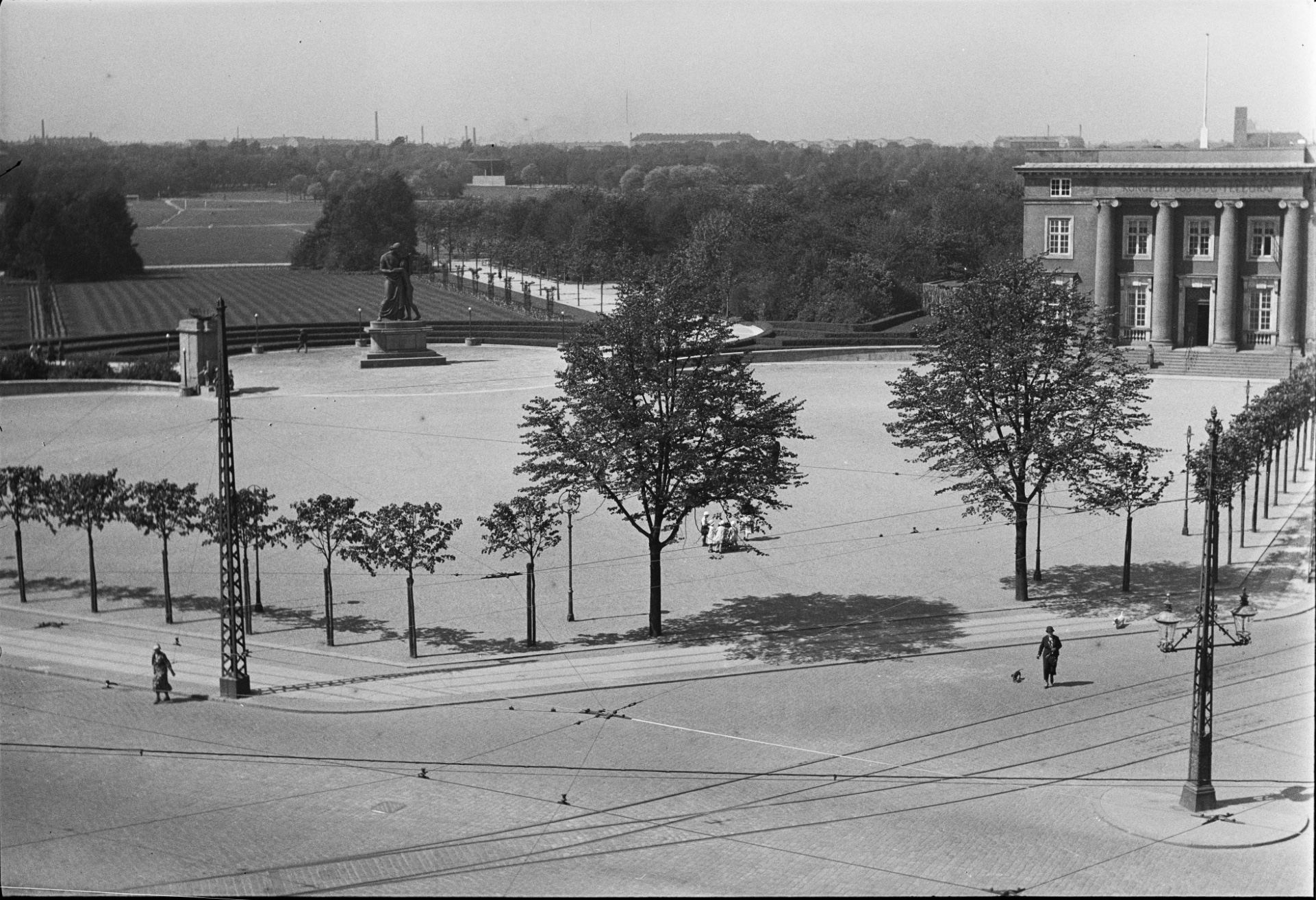
The monument by the sculptor Axel Poulsen was completed in 1930 to mark the return in 1920 of lands in southern Jutland that had been lost to Germany in the war of 1864.

The sculpture on a substantial stone plinth and flanking drinking-water fountains and lights were part of improvements to the entrance to Fælledparken - the large public park - established in 1908 on open land outside the city defences.

read more


Sansehaven / the sensory garden


Designed by Helle Nebelong and opened in 1996 - when Copenhagen was City of Culture - this was the first sensory garden in the country and was designed for children who have problems with access or might have impaired sight. This is a very calm and very beautiful area just to the right as you enter Fælledparken from Trianglen.

read more


Enigma Museum / Østerbro Post Office

A large and grand post office with a portico and with the entrance at the top of imposing stone steps. It was designed by Thorvald Jørgensen and opened in 1922.

With recent reorganisation of postal services in the city, the post office counter service has been scaled back but this building is now a museum of postal and telegraph services called Enigma. There is a good cafe.

ENIGMA


Østre Power Station

Designed by the municipal architect Ludvig Fenger with Ludvig Clausen, the power staion, the third in the city, opened in 1902. With its ornate façade to Øster Allé it forms an important backdrop to the entrance to the park.


Idræhuset stadium  and Øbro Hal swimming pool

Football was first played here in the 1870s but work on Idrætsparken - a new football stadium - was started in 1908 - just as the public park was established - and it was completed in 1911.

The present national stadium is on the same site and is by Gert Andersson and was completed in 1992.

Idræhuset stadium - for gymnastics and field sports - was designed by Søren Lemche and completed in 1914 and Øbro Hal, a swimming pool by Frederik Vilhelm Hvalsoe and Arthur Wittmark, was completed in 1930. A high arch at the east end of this building was built to form an impressive entrance to the stadium from Østerbrogade.


Brumleby

The Medical Association housing scheme was designed by Michael Gottlieb Bindesbøll and Vilhelm Klein and built between 1853 and 1872. These houses were built as a practical response to a major outbreak of cholera in the city in 1853 when 5,000 people died. This heavy loss of life was attributed to the overcrowded and insanitary courtyard housing in the centre of the city and plans were drawn up to demolish old and poorly built housing in the city and build new housing for the rapidly-expanding population of ordinary working families on land outside the city gates, so beyond the old city walls and in new and rapidly-expanding suburbs.

read more


Røde Kors / Red Cross Volunteer House

The headquarters of the Danish Red Cross is in a building that dates from the 1950s. The plot on Blegdamsvej is very wide but with tightly-constricted depth as the building backs on to Fælledparken. An addition to the existing building, designed by the Copenhagen architects COBE,  was completed in 2018 to form a new entrance on what was an open area across the front of the building but it also tries to form a new public space with open access from the street withsteps that face south and provide an area for sitting outside.


Hall of the Danish Order of Freemasons

A very large building designed by Holger Rasmussen and built between 1923 and 1927. The entrance has a giant order with two columns that are 16 metres high and are said to weigh 72 tons each. The proportions of the front seem slightly odd and extended and the column bases oddly tight to fit in the restricted space but the render of the façade and the quality of the architectural details could not be better.


Apartment building on Blegdamsvej

A general workers' housing association - Arbejdernes Andels Boligforening - the Labour employees Housing Association - was founded in 1912 by Jens Christian Jensen who was the first socialist mayor of the city and was a leading proponent for the public park - Fælledparken - that was established on open common land in Østerbro in 1908.

This large apartment building, around three sides of a large open courtyard faces onto Blegdamsvej but the main side ranges return each way along the street and shield long narrow side courtyards.

Designed by Bent Helwig-Moller and completed in 1935, most of the apartments run right across the block so are through apartments with windows to both sides. With balconies, lifts and rubbish shutes and a large communal courtyard garden it is typical of the best social housing of the period.

Original plans and elevation drawings in the national collection of Danmarks Kunstbibliotek are available on line.


Tower Playground

Tucked away at the south corner of the park, Tower Playground by GHB Landskabsarkitekter and the Spejlhuset / Mirror House by MLRP were part of extensive improvements made to Fælledparken in 2012.

read more


Fælledparken - the entrance from Trianglen

Entrance Faelled Park.jpeg
 

At the corner of Blegdamsvej and Øster Allé is a large area of gravel that is triangular in shape — the site of a major new metro station - and set back, beyond the triangle, is the entrance to Fælledparken.

Established in 1908, the main feature here, on the central axis of the entrance, is a memorial … a large figure group in bronze raised on a high stone base that was installed in 1930 to commemorate the return to Denmark, in an international settlements following the First World War, of land in South Jutland that had been lost to Germany in a war of 1864.

Lettering on the stone base reads:

TIL MINDE OM SONDERJYLLANDS GENFORENING MED MODERLANDET 1920

In memory of South Jutand's reunification with mother country 1920

The main figure is a woman who is looking down at an adolescent girl who holds or, rather, she clings to her side, looking up but not at the woman so up and away into the distance at the sky or to the heavens. It is a powerful depiction of a mother embracing or drawing in a child for their protection.

The woman is wearing a loose, finely- pleated costume, that is clearly classical in style, with an outer garment or stola that she is lifting to cover the girl who is naked … nakedness, at least here, implying both innocence and vulnerability.

The sculptor was Axel Poulsen who nearly twenty years later repeated the image of mother and child - a woman holding a dead youth slumped across her lap - for the incredibly powerful stone sculpture for the Mindelund Park in Copenhagen that is a memorial garden for the dead of the Second World War.

On either side of the reunification monument, there are elaborate stone drinking-water fountains.

Again the style is taken from classical architecture. For each there is a tall stone podium that is square in plan with a moulded base and cap and on the top are giant open bronze shells that are, presumably, a symbol of wisdom.

The front of these drinking fountains have very bold architectural treatment with squat but finely-fluted applied half column broken by a bold square block across the lower part in a form usually called rustication but here on a giant scale, and those blocks hold a fine bronze shell that drops water down into a round stone basin at the base.

Both drinking fountains are set at an angle, facing inwards towards the apex of the triangle and they frame the two paths on either side of the memorial that lead into the park, There are low retaining walls curving out to the buildings on either side to create a symmetrical arrangement that closes the open public space of the triangle and marks the transition to the open space and trees of the park beyond.

Around the curve behind the monument are nine lights  - low or rather not tall and each with a bronze stanchion and a simple pearl-like globe light.

There is a strong underlying geometry to the design that is not immediately obvious when you are walking through the space, in part because it is on such a large scale, but it gives the entrancea rational and clever underlying structure that creates a clear order to the space and to the procession from the urban space of Trianglen through to the open space of the grass area of the park. This should be read as if it is movement through a series of spaces, comparable to moving through a series of rooms and certainly not like moving through a natural landscape.

Also, the design shows how an architect or designer can pull together existing angles of roads and buildings - determined by topography or street alignments - and can direct the way in which people will move through the spaces but the plan also creates interesting and dynamic diagonal views that you would not get with a simple progress along a straight axis.

The statue and its plinth are set in a circle of cobbles but that is set within a larger but less obvious circle of gravel that is itself framed by a border of cobbles. That larger circles overlaps a large stadion on the axis that is set out with a gravel path beyond but the overlap is masked by a low hedge following the back curve of the circle of the statue.

A stadion is simply a long rectangle with semi circles across each end so there are long straight sides and curved ends so not an oval. The form is found most obviously as the shape of a running track so here it is a reference to the use of the public space of the park for sport. Seen from above, the statue is at the centre of its circle but also on the long axis of the stadion and actually sits across the path - so if you run around the stadion, as if it was a running track, then you have to divert around the statue.

At the far end of the stadion, towards the open park, the gravel path expands out into a curve that cuts into the main shape of the stadion. It mirrors the entrance end, but without the full circle of the setting of the statue, and has a set of curved stone benches where you can sit and look out across the park.


It is fascinating to see how a city or a country has seen itself at various points in history by looking at how a style of architecture is used to establish or reflect or reinforce a common sense of self identity.

Following the war of 1864, and the loss of much of Jylland - the south part of Jutland that was annexed by Germany - Denmark spent the last decades of the 19th century reassessing and then rebuilding and then moving forward.

Initially the style adopted for much of the new architecture at the end of the 19th century was inspired by the rebuilding of Paris in the period of Hausmann after the revolution of 1848 - so many of the new apartment buildings from that period in Copenhagen imitate pale stone ashlar, have large sash windows, mansard roofs and ornate wrought-iron balconies.

By 1900, and with the growing prosperity of the city based on trade, many of the new office building along Hans Christian Boulevard and even the new city hall itself looked to that other great trading nation of city states for inspiration so to Italy and to Florence and Sienna and to banks and civic buildings in those cities as a source of architectural forms and decorative motifs.

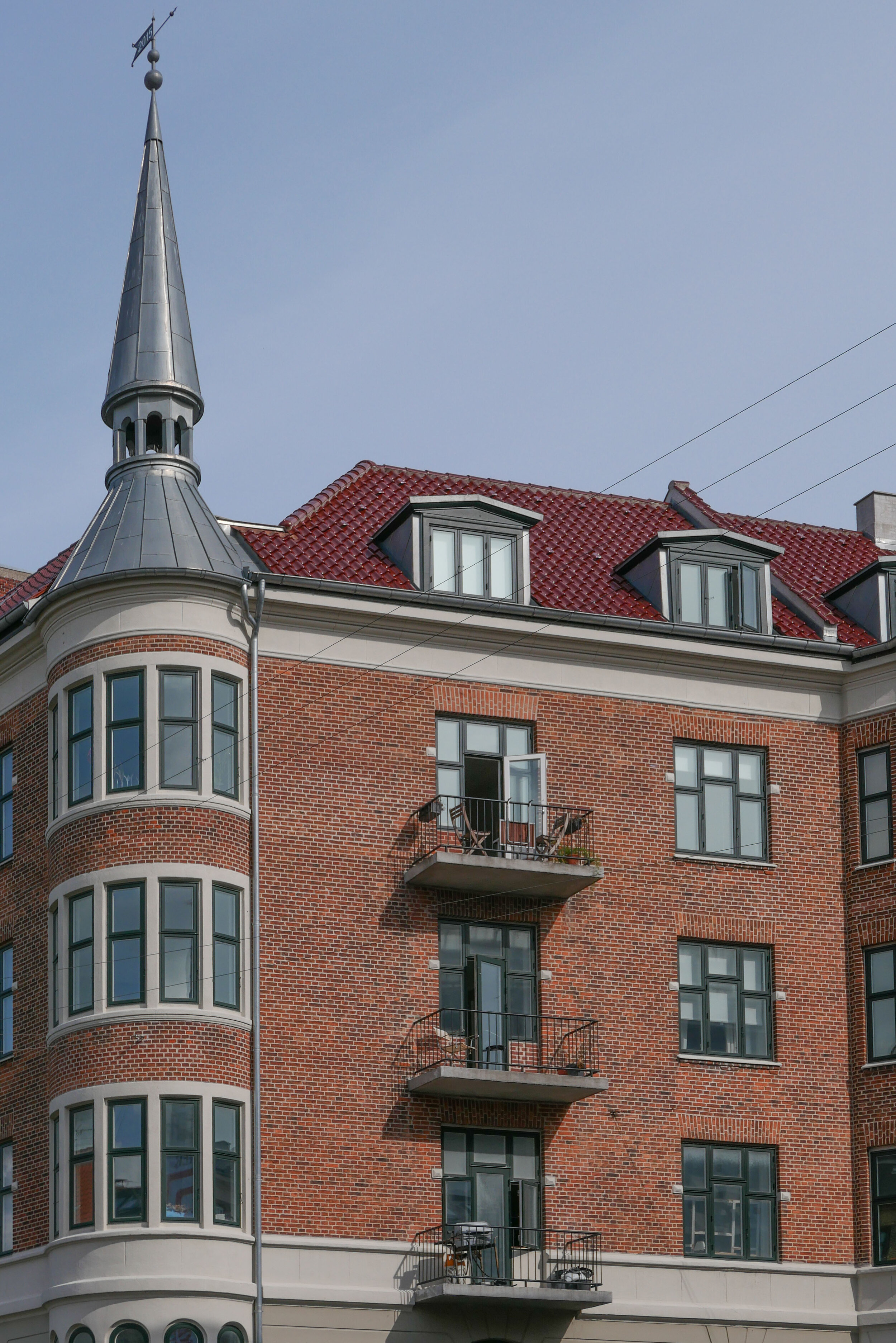
As the prosperity and success of the Copenhagen renaissance became more tangible, there was a growing sense of pride in architecture and achievements that were more specifically Danish or Scandinavian so architects and sculptors looked for inspiration to the buildings of Christian IV in the first half of the 17th century so towers and turrets and gables in the style of Frederiksborg or Kronborg, but dating from around 1900, can be seen all over the city.

But the entrance to the park and many of the new public buildings around the park are different in style again. Here, through the 1920s and 1930s, the inspiration is classical architecture - not Renaissance Italy but ancient Greece and Rome - and of course that seems appropriate for buildings like a swimming pool and the stadium so it appears that there was a new worship of fitness and the male body - or at least a sanitised view of what Hellenic sport was all about - and with it came a need to express or imply heroism and nationalism … and, in terms of style, a different form of nationalism to the power and wealth shown by the buildings of Børsen - the Royal Exchange - or Rosenborg or Kronborg.

This gets perilously close to the architecture of nationalism of the right in Italy or Germany in the 1920s and 1930s but maybe that slight uneasiness we can feel, when we see architecture like this, comes because we are looking back but of course, these architects could only look for styles of architecture that they felt were appropriate without our awareness of the dark consequences of some forms of nationalism some ten or twenty years later. The monument to the motherland at the entrance to Fælled Park - to mark the return of South Jutland to Denmark - implies a quiet national pride … it's certainly not bombastic, not vainglorious and not triumphalist because that's not the Danish way.

note:

Several architects produced designs for this entrance after the park was established.

Kaj Gottlob designed two large, U-shaped buildings on either side that were to be set at an angle determined by each of the main roads (so before the post office was built) with open courtyards to the back and with forward-facing facades and between them a tall and elaborate loggia with pairs of columns, one behind the other, on the side towards the triangle and matching pairs on the side towards the park and people entering the park would have walked across - not along - the loggia.

In 1917 Vilhelm Lauritzen designed a similar pair of large buildings to flank the entrance but he designed between them an arcade with five giant arches rather like a Roman viaduct.

In complete contrast, in 1918, Peder Pedersen designed a low geometric fence across the back of the triangle with a pair of pavilions on either side of the entrance, gate lodges between the triangle and the park so a rather rustic version of the fence and pavilions around the King's Garden in the city. The drawing by Pedersen in the national archive is also interesting because his plan shows the tram tracks and the triangle in front of the entrance had a large tram stop on the Øster Allé side and a turning circle for the trams in part across the triangle.