Bispeengbuen - a new plan

Yesterday, an article in the Danish newspaper Politken reported that planners and politicians in Copenhagen might have come to a decision on the fate of Bispeengbuen - the section of elevated motorway that runs down the border between Frederiksberg and the Nørrebro district of Copenhagen.

One of several major schemes to improve the road system in the city in the late 1960s and 1970s, Bispeengbuen was planned to reduce delays for traffic coming into the city from suburbs to the north west.

At the south end of the elevated section, at Borups Plads, traffic, heading into the city, drops back down to street level and continues first down Ågade and then on down Åboulevard to the lakes and, if it is through traffic, then on, past the city hall, and down HC Andersens Boulevard to Langebro and across the harbour to Amager.

Between the elevated section and the lakes, the road follows the line of a river that, from the late 16th century, had flowed through low-lying meadows - the Bispeeng or Bishop's Meadow - and brought fresh water in to the lakes. In 1897, the river was dropped down into a covered culvert and it still flows underground below the present traffic.

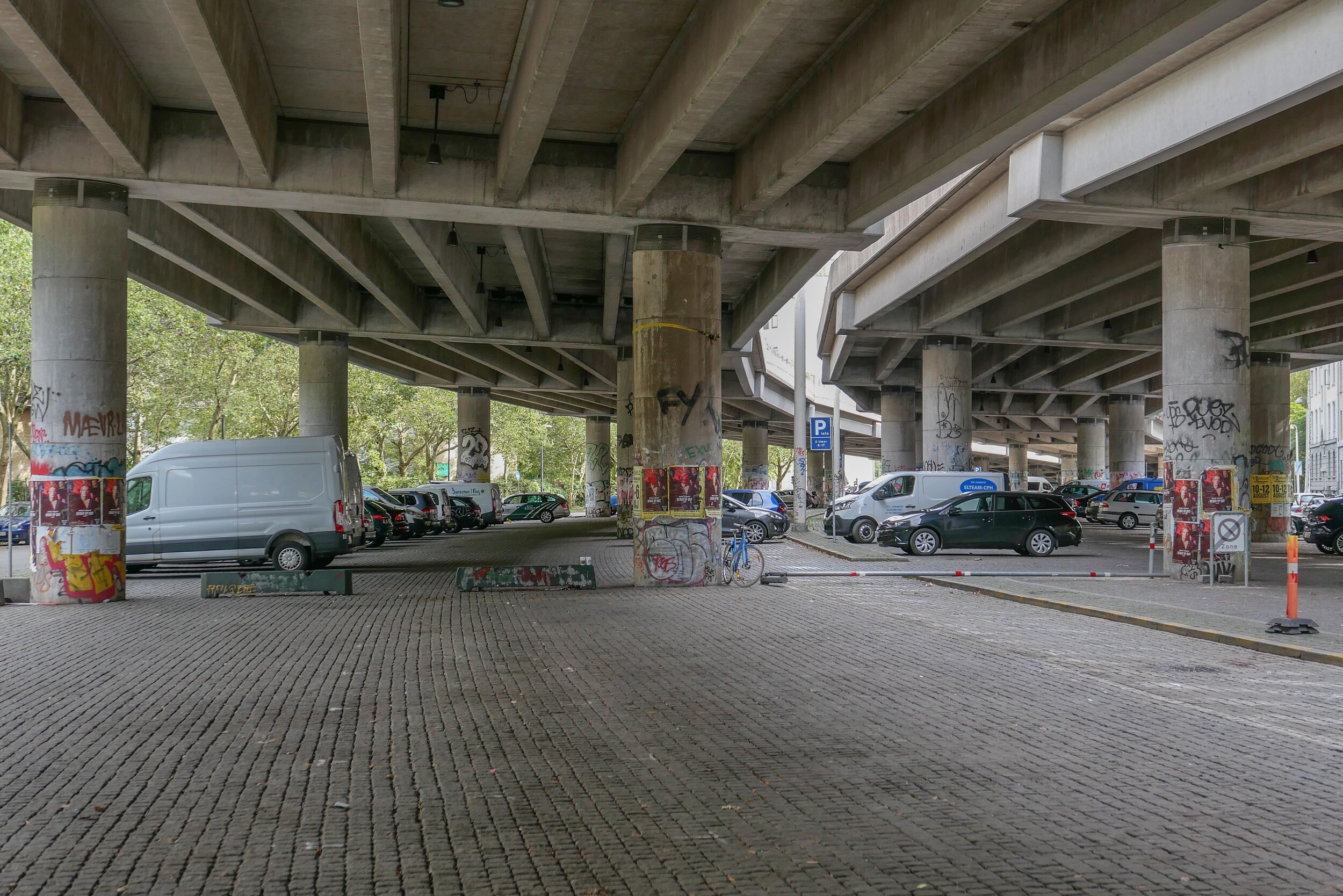
From the start, the elevated section was controversial as it cuts past and close to apartment buildings on either side - close to windows at second-floor level - and the area underneath is gloomy and generally oppressive. Traffic is fast moving and generates a fair bit of noise and it forms a distinct barrier between the districts on either side.

There has been an ambitious plan to drop the road and its traffic down into a tunnel with the river brought back up to the surface as the main feature of a new linear park. The full and very ambitious plan - for ambitious read expensive - was to extend the tunnel on to take all through traffic underground, to Amager on the south side of the harbour.

There has been talk of a less expensive plan to demolish the elevated section, to bring all traffic back down to street level, which would be cheaper but would not reduce the traffic and would leave the heavy traffic on HC Andersens Boulevard as a barrier between the city centre and the densely-populated inner suburb of Vesterbro.

This latest scheme, a slightly curious compromise, is to demolish half the elevated section. That's not half the length but one side of the elevated section. There are three lanes and a hard shoulder in each direction and the north-bound and city bound sides are on independent structures. With one side removed, traffic in both directions would be on the remaining side but presumably speed limits would be reduced - so, possibly, reducing traffic noise - and the demolished side would be replaced by green areas although it would still be under the shadow of the surviving lanes.

It was suggested in the article that this is considered to have the least impact on the environment for the greatest gain ... the impact of both demolition and new construction are now assessed for any construction project.

There is already a relatively short and narrow section of park on the west side of the highway, just south of Borups Plads, and that is surprisingly quiet - despite alongside the road.

On both sides of the road, housing is densely laid out with very little public green space so it would seem that both the city of Copenhagen and the city of Frederiksberg are keen to proceed. Presumably they feel half the park is better than none although I'm not sure you could argue that half an elevated highway is anywhere near as good as no elevated motorway.

The situation is further complicated because the highway is owned and controlled by the state - as it is part of the national road system - so they would have to approve any work and police in the city may also be in a position to veto plans if they feel that it will have too much of an impact on the movement of traffic through the area.

update - Bispeengbuen - 14 January 2020
update - a road tunnel below Åboulevard - 15 January 2020

note:
Given the brouhaha over each new proposal to demolish the elevated section of the motorway, it is only 700 metres overall from the railway bridge to Borups Plads and it takes the traffic over just two major intersections - at Nordre Fasanvej and Borups Allé -  where otherwise there would be cross roads with traffic lights. I'm not implying that the impact of the road is negligible - it has a huge impact on the area - but, back in the 1960s, planners clearly had no idea how many problems and how much expense they were pushing forward half a century with a scheme that, to them, must have seemed rational.

My assumption has been that the motorway was constructed, under pressure from the car and road lobby, as part of a tarmac version of the Finger Plan of the 1940s.

The famous Finger Plan was an attempt to provide control over the expansion of the city, and was based on what were then the relatively-new suburban railway lines that run out from the centre. New housing was to be built close to railway stations and with areas of green between the developments along each railway line .... hence the resemblance to a hand with the city centre as the palm and the railway lines as outstretched fingers.

Then, through the 1950s and 1960s, the number of private cars in Copenhagen increased dramatically and deliveries of goods by road also increased as commercial traffic by rail declined.

I don't know who the traffic planners were in Copenhagen in the 1950s and 1960s but, looking back, they barely appreciated old building or existing communities, and, presumably, looked to LA and, possibly, to the Romania of Nicolae Ceaușescu for inspiration. Their ultimate aim, in their professional lives, seems have been to design a perfect motorway intersection where traffic flowed without any delays.

They wanted to build a motorway down the lakes and when that was thwarted they proposed a massive motorway system that was to be one block back from the outer shore of the lakes - sweeping away the inner districts of Østerbro and Nørrebro - and with new apartment buildings along the edge of the lake - between their new motorway and the lake - that would have formed a series of semi-circular amphitheatres looking across the lakes to the old city. The whole of the inner half of Vesterbro, including the meat market area, and the area of the railway station would have become an enormous interchange of motorways where the only purpose was to keep traffic moving.

We have to be grateful that few of those road schemes were realised but there is also a clear lesson that, however amazing and visionary a major plan for new infrastructure may appear, it can, in solving an immediate problem, create huge problems for future generations to sort out.

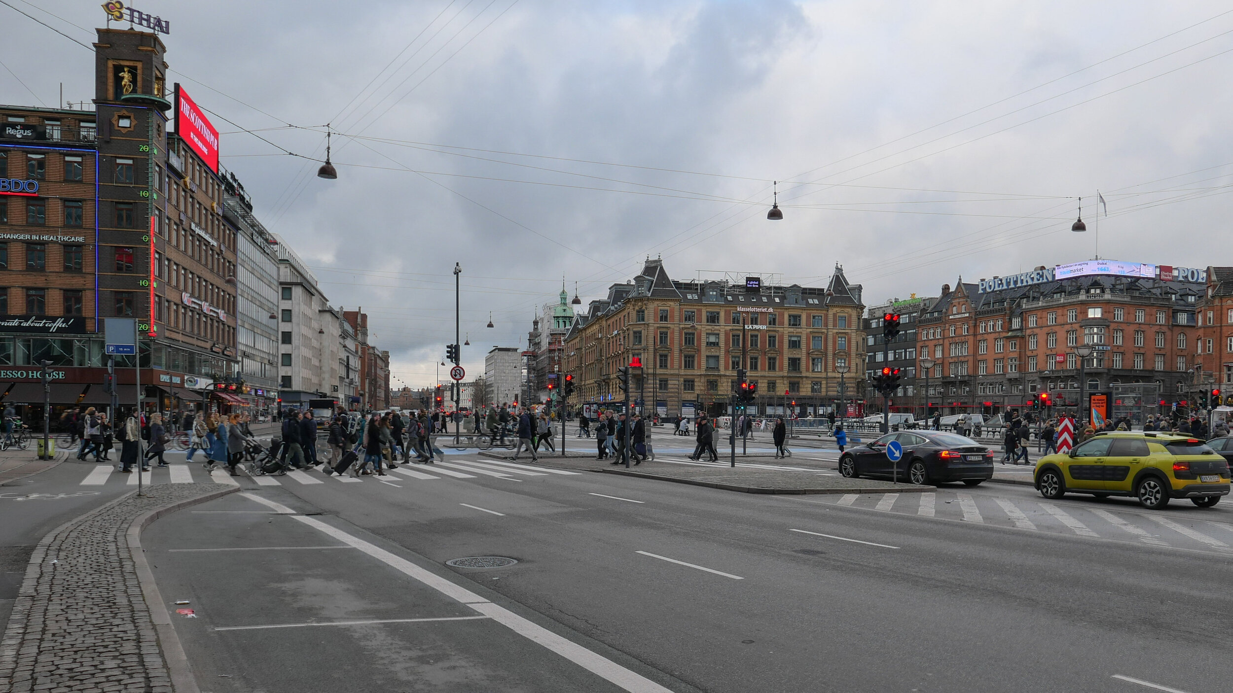
approaching the elevated motorway from the south
the motorway from Ågade on the east side
the motorway crossing Borups Allé

the river close to the lakes at Åboulevard but now in a culvert below the road

Bispeengbuen under construction showing how it cut a swathe through the existing neighbourhood - city archive 50675

the earlier proposal to bury the road in a tunnel and bring the river back up to the surface as the main feature of a new linear park

small area of park on the west side of the road

update - Bispeengbuen

Bispeengbuen is a raised section of motorway in the north part of the city that opened in August 1972.

It has three lanes of traffic in each direction but with slip roads and with high sound baffles, added in the 1990s, it is intrusive as it cuts through and divides a densely-built residential neighbourhood. The heavy traffic using the road as a fast route into or out of the city is close to apartment buildings at the level of second-floor windows and, from the start, there were strong local protests with the opening marked by demonstrations and even a bomb threat.

The road is owned by the state but one suggestion now is that it should be transferred to the city and to the municipality of Frederiksberg - the road runs between the two - and, in 2017, politicians from both Copenhagen and Frederiksberg suggested that the road and its traffic could be taken down into a tunnel and the elevated section demolished.
This would provide an opportunity to reinstate a river that had flowed through a meadow here since the late 16th century although the river itself did not run along a natural course. In the 1580s, it was diverted to bring water to low marshy ground around the west side of the city, outside and below the defensive embankments, to form a stronger outer defence and to provide a supply of fresh water for the city.

Around 1900, at the city, end the river, Ladegårdsåen, was taken down into a covered culvert and the road to the lakes became a major route into the city from the north.

From the north end, from Borups Allé, traffic coming into the city goes under the suburban railway line - just to the east of the station at Fuglebakken - and then, immediately south of the railway line, the traffic is taken up onto the raised section that continues on for about 700 metres to Borups Plads where the road returns to ground level but the tunnel would continue on further, closer to the intersection with Jagtvej to make this north part of the proposed tunnel about a kilometre in length.

If the river is reinstated with extensive planting to create a park here, the work could be part of major climate-change mitigation on this side of the city and would create a significant amenity for this residential area.

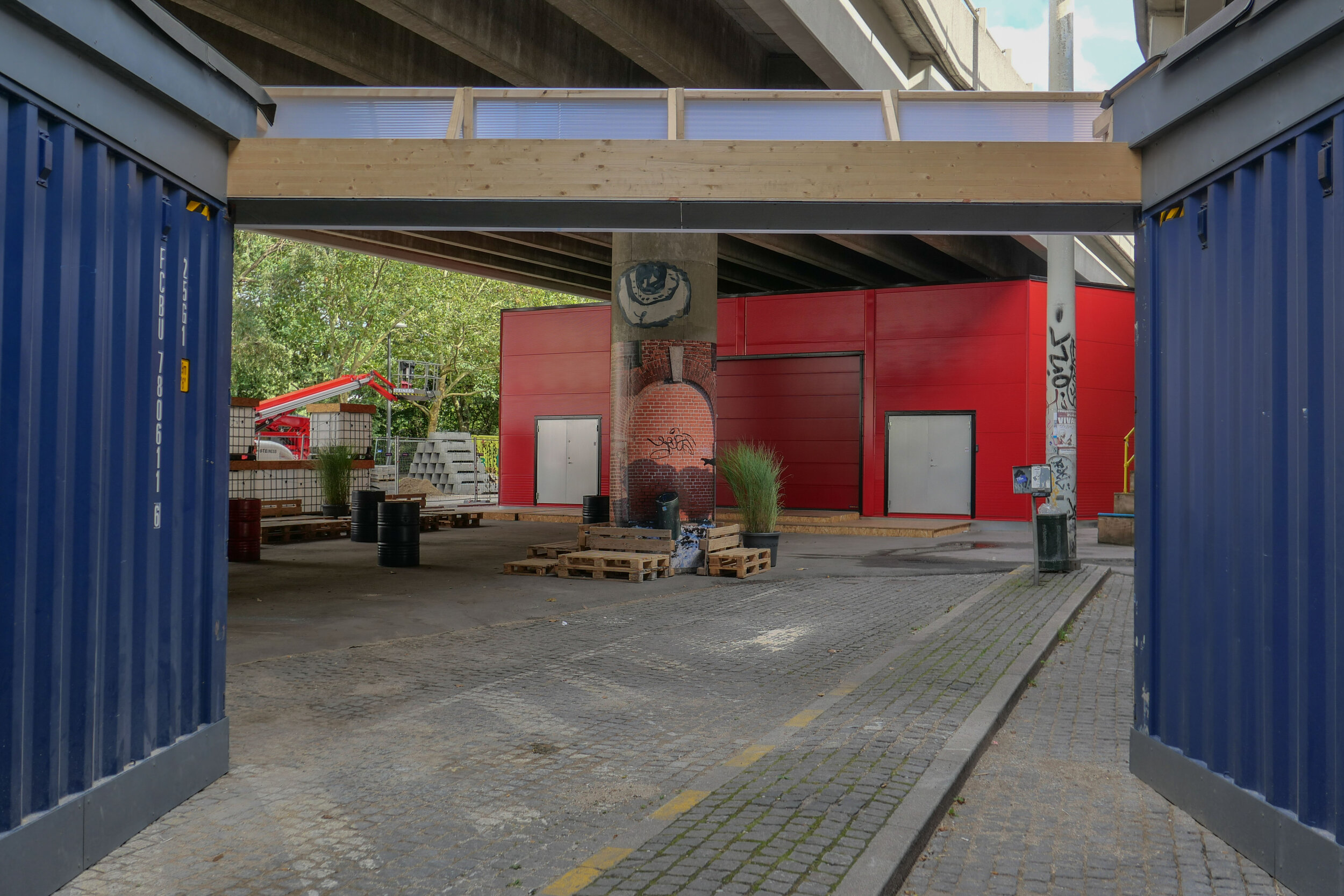
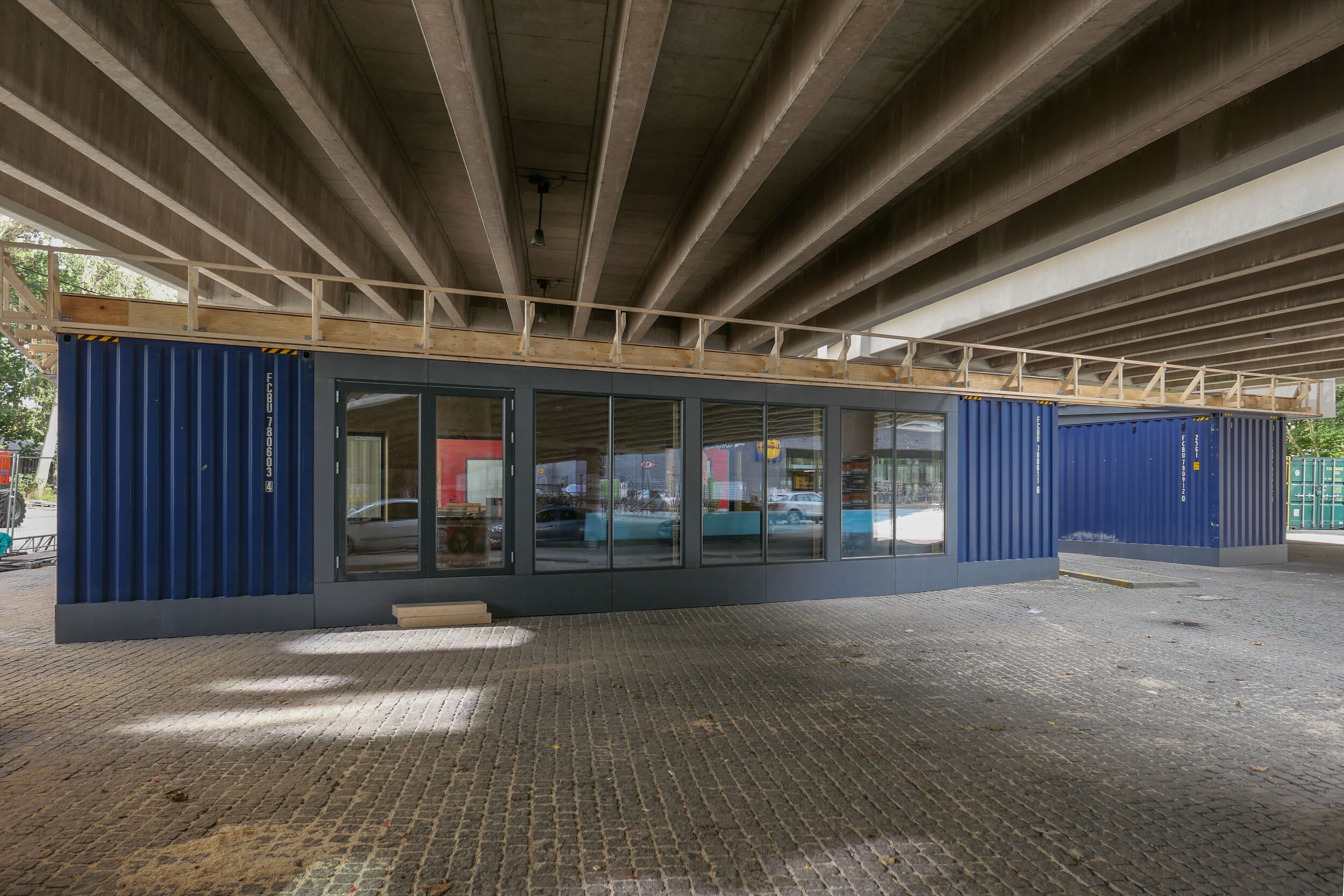
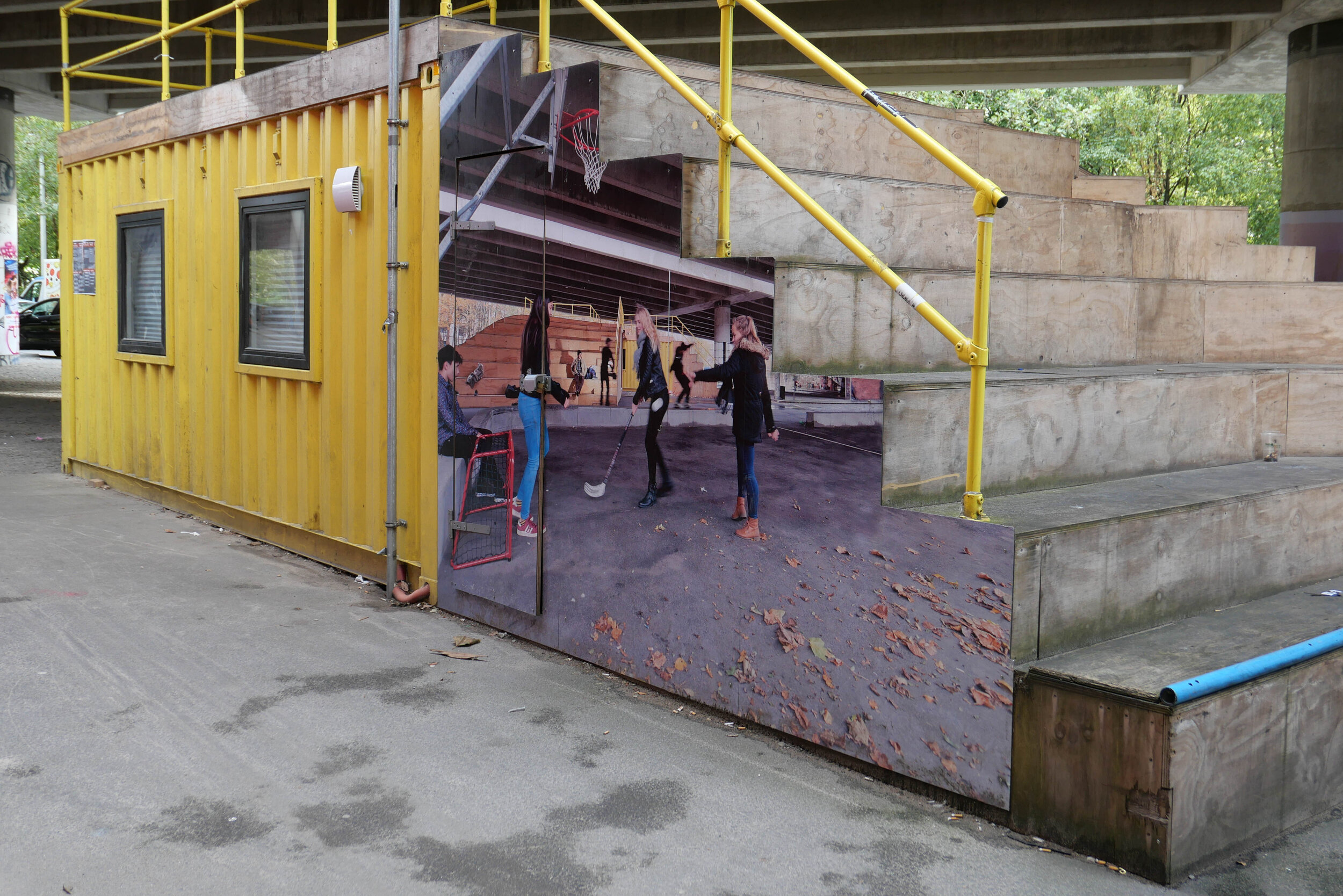
With a decision on the tunnel delayed, the area under the raised section of the road has been improved with the opening in April 2019 of Urban 13 - “a creative urban space.”

Designed by Platant, shipping containers have been adapted to create a cafe and a function room for local events and an area with steep blocks or steps for seating forms an outdoor concert venue and there is new planting in containers.

proposal from PLATANT to build a deck over the elevated motorway for housing and gardens with access by new towers against the edge of the road

Container City will be here for five years and, even then, work on the elevated roadway may be delayed so Platant have put forward an imaginative and ambitious scheme to adapt the motorway itself with an upper deck that could be constructed above the road deck to support new housing and gardens and with access by way of a number of new towers built along the road edge. It would be designed so that this could be dismantled and the materials reused if work on demolishing the road and building the tunnel does go ahead.

URBAN 13
PLATANT
Cloudburst Masterplan by Rambøll


view from Google Earth with the curve of the elevated section of motorway top left

a tunnel, to take the main through traffic underground, could replace the motorway and it could be continued down Åboulevard, following the line of an old river to the lakes, and the river, now in a covered culvert below the road, would then be returned to the surface


the line of the proposed tunnel from the suburban railway line at Fuglebakken to the lakes and from there along the line of HC Andersens Boulevard and on under the harbour to Islands Brygge to connect with a north harbour tunnel that is also being considered.

there would be a limited number of entry and exit points from the tunnel because it is not for local journeys but for through traffic

the tunnel from Fugglebakken to Islands Brygge is just over 4.5 kilometres


proposal for the park and the reinstated river if Bispeengbuen - the elevated motorway - is demolished and the traffic taken down into a new tunnel


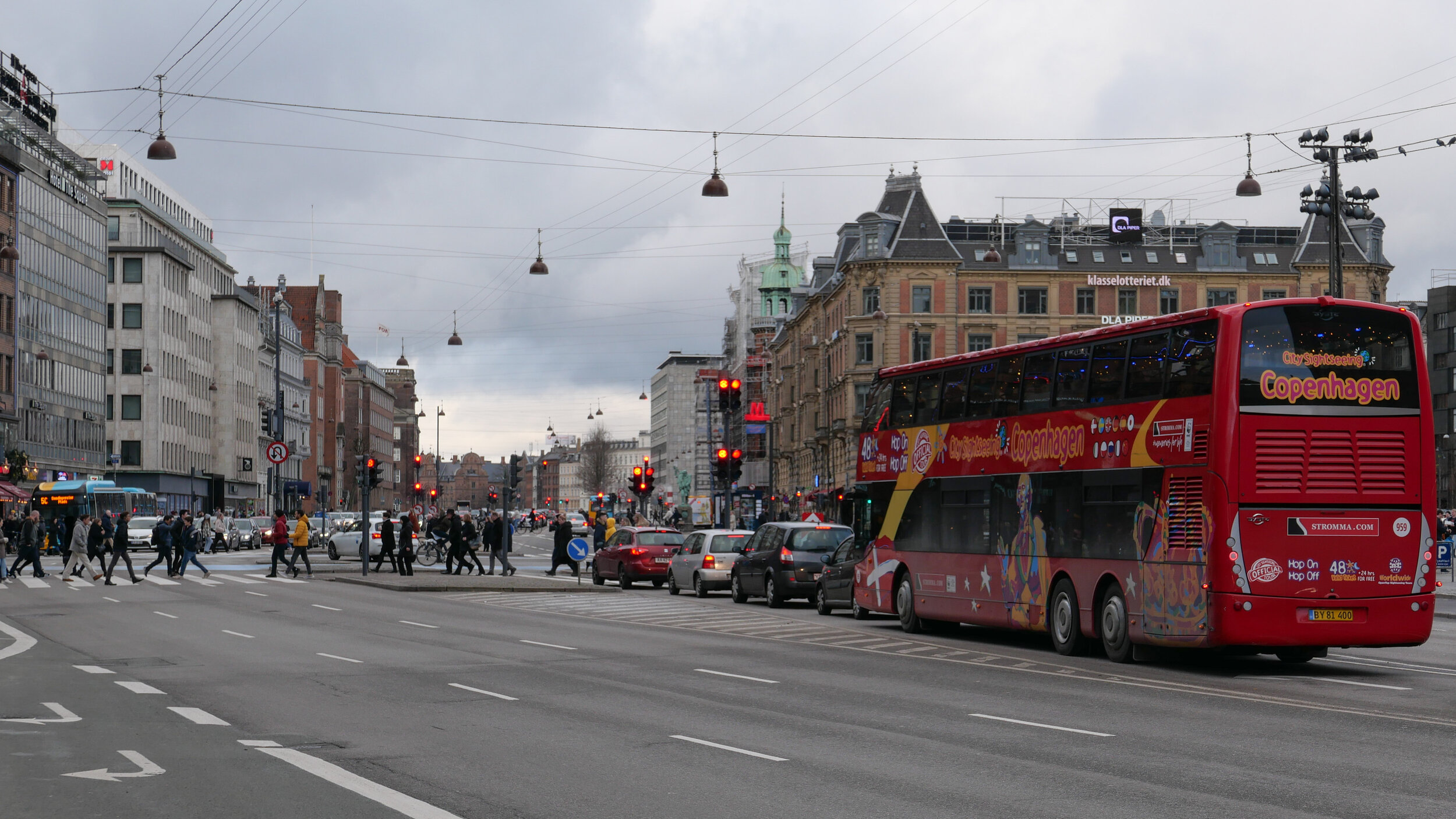
update - a road tunnel below Åboulevard and then on below HC Andersens Boulevard

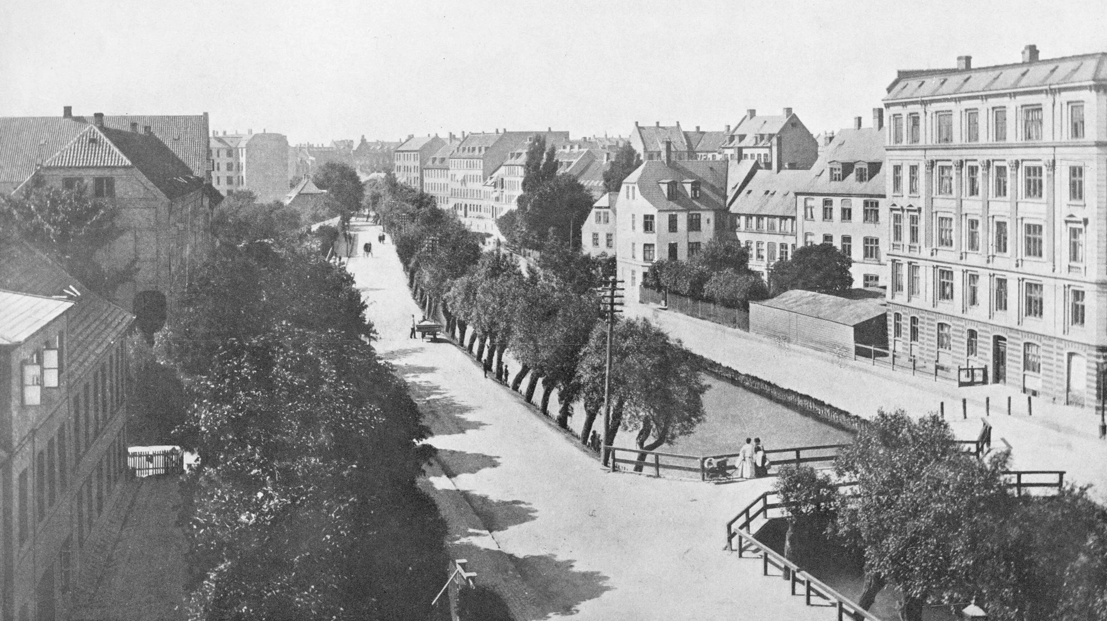
Åboulevard in the late 19th century looking north with the river still at the centre

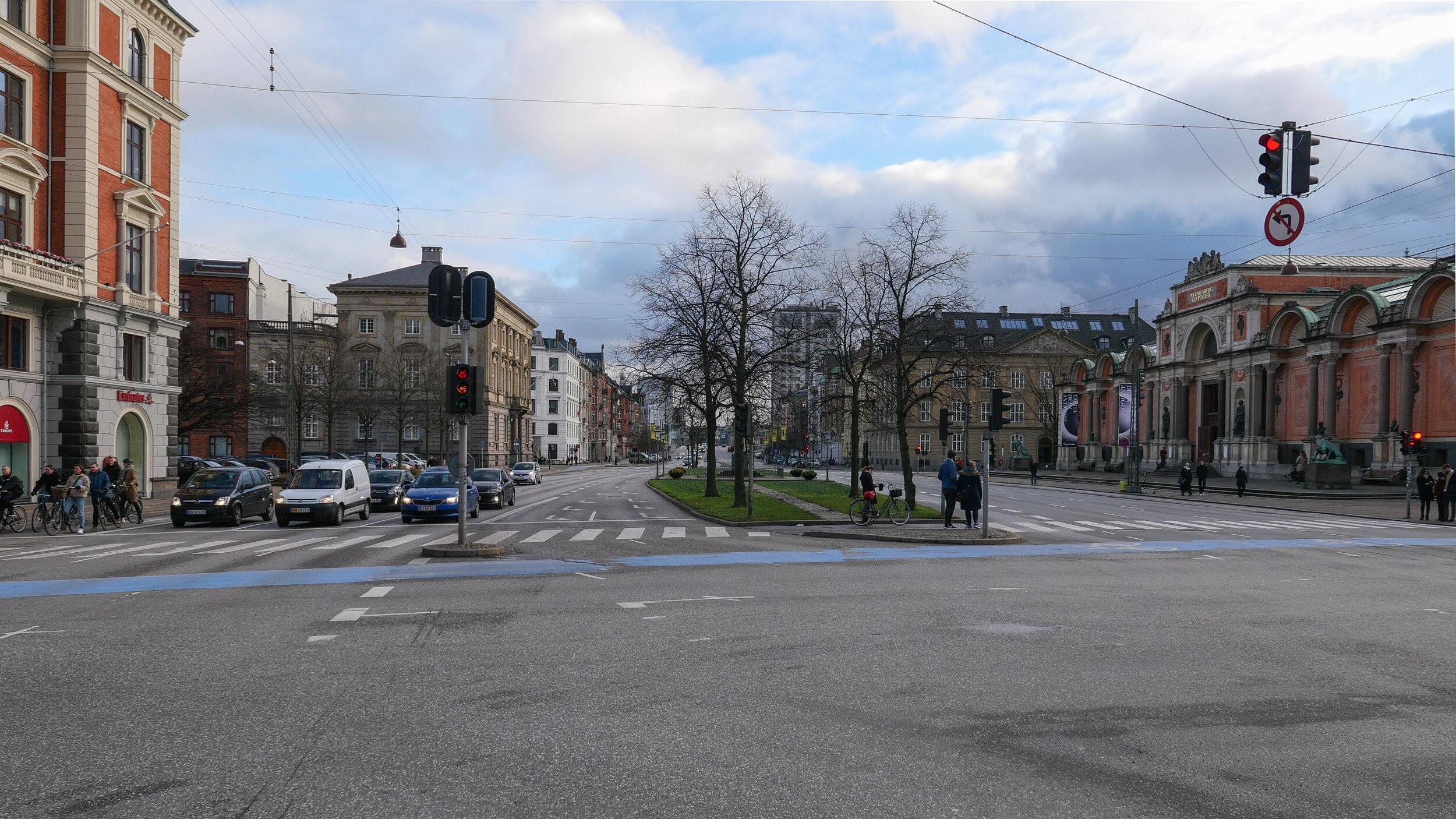
Bethlehem church designed by Kaare Klint was completed in 1938 but the apartment building dating from around 1900 is on the right on both the historic view and the photograph of Åboulevard now


A proposal for a major engineering project, to construct a traffic tunnel down the west side of the historic city centre, is now in doubt.

It would take underground much of the traffic that now drives along HC Andersens Boulevard, on the west side of the city hall, and is part of a plan to remove the elevated motorway at Bispeengbuen - bringing traffic into the city from the north - and this would make it possible to reinstate a river that flowed into the lakes that now flows through a covered culvert below Åboulevard.

From Jagtvej, at the south end of the elevated highway at Bispeengbuen, and following the line of Åboulevard to the outer side of the lake, is about 1.6 kilometres and, from the lakes, a tunnel running between Jørgens Sø and Peblinge Sø and on along the line of Gyldenløvesgade to Jarmers Plads and then down the full length of HC Andersens Boulevard and then under the harbour to Islands Brygge is another 2 kilometres so, including the proposed tunnel at Bispeengbuen, that would be between 4.5 and 5 kilometres of tunnel in total.

For comparison, in Oslo, the Festning tunnel - opened in 1990 to take traffic away from the square in front of Oslo city hall - and then an extension to the east - the Operatunnelen completed in 2010 - form, together, about 5.7 kilometres of underground motorway.

The landscape and architecture studio Tredje Natur and the engineering specialists COWI have drawn up a feasibility study for the proposed scheme for the finance directors of the city and of the municipality of Frederiksberg - the road runs between the two areas.

Reinstating the river and extensive landscaping would be an important part of storm water protection for the low-lying areas of Frederiksberg with planting, surface drains, and culverts controlling storm floods before taking it away from the area in substantial storm drains in the bottom half of the tunnels below the road decks in the upper half of the tunnel.

Tredje Natur have produced drawings for the planting that would be possible along HC Andersens Boulevard if the heavy traffic that uses the road is taken down into a new tunnel. There could be a narrow road for local traffic, an open water course and extensive planting.

Tredje Natur


a suggestion for new landscaping along HC Andersens Boulevard proposed by Tredje Natur

1 south end of the boulevard looking south towards Langebro with the Glyptotek to the right
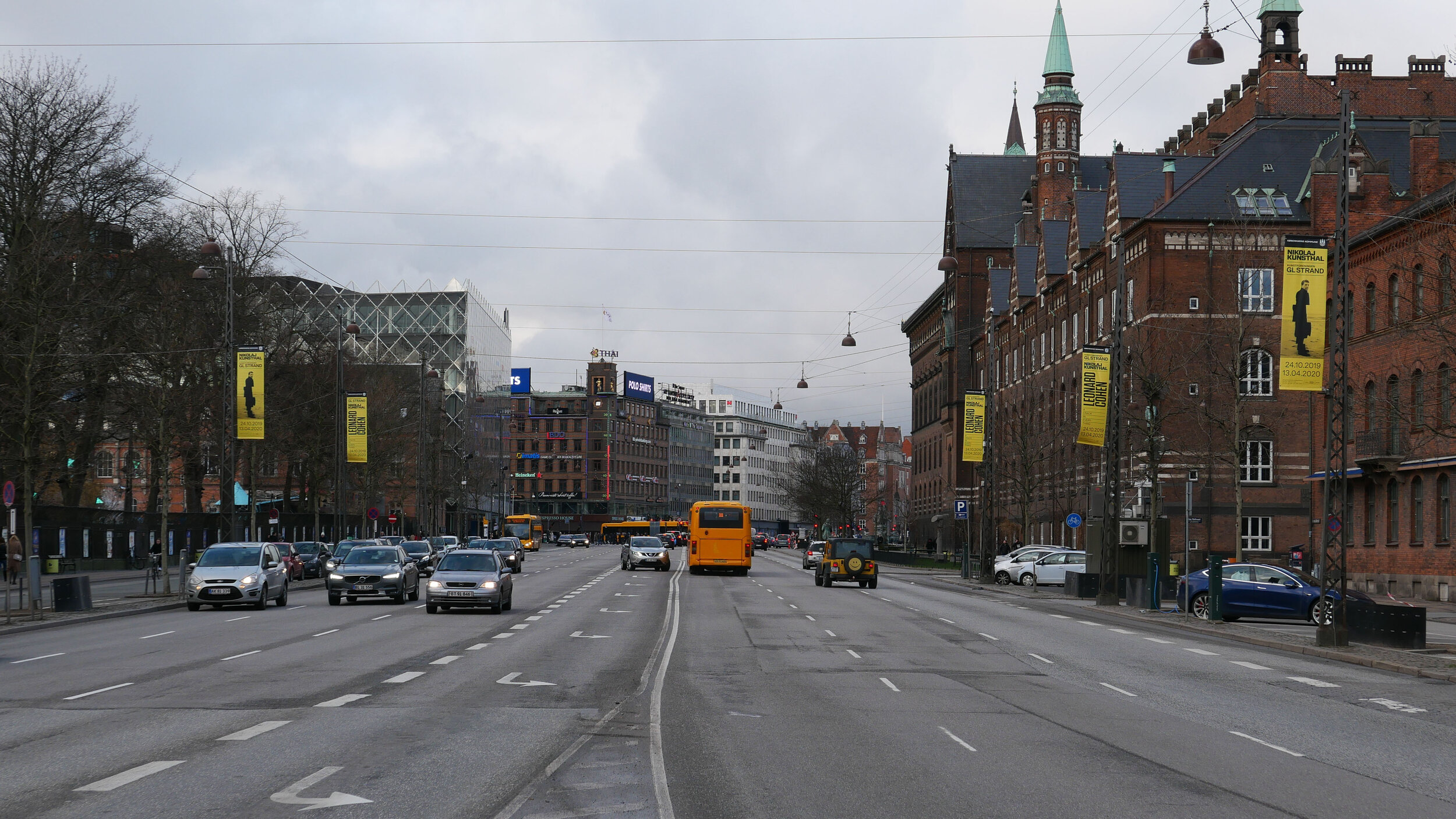
2 looking north from the Glyptotek with Tivoli to the left and the city hall to the right
3 from the south-west corner of the city hall square
4 crossing the city hall square heading north
5 the north end of HC Andersens Boulevard looking to to the tower of Realdania on Jarmers Plads

the map was published in 1860 and shows the river flowing into the lakes at the south end of Peblinge Sø with the road on the south bank and just a narrow lane, Aagade, at the back of gardens on the north bank

the river was moved down into a culvert and Åboulevard - the road above the culvert - is now wide and busy with traffic to and from the centre of the city

the lakes to the top with Sankt Jørgens Sø to the left and the end of Peblinge Sø to the right

the road over the causeway comes down to Jarmers Plads and then past the west side of the city hall at about the centre of the photograph with Tivoli to the left and then HC Andersens Boulevard continues on down to Langebro as a main route to cross from the city to Amager

historic aerial view showing the bridge over the harbour at Langebro that was built in 1903 and the first part of HC Andersens Boulevard with densely-planted trees down the centre rather than bumper to bumper cars now


Ørkenfortet / Desert Fort, Christianshavn

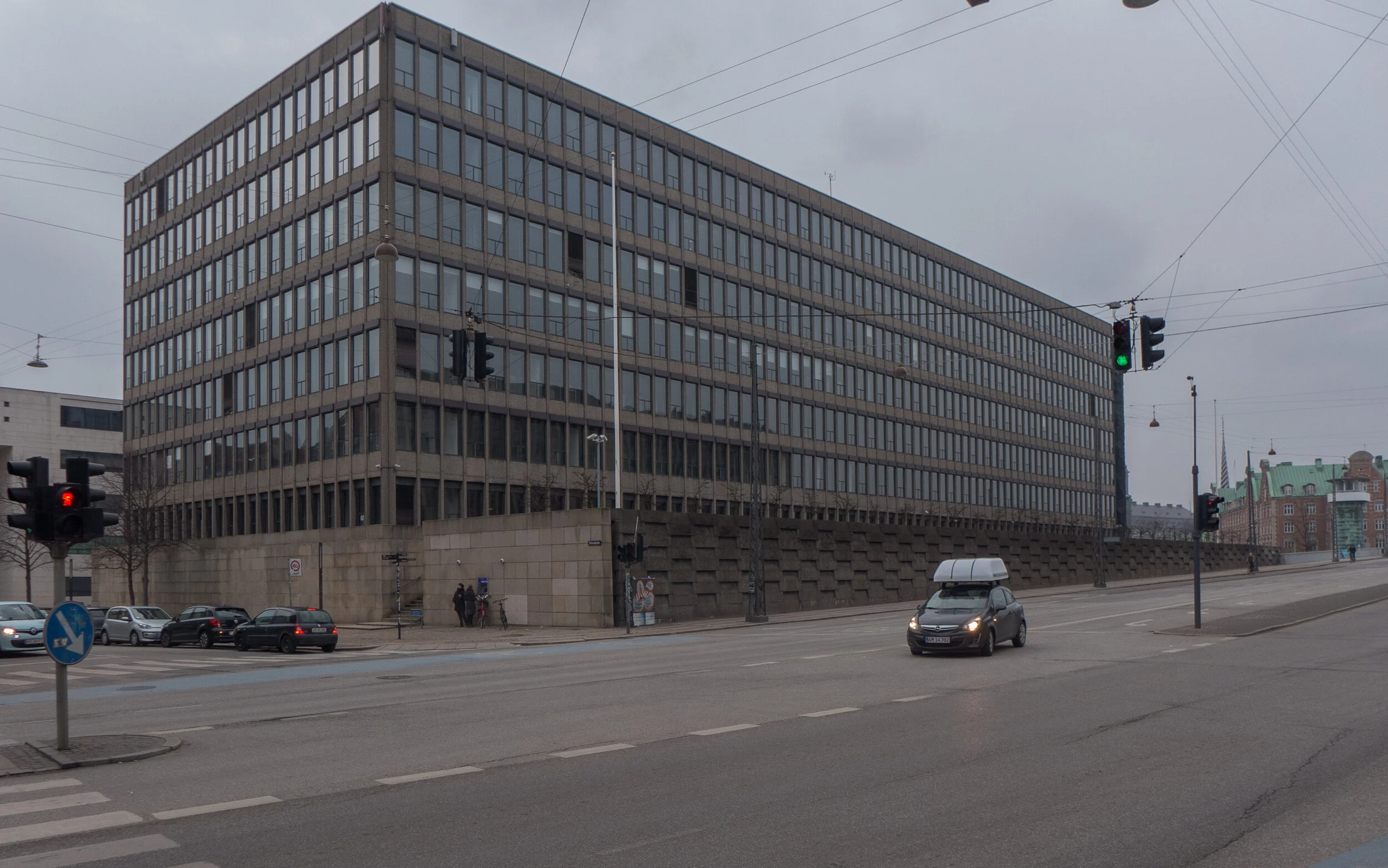
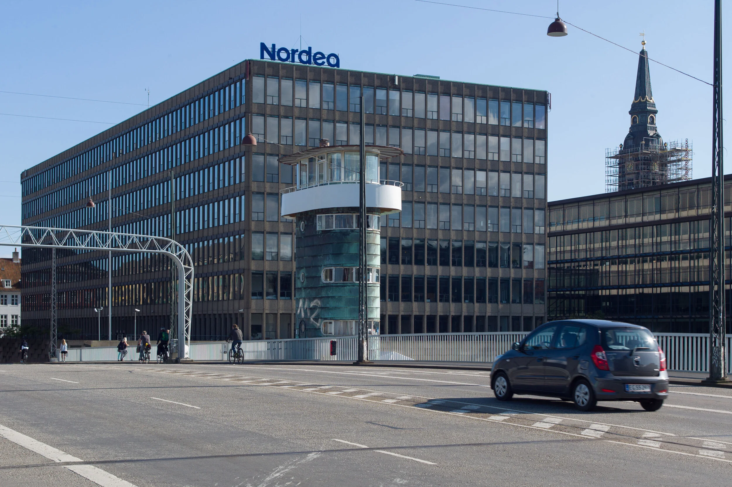
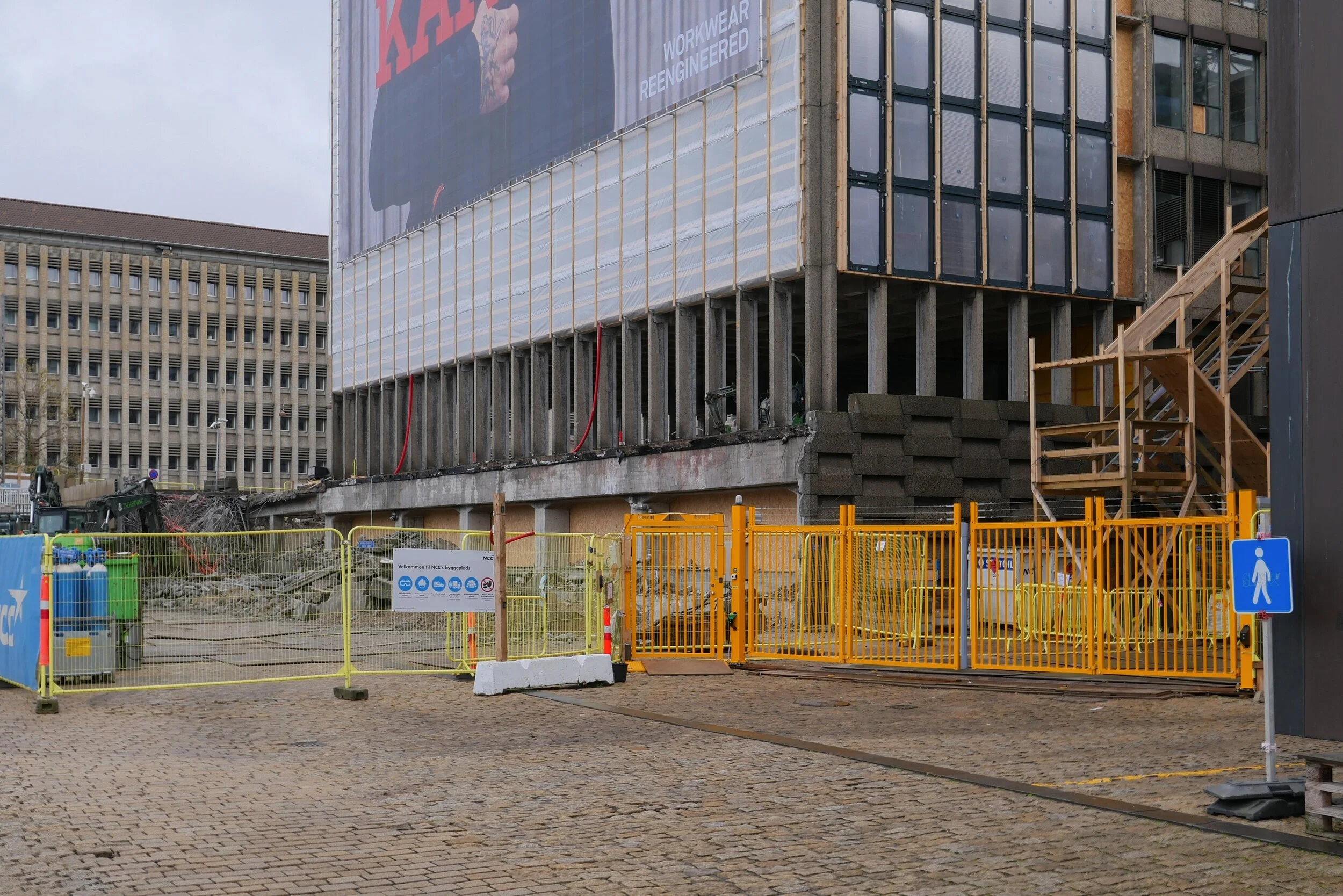
Work is moving forward fast on Ørkenfortet, the Desert Fort - the large office building that is at the centre of the harbour at the Christianshavn end of Knipplesbro - the central bridge that crosses the harbour between the centre of the city and Christianshavn.

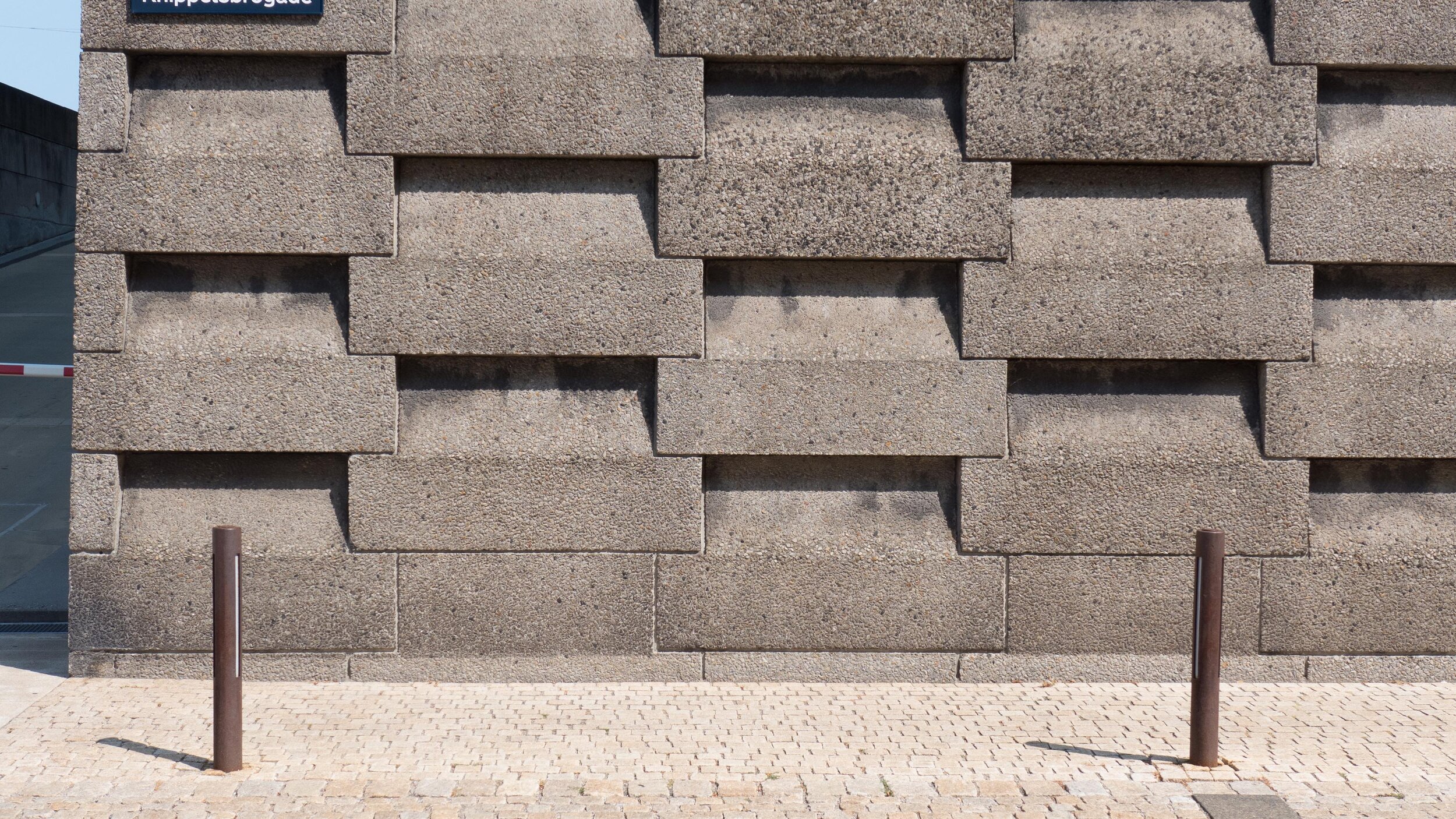
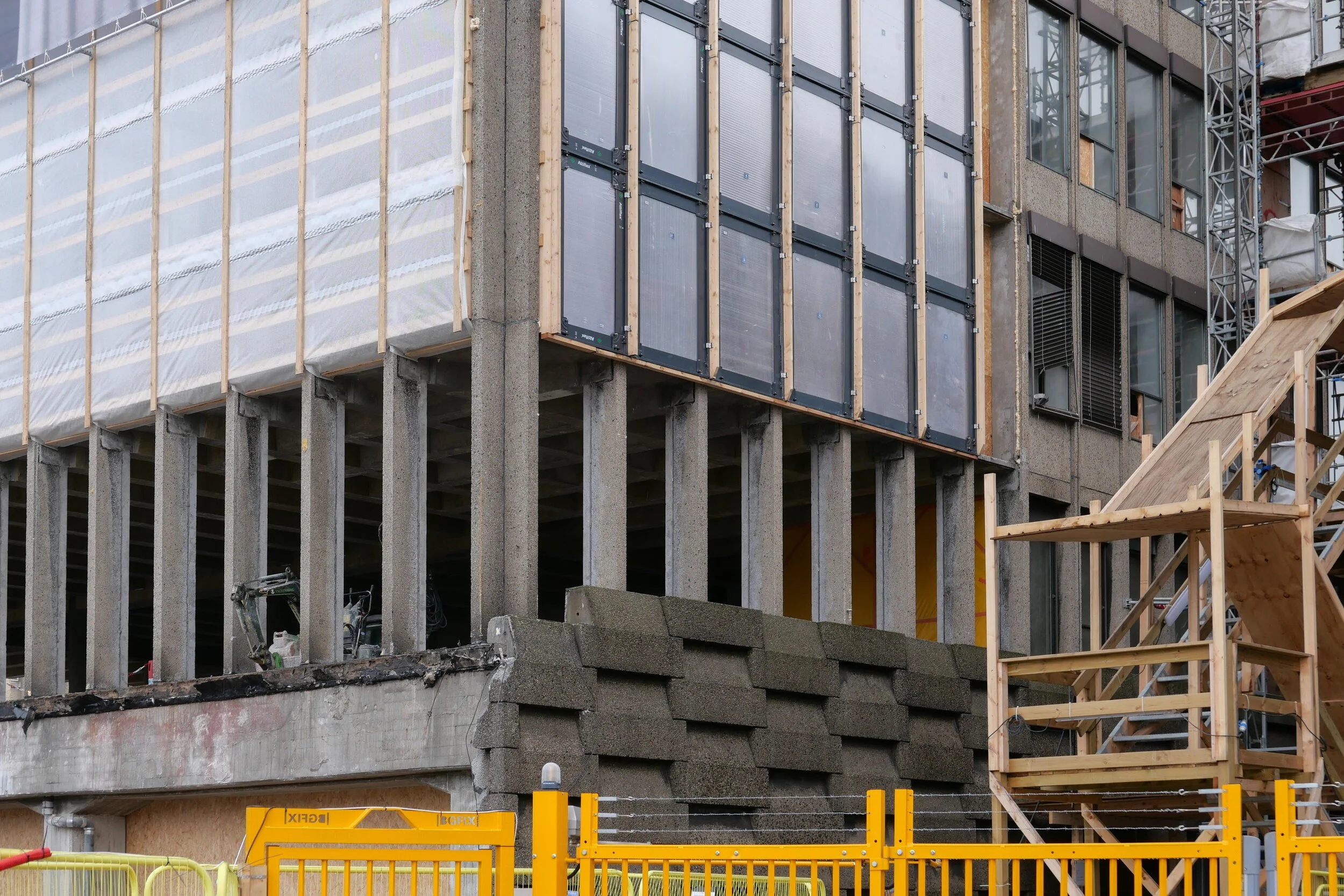
The interior at all levels has been gutted and all original windows and all external cladding have been removed. Work has started on cutting down new internal courtyards or light wells within the concrete structure of the block and on removing hefty concrete retaining walls along both the street frontage towards Torvegade and at the level of the quay on the end of the building towards the harbour that formed a base for the building.

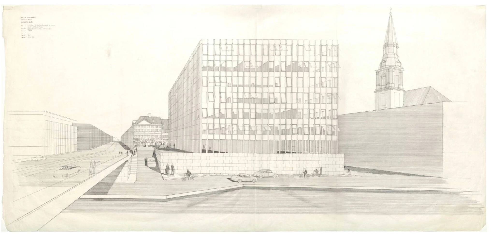
Ørkenfortet was designed by Palle Suenson (1904-1987) and was completed in 1962 as offices for Burmeister & Wain who were a well-established and major engineering and ship-building company in the city.

They had been established under that name in 1865 and, by the middle of the last century, their main ship yards were at Reshaleøen - at the north end of the harbour - where the main dry dock survives along with the some of the huge sheds and buildings of the yards but the engine works were here at the south end of Christianshavn, immediately south of this office building.

These extensive engineering yards on Christianshavn shut in 1993. Although some of the earlier buildings - including former drawing offices and the works' gates - survive, most of the buildings along the quay towards the harbour were demolished and wharves and docks were filled in for the site to be redeveloped with large new apartment buildings and extensive office buildings that were designed by the architects Henning Larsen.

Several of these office buildings along the harbour were occupied by the Danish headquarters of Nordea Bank including the office building by Suenson but in 2017, the bank moved their offices to a new site, close to the metro station at DR Byen, and the main office building from the 1960s became available for redevelopment.

This is all fairly straightforward history - the recent history of the site and of the building - but what I don't understand is the planning decisions then made for this key site at the very centre of the harbour.

Of course, I can see the logic and the reasons for planning decisions made in the 1950s. As Denmark emerged from the war, the priorities were for economic recovery. These ship-building and engineering works were not only a major employer in the city but these were highly skilled and, presumably, relatively well-paid jobs. The company was well established and, if nothing else, emerging from the widespread destruction of the war, there was an obvious market for new engines and new ships to replace what had been lost. Perhaps, and even more significant at that stage, although the harbour was, in terms of topography, at the heart of the historic city, attitudes to the harbour then were very different.

Then , north of Knippelsbro, were the working naval docks, with all that meant, and with the only road access through Christianshavn. Through the centre of the harbour and below or south of Knippelsbro was a working port with all that meant. Polite, middle-class society in the city would have seen the harbour as a major resource but that was as a major financial resource, so a massive new office building for Burmeister & Wain would not have been seen as an eye sore … even though its within sight of the 17th-century buildings of the exchange, on the other side of the harbour, and close to the magnificent warehouses from the 18th century, of the Asiatic Quay and Gammel Dok, on the other side of the road … but it would have been seen as an astute and positive show of confidence in the industries of the city and in their future.

It has only been with the decline of the dockyard and the working port and those industries that the harbour had to look for and has certainly found a new purpose at the heart of the city but I'm not sure how this massive hotel development actually makes a positive contribution.

On the side away from the harbour, the existing building looms over Strandgade - an exceptionally important street of historic buildings with many that date back to the early 17th century - and it overshadows the stunning Christians Church by Nicolai Eigtved that was built in the 1750s.

The block of the existing building is massive - one of the largest and certainly one of the most prominent at the centre of the harbour. It's 90 metres long by 31 metres deep and about 30 metres high. It's not a bad building as such but simply a product of its period and certainly not the best building for this location.

In terms of planning, the retention of the building and its conversion to a hotel by the Hilton Group, raises lots of issues.

It will have about 400 rooms so how will Christianshavn cope with the amount of traffic a hotel of this size generates with visitors coming and going, staff arriving and leaving and delivery lorries coming and going?

And why, when it is such a large building anyway, has permission been given to add a whole extra floor on the top that will increase the visual impact of the building and ensure that it overlooks even more properties. I can see that a roof-top dining room and roof terraces are a huge bonus for the hotel but I cannot see what they contribute to the harbour or to the neighbourhood.

Consent has been given to remove the hefty concrete retaining wall along the lowest level towards the quay but this means that the hotel can colonise and make use of the quayside as an asset for the hotel although citizens gain little from this apart from some new steps up from the quay to the bridge on this side. Note there are already steps up to the bridge on the other side of Torvegade and steps on both sides of the bridge on the city side so access from the bridge to the quay is actually adequate.

Almost-certainly, the city would not have given permission for a building of this size and prominence if the site had been empty land or there had been much lower buildings here.

Surely, it would have been better for the city and for the harbour if the building from the 1960s had been demolished and replaced with buildings that were lower and more compact, and with new buildings that reinstated or created a reasonable street frontage to the road up to the bridge and a more appropriate and more respectful frontage towards Strandgade.

Planning Statement - appendix to the Local Plan

notes:

In Danmarks Kunstbilbliotek / the Danish Art Library in Copenhagen there is a drawing of the building by Palle Suenson Inv. nr. 53296 - a perspective from Knippelsbro

While tracking down information on the building I came across a web site that revealed that the building was given a nickname by locals who called it Røven or The Arse. Initially, I assumed that was because the building was thought to be butt ugly but actually it was because at lunchtime workers in the office came out onto the forecourt and sat along the parapet of the wall along Torvegade and, for people walking along the pavement below, the only thing that could be seen from the street was a line of backsides.


photograph from 1965 showing Knippelsbro and Torvegade with the office building designed by Palle Suenson in the foreground and the engineering works of Burmeister & Wain beyond - along the harbour as far as the canal and around the south and east side of Christians Church


the forecourt of the design museum


Work continues at Designmuseum Danmark where the entrance gates, railings and stone piers along the street are being rebuilt and the setts of the forecourt relaid to form a new ramp to replace the steps up to the front entrance door and to install lighting and so on for new outdoor exhibition cases. 

The project - designed by the architectural practice COBE - includes a new ticket area, book shop and new cafe in the lower part of the old pharmacy … that’s the pavilion to the right of the forecourt.


As new blocks of stone have been brought to the site and set up, the work is an opportunity to see some of the details of 18th-century stone masons’ techniques that have been replicated … so it is possible to see the way bold mouldings are cut across large blocks to form plinths and caps to the piers.

The large ashlar blocks of the stone piers and the blocks that form the moulded bases and caps are dressed back with strong vertical tooling which contributes a distinct surface texture and gives a darker tone to the architectural details. Note how at each end of the ironwork screen the outer piers are not butted against the brickwork of the pavilions but are set into them which would suggest that the brickwork and stonework were built up at the same time … not one built against the other.

top left - the door into the former pharmacy of the hospital which will be the access to a new arrival space with ticket desk, book shop and new cafe. Note the silhouette in the brickwork of the ball finial and moulded cap of the stone pier that has been dismantled.

top centre - an iron pintel, set into the stonework of the pier, that will hold the strap of the lower hinge of the gate


Heavy spiked or barbed railings and the ornate iron gates are held in sockets cut into the blocks.

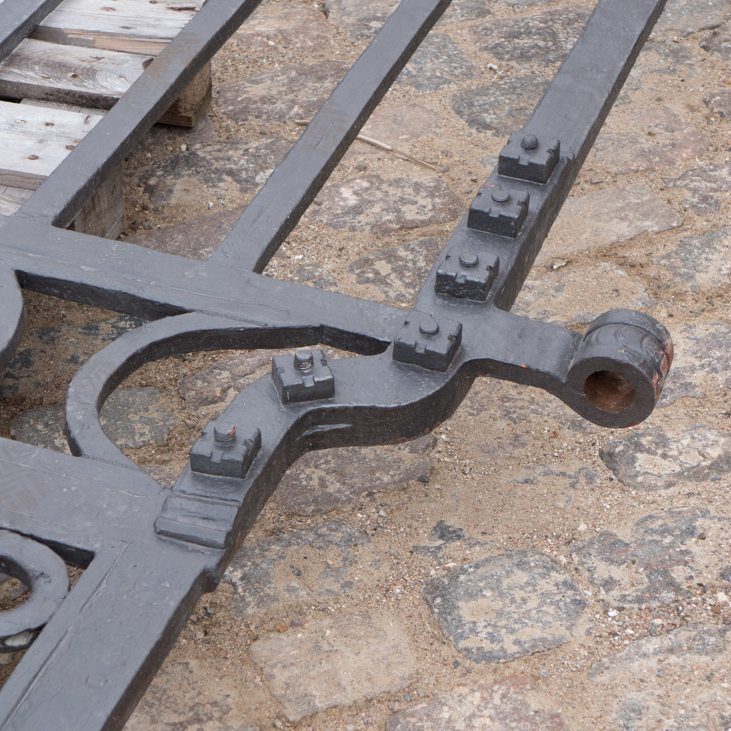
At this stage the gates are back on site but are on pallets so it is possible to see the robust quality of the iron work and to see how the straps of the gate hinges form a loop that will be dropped over hefty iron ‘pintels’ set into the stonework. 

This major project has also been an opportunity to repair some of the stonework on the entrance front of the main building and it is interesting to see around the doorway that although the stone frame or architrave of the door looks hefty or robust, it is, in fact, made up with relatively thin slips of stone with pieces forming the moulded front and separate pieces forming the reveal or jamb running back to the door frame and the brickwork behind is surprisingly crude.


Søringen - a motorway along the lakes


Not all major road schemes proposed for Copenhagen have been good and, more important, not all major road schemes get built.

Perhaps the most ambitious and most contentious and, if it had been built, the most destructive road scheme proposed was the lake motorway that was planned in 1958 and approved by parliament in 1964.

Two problems had been identified by planners. The first was how to get road traffic in to the centre of the city quickly and how and where to build a brave new metropolis to show Stockholm and Paris that anything they could do to be thoroughly modern, Copenhagen could do too.

The solution? Traffic from the north came down what is now Helsingørmotorvejen and Lyngbyvej, Nørre Allé and Tagensvej to the shore of the lake. This was to be made into motorway all the way but instead of continuing on over the lake and down what is still Sølvgade it was to do a sharp turn south and continue down the lakes … literally down the lakes against the city side … with six lanes of traffic in each direction (that’s right - a 12 lane motorway so actually rather more like LA than Stockholm) and then, at the south end of the lakes, everything, or just about everything except the recently-completed SAS Hotel by Arne Jacobsen was to be cleared for a brave new world of office blocks and public squares over a huge area west of the main railway station.

Work actually started on clearing housing on the outer side of the lake in 1973 but, when the scheme was abandoned, that area became a rather odd long narrow park running up from the lake to the hospital. The Panum Institute, where building work started in 1971, was set back to respect the alignment of the new motorway.

from the hospital looking down towards the lakes - this is where buildings were demolished in anticipation of constructing the motorway

from the bridge looking out of the city where buildings were demolished - the roof of the hospital is just visible over the trees

from the bridge where the motorway would have turned down the lake with twelve lanes down the left or city side heading to Vesterbro

the new park looking from the lake towards the hospital - the exercise equipment is where there would have been six lanes of road heading out of the city


Note that the plan published in Politiken shows dotted the line of a harbour tunnel from just above Svanemøllen - from the east end of what was proposed as a middle ring road - across to Refshaleøen and on to connect to the top end of a main road running down the east beach of Amager. The bridge to Malmö was part of the scheme but the airport was to have been moved out to Saltholm and much of Amager was to have been a major new housing scheme.

south down the lakes towards Vesterbro


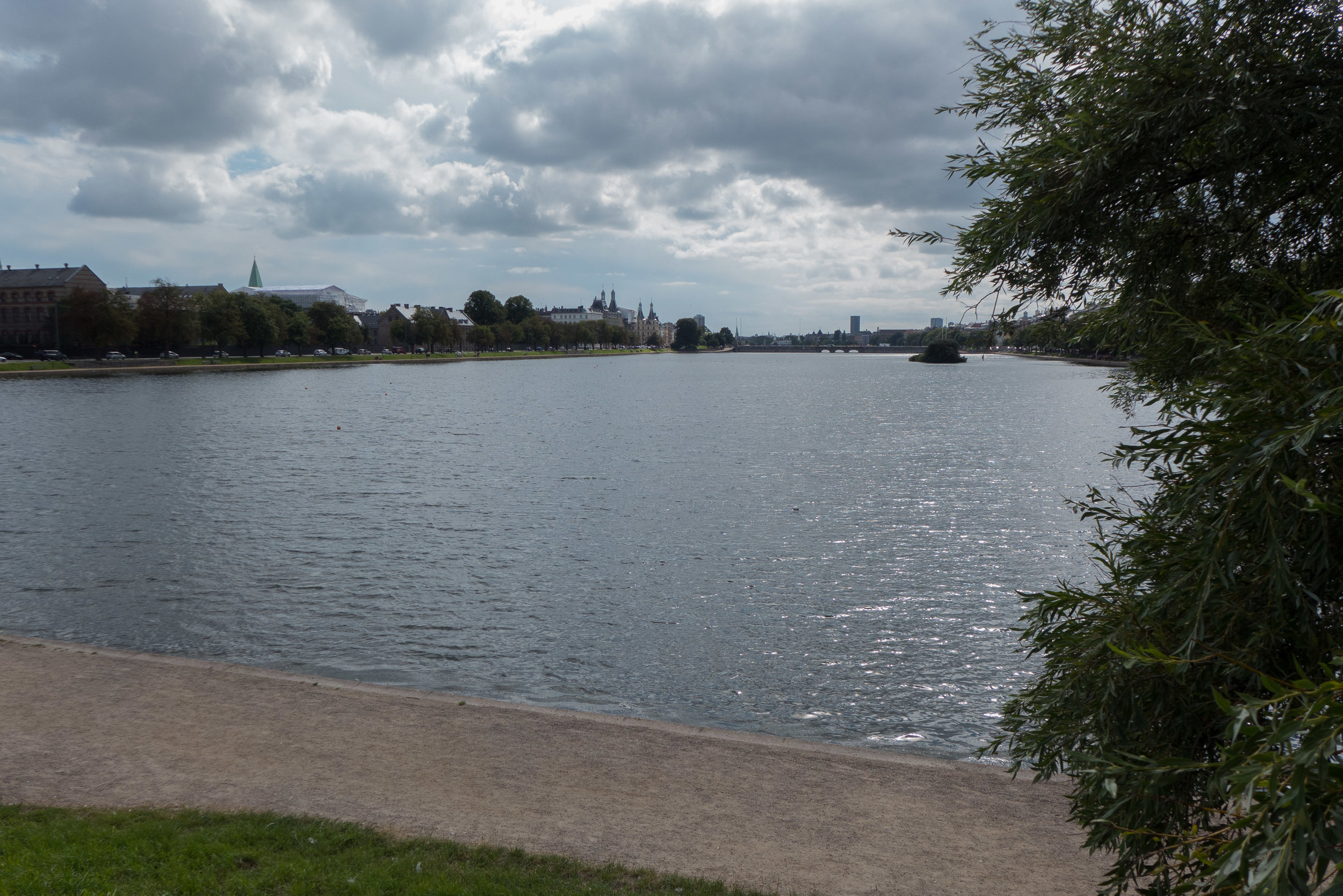
The lakes are a much-appreciated features of the city used for walking and talking, running and playing but they were so nearly reduced to a narrow strip of water beside an urban super highway.

a new road tunnel alongside city hall?


A proposal for a major engineering project, to construct a tunnel down the west side of the historic city centre, is now in doubt.

It would take underground much of the traffic that now drives along HC Andersens Boulevard on the west side of the city hall and would have much more impact on the inner city than a north-harbour tunnel. 

It is also more controversial than the north tunnel because it would be expensive; because there would be complicated gains; some people would resent this as the first stage of banning traffic from the centre with all the restrictions that implies and there could be considerable disruption during construction work … although, actually, most people in the city seem to accept major engineering works as now somehow part of everyday life in Copenhagen with the extent of the works and the time scale for the current work on building a new metro line.


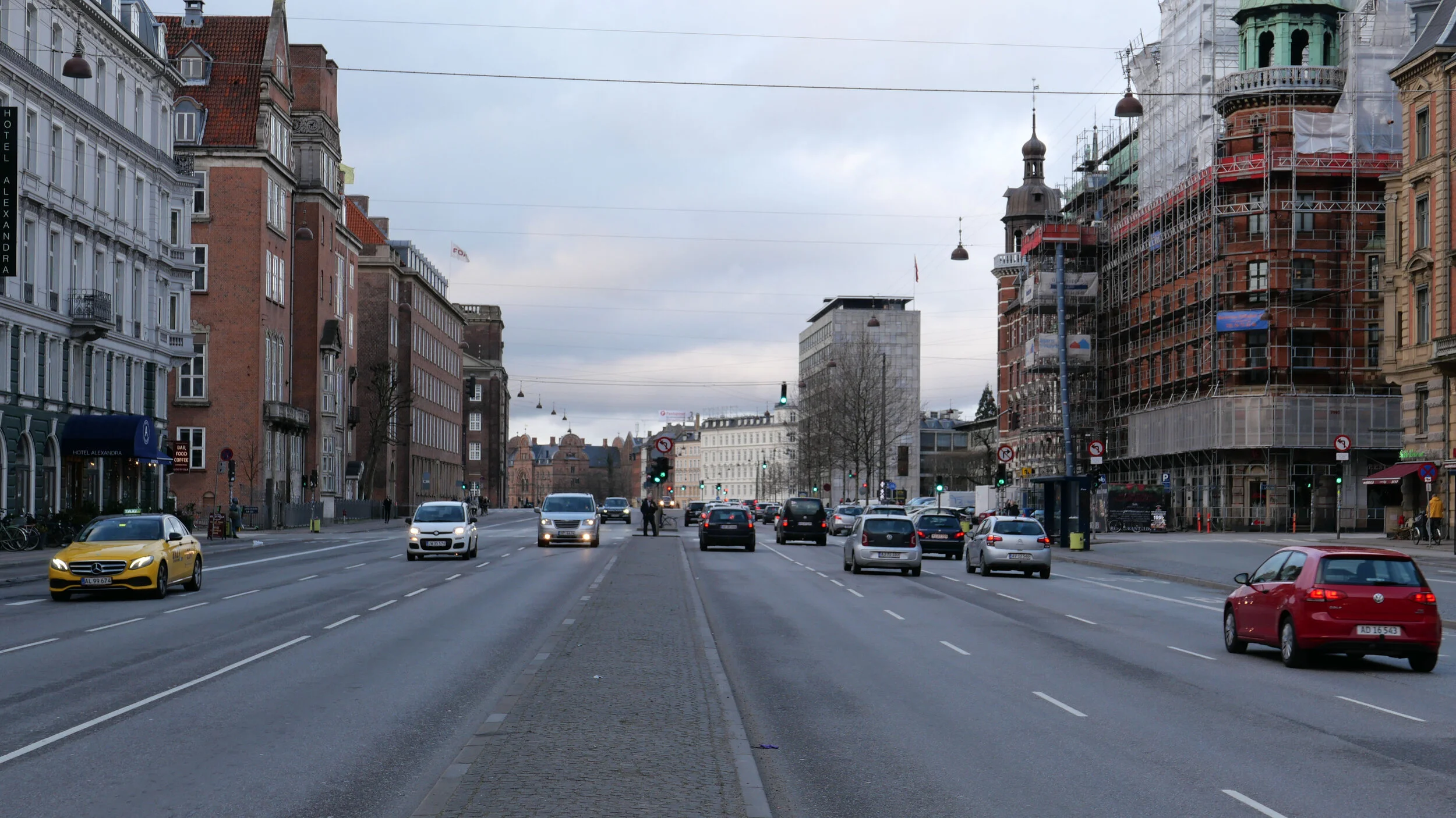
the view along Åboulevard looking north - looking out from the city. The river feeding fresh water into the lakes is now in a culvert below this road 


The first north section of the tunnel was suggested some years ago to follow first under Åboulevard and then under the lakes to emerge on the city side at the north end of H C Andersens Boulevard. At present the road is wide but has very heavy traffic that would be taken underground but that was not, in fact, the primary reason for the scheme. 

Beyond the lakes, this road was, in fact, the line of a river feeding fresh water into the lakes until the early 1900s and by taking the road traffic down then the river could be reinstated on the surface, brought up from the culvert that it now runs through. This is not simply a nice piece of landscaping but the river would have a very serious part to play in plans by the city to cope with climate change. 

The problem now and a problem that is predicted to be much more serious in the future will come from sudden and intense rain storms that overwhelm the existing drain system; flood roads and property; break through sewage systems and take polluted water out into the harbour. By bringing the river back up to the surface - to run through a long, narrow and well-planted park - it would be part of a new and extensive system to control surface water. The lower part of a new road tunnel would be a substantial new storm drain and the road, in the upper half of the tunnel. could be closed to traffic to carry water through to holding tanks or out to the harbour in the very worst storms.

However, recently, there has been a proposal to extend the tunnel on beyond the lakes and on below H C Andersens Boulevard to the harbour and, going under the harbour, it could then link with traffic in a new tunnel down from Refshaleøen. It has even been suggested that if the tunnel drops down to a lower level than suggested initially then there could be extensive underground car parks close to the city hall that would be accessed from the tunnels so, stage by stage, the project has become more ambitious but much more complicated and considerably more expensive.

The advantage would be that very heavy traffic running along HC Andersens Boulevard - between the city hall and Tivoli - would be removed and the west area of the city, including the main railway station and the area beyond, could be more-effectively linked with the historic centre. Obviously, it’s not impossible to cross the road when walking from the railway station to the city hall but not pleasant for pedestrians and more than a bit frustrating for drivers. 

Drawings have been published that show a bucolic cycle route and pathway from the city hall to the harbour but in the end that may not be the deciding factor that swings the decision. The reality, unfortunately, is that the threat of terrorist attacks has brought back to the agenda the need to ban traffic from much more of the historic centre and HC Andersens Boulevard, to the west of the city hall, would become the outer line for traffic and that might well mean that, without the tunnel, it just could not cope.

Articles that have been published in newspapers and journals recently have pointed out that the present metro system is at full capacity and it is beginning to struggle. With an extensive new metro line opening next year or so and with work now given the green light for an extension of the metro north to Nordhavn and to the south, to the south harbour area, then perhaps what is needed is a little time to see how this itself changes the way people move around the city. Initial extensions to the area of the centre with restricted access for vehicles needs planning and road signs and a change of habit or routine for citizens but little infrastructure so it will soon become clear just how necessary a western tunnel is or if it should be pushed on down the road … if you see what I mean.