Copenhagen by the early 19th century
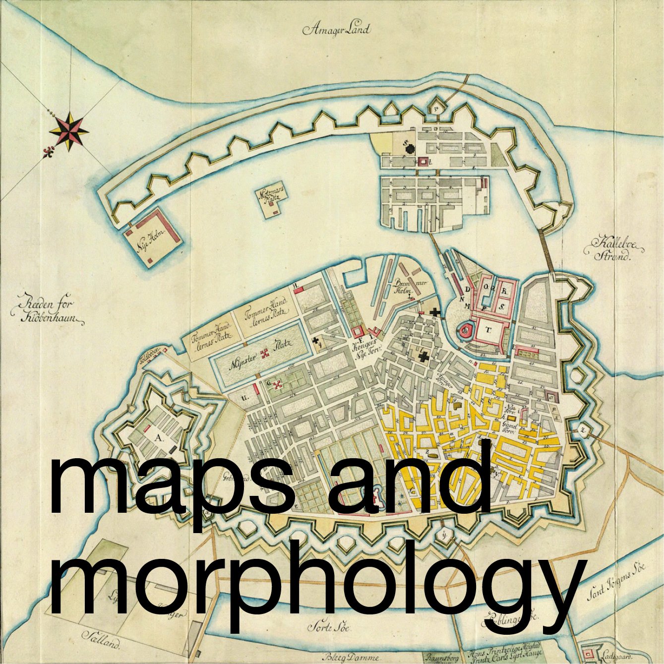
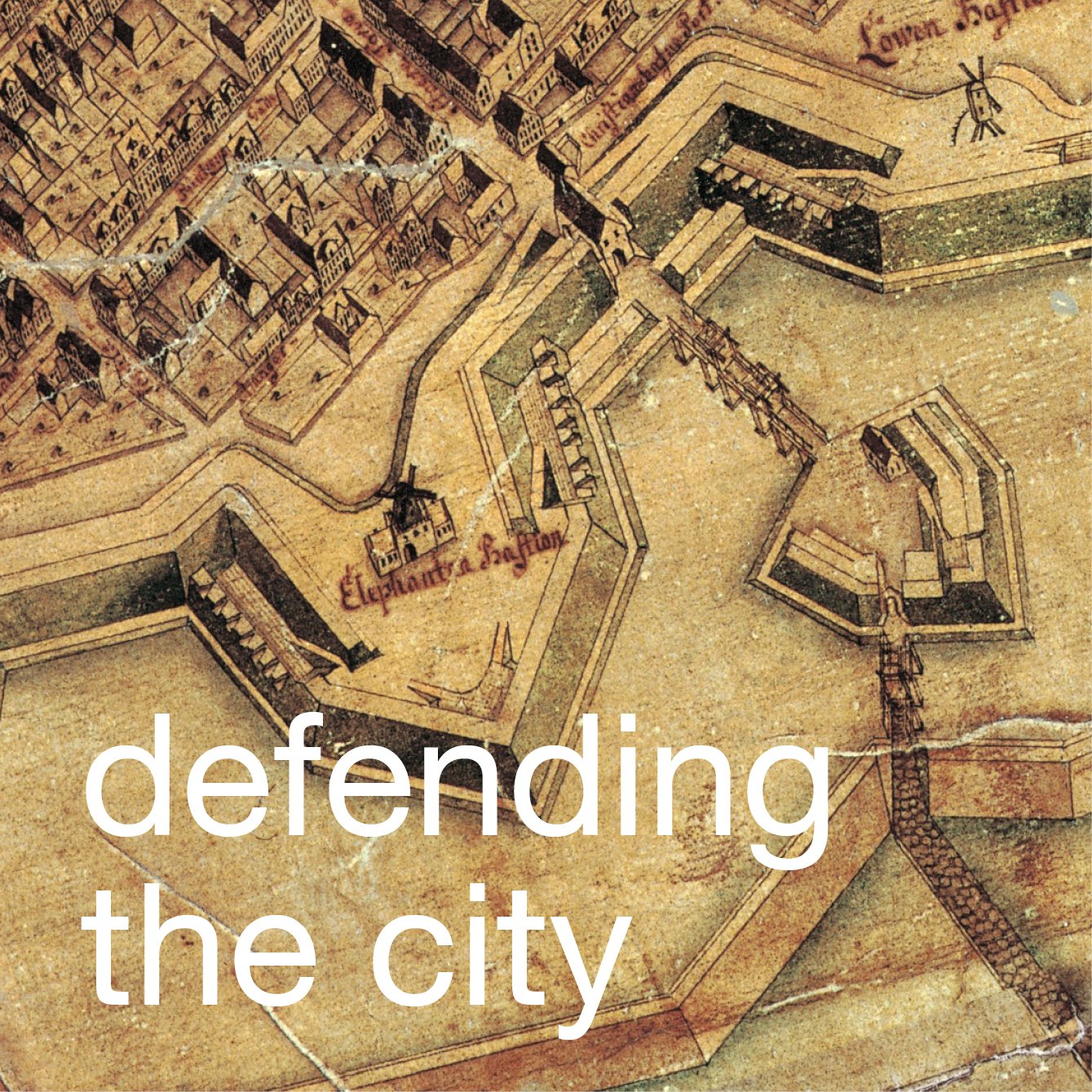
/This map of 1837 shows the extent of the city with the line of embankments, bastions and moats that had been constructed around the west side of the city in the late 17th century. These defences ran from the Kastellet, still standing and here shaded in red, at the north end and returned down to the harbour at the south end through what is now the Tivoli Gardens ... the lake in the garden is a surviving section of the moat.
To control access into the city there were four gateways all with a single archway and guard houses on the inner side and there were pathways angled up the inner slope of the embankment to reach the top to look out over the moat to the countryside beyond. There were timber bridges over the moat and further guard houses at the outer end of the bridges presumably where custom payments and papers were checked.
Building immediately outside the defences was not permitted but beyond the lakes and along the road to Roskilde there were small groups of houses. At the top left corner of the map is the royal palace and gardens at Frederiksberg.